
360 SUPPLIER
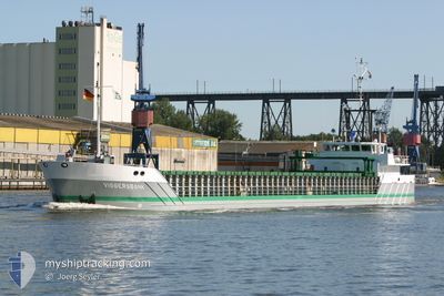
General Cargo
Current Trip
| Trip Time | 15 h, 57 mins |
|---|---|
| Trip Distance | 76.57 nm |
| AVG Speed | 8.3 Knots |
| MAX Speed | 9.7 Knots |
| Draught | 4 m |
| AVG Wind | 7 knots |
| MAX Wind | 9.5 knots |
| MIN Temp | 6.6°C / 43.88°F |
| MAX Temp | 18.5°C / 65.3°F |
| Position Received | 2023-10-06 09:38 |
Current Position
| Longitude | -62.56559° |
|---|---|
| Latitude | 44.42148° |
| Status | Under way using engine |
| Speed | 8.6 Knots |
| Course | 60° |
| Area | North Atlantic Ocean |
| Station | T-AIS |
| Position Received | 2023-10-06 09:38 |
Info
Information
The current position of 360 SUPPLIER is in North Atlantic Ocean with coordinates 44.42148° / -62.56559° as reported on 2023-10-06 09:38 by AIS to our vessel tracker app. The vessel's current speed is 8.6 Knots and is currently inside the port of HARBOUR BRETON.
The vessel 360 SUPPLIER (IMO: 9075371, MMSI: 316006910) is a General Cargo that was built in 1994 ( 30 years old ). It's sailing under the flag of [CA] Canada.
In this page you can find informations about the vessels current position, last detected port calls, and current voyage information. If the vessels is not in coverage by AIS you will find the latest position.
The current position of 360 SUPPLIER is detected by our AIS receivers and we are not responsible for the reliability of the data. The last position was recorded while the vessel was in Coverage by the Ais receivers of our vessel tracking app.
The current draught of 360 SUPPLIER as reported by AIS is 4 meters
Weather
| Temperature | 6.2°C / 43.16°F |
|---|---|
| Wind Speed | 7 knots |
| Direction | 29° NNE |
| Pressure | 1014.3 hPa |
| Humidity | 80.4 % |
| Cloud Coverage | 100 % |
Featured Company
Last Port Calls
| Port | Arrival | Departure | Time In Port |
|---|---|---|---|
| 2024-05-17 22:44 | |||
| 2024-05-11 19:59 | 2024-05-17 06:47 | 5 d | |
| 2024-05-06 18:47 | 2024-05-10 07:56 | 3 d | |
| 2024-04-30 09:51 | 2024-05-03 11:14 | 3 d | |
| 2024-04-25 20:17 |
Most Visited Ports (Last year)
| Port | Arrivals | |
|---|---|---|
| 3 | ||
| 1 |
Last Trips
| Origin | Departure | Destination | Arrival | Distance | |
|---|---|---|---|---|---|
| 2024-05-17 04:17 | 2024-05-17 20:14 | 76.57 nm | |||
| 2024-05-10 05:26 | 2024-05-11 17:29 | 77.71 nm | |||
| 2024-05-03 08:14 | 2024-05-06 16:17 | 681.98 nm | |||
| 2024-04-25 17:47 | 2024-04-30 06:51 | 688.76 nm |
Events
| Time | Event | Details | Position / Dest | Info |
|---|---|---|---|---|
| 2024-05-17 22:44 | PORT ARRIVAL |
|
47.48000 / -55.79333
[CA] HARBOUR BRETON
|
Speed: Course: -1° |
| 2024-05-17 22:39 | STOP Moving | 0.47 nm, South East of HARBOUR BRETON |
47.48000 / -55.79167
HARBOUR BRETON
|
Speed: Course: -1° |
| 2024-05-17 19:33 | START Moving | 17.04 nm, East of HARBOUR BRETON |
47.56667 / -55.40167
HARBOUR BRETON
|
Speed: 7 kn Course: 161° |
| 2024-05-17 17:43 | STOP Moving | 16.94 nm, East of HARBOUR BRETON |
47.57059 / -55.40590
HARBOUR BRETON
|
Speed: Course: 346° |
| 2024-05-17 16:30 | START Moving | 20.23 nm, North East of HARBOUR BRETON |
47.65833 / -55.37667
HARBOUR BRETON
|
Speed: 8 kn Course: 239° |
| 2024-05-17 15:38 | STOP Moving | 20.58 nm, North East of HARBOUR BRETON |
47.66405 / -55.37186
HARBOUR BRETON
|
Speed: 0.1 kn Course: 105° |
| 2024-05-17 14:37 | START Moving |
47.63881 / -55.23794
HARBOUR BRETON
|
Speed: 8.7 kn Course: 275° |
|
| 2024-05-17 10:49 | STOP Moving |
47.63924 / -55.23135
HARBOUR BRETON
|
Speed: 0.2 kn Course: 66° |
|
| 2024-05-17 06:48 | START Moving | 0.7 nm, South East of HARBOUR BRETON |
47.47833 / -55.78667
HARBOUR BRETON
|
Speed: 4 kn Course: -1° |
| 2024-05-17 06:47 | PORT DEPARTURE |
|
47.47833 / -55.78667
HARBOUR BRETON
|
Speed: 2 kn Course: -1° |