
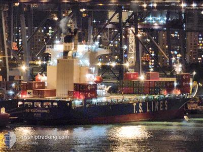
TS KAOHSIUNG
Cargo B
Current Trip
| Time Travelled | 1 day |
|---|---|
| Remaining Time | --- |
| Distance Travelled | 52.19 nm |
| Remaining Distance | --- |
| AVG Speed | 13.2 Knots |
| MAX Speed | 15.1 Knots |
| AVG Wind | 10.9 knots |
| MAX Wind | 12 knots |
| MIN Temp | 28.9°C / 84.02°F |
| MAX Temp | 30.1°C / 86.18°F |
| Draught | 9.8 m |
| Position Received | 1 d ago |
Current Position
| Longitude | 113.80603° |
|---|---|
| Latitude | 22.11381° |
| Status | Under way using engine |
| Speed | 12.4 Knots |
| Course | 153.7° |
| Area | South China Sea |
| Station | T-AIS |
| Position Received | 1 d ago |
Info
Information
The current position of TS KAOHSIUNG is in South China Sea with coordinates 22.11381° / 113.80603° as reported on 2024-06-28 05:25 by AIS to our vessel tracker app. The vessel's current speed is 12.4 Knots and is heading at the port of MANILA. The estimated time of arrival as calculated by vessel tracking app is 2024-06-30 12:00 LT
The vessel TS KAOHSIUNG (IMO: 9810068, MMSI: 538007728) is a Cargo B It's sailing under the flag of [MH] Marshall Is.
In this page you can find informations about the vessels current position, last detected port calls, and current voyage information. If the vessels is not in coverage by AIS you will find the latest position.
The current position of TS KAOHSIUNG is detected by our AIS receivers and we are not responsible for the reliability of the data. The last position was recorded while the vessel was in Coverage by the Ais receivers of our vessel tracking app.
The current draught of TS KAOHSIUNG as reported by AIS is 9.8 meters
Weather
| Temperature | 30°C / 86°F |
|---|---|
| Wind Speed | 6 knots |
| Direction | 219° SW |
| Pressure | 1010.8 hPa |
| Humidity | 73.2 % |
| Cloud Coverage | 15 % |
Featured Company
Last Port Calls
| Port | Arrival | Departure | Time In Port |
|---|---|---|---|
| 2024-06-27 19:09 | 2024-06-28 03:01 | 7 h | |
| 2024-06-26 05:05 | 2024-06-26 17:24 | 12 h | |
| 2024-06-22 14:47 | 2024-06-22 19:29 | 4 h | |
| 2024-06-21 15:32 | 2024-06-22 04:45 | 13 h | |
| 2024-06-17 02:37 | 2024-06-18 00:09 | 21 h | |
| 2024-06-12 10:35 | 2024-06-13 00:10 | 13 h | |
| 2024-06-09 22:29 | 2024-06-10 16:15 | 17 h | |
| 2024-06-05 17:09 | 2024-06-06 15:56 | 22 h | |
| 2024-05-30 09:00 | 2024-05-30 13:46 | 4 h | |
| 2024-05-28 17:11 | 2024-05-29 01:57 | 8 h |
Last Trips
| Origin | Departure | Destination | Arrival | Distance | |
|---|---|---|---|---|---|
| 2024-06-27 01:24 | 2024-06-28 03:09 | 113.63 nm | |||
| 2024-06-23 03:29 | 2024-06-26 13:05 | 1167.35 nm | |||
| 2024-06-22 12:45 | 2024-06-22 22:47 | 139.90 nm | |||
| 2024-06-18 08:09 | 2024-06-21 23:32 | 522.40 nm | |||
| 2024-06-13 08:10 | 2024-06-17 10:37 | 1466.82 nm | |||
| 2024-06-11 00:15 | 2024-06-12 18:35 | 644.08 nm | |||
| 2024-06-06 23:56 | 2024-06-10 06:29 | 31.64 nm | |||
| 2024-05-30 21:46 | 2024-06-06 01:09 | 698.77 nm | |||
| 2024-05-29 09:57 | 2024-05-30 17:00 | 107.16 nm | |||
| 2024-05-25 17:28 | 2024-05-29 01:11 | 1167.14 nm |
Events
| Time | Event | Details | Position / Dest | Info |
|---|---|---|---|---|
| 2024-06-28 05:29 | Status Changed | Default Under way using engine |
22.10122 / 113.81287
PH MNL
|
Speed: 12.4 kn Course: 153.7° |
| 2024-06-28 05:25 | Status Changed | Under way using engine Default |
22.11381 / 113.80603
PH MNL
|
Speed: 11.7 kn Course: 163° |
| 2024-06-28 05:25 | OUT of Coverage |
22.11381 / 113.80603
South China Sea
PH MNL
|
Speed: 12.4 kn Course: 153.7° |
|
| 2024-06-28 05:21 | Status Changed | Default Under way using engine |
22.12645 / 113.80061
PH MNL
|
Speed: 8.7 kn Course: 160.9° |
| 2024-06-28 05:02 | Status Changed | Under way using engine Default |
22.18784 / 113.78842
PH MNL
|
Speed: 14.1 kn Course: 193° |
| 2024-06-28 04:41 | Status Changed | Default Under way using engine |
22.26646 / 113.80440
PH MNL
|
Speed: 13.6 kn Course: 174.1° |
| 2024-06-28 03:41 | Draught Changed | 9.8 9.6 |
22.47872 / 113.75016
PH MNL
|
Speed: 14.3 kn Course: 171.2° |
| 2024-06-28 03:41 | Destination Changed | PH MNL CN NSA |
22.47872 / 113.75016
PH MNL
|
Speed: 14.3 kn Course: 171.2° |
| 2024-06-28 03:41 | ETA Changed | 2024/06/30 12:00 2024/06/27 19:00 |
22.47872 / 113.75016
PH MNL
|
Speed: 14.3 kn Course: 171.2° |
| 2024-06-28 03:06 | Status Changed | Under way using engine Default |
22.61499 / 113.70301
CN NSA
|
Speed: 8.5 kn Course: 125° |