
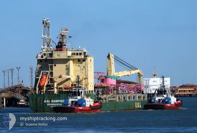
AAL DAMPIER
General Cargo
Aktuelle Reise
| Bisherige Reisezeit | 2 Tage |
|---|---|
| Verbleibende Reisezeit | --- |
| Zurückgelegte Distanz | 863.92 nm |
| Verbleibende Distanz | 60.43 nm |
| Durchschnittliche Geschwindigkeit | 12.7 Knoten |
| Maximale Geschwindigkeit | 16 Knoten |
| Durchschnittliche Windgeschwindigkeit | 12.7 Knoten |
| Maximale Windgeschwindigkeit | 24 Knoten |
| Minimale Temperatur | 25.7°C / 78.26°F |
| Maximale Temperatur | 30.8°C / 87.44°F |
| Tiefgang | 6.6 m |
| Position erhalten | 2 d alt |
Aktuelle Position
| Länge | --- |
|---|---|
| Breite | --- |
| Zustand | Under way using engine |
| Geschwindigkeit | 16 Knoten |
| Kurs | 38.8° |
| Gebiet | Eastern China Sea |
| Station | T-AIS |
| Position erhalten | 2 d alt |
Schiffsdetails
Information
Die AAL DAMPIER befindet sich derzeit in Eastern China Sea mit den Koordinaten 25.44107° / 121.15552°, Diese Position wurde am 2024-09-26 00:57 von unserer Schiffsverfolgungs-App über AIS erfasst. Das Schiff fährt momentan mit einer Geschwindigkeit von 16 Knoten und fahrt in den Hafen von BUSAN. Die geschatzte Ankunftszeit, berechnet von der -App zur Schiffsverfolgung, ist 2024-09-28 12:00 LT
Das Schiff AAL DAMPIER (IMO: 9521540, MMSI: 210418000) ist General Cargo das wurde im Jahr 2011 ( 13 Jahre alt ) gebaut. und fährt unter der Flagge von [CY] Cyprus.
Auf dieser Seite erhalten Sie Informationen zur aktuellen Position des Schiffes, zu den letzten bekannten Hafenanläufen und zu den aktuellen Reiseinformationen. Sollte das Schiff nicht durch AIS abgedeckt sein, wird die zuletzt erfasste Position angezeigt.
Die AAL DAMPIER wird durch unsere AIS-Empfänger ermittelt. Wir übernehmen keine Gewähr für die Richtigkeit der Daten. Die letzte Position wurde von unseren AIS-Empfängern aufgezeichnet, während das Schiff in Reichweite war.
Der aktuelle Entwurf von AAL DAMPIER, wie von AIS gemeldet, betragt 6.6 meter
Wetter
| Temperatur | 25.7°C / 78.26°F |
|---|---|
| Windgeschwindigkeit | 23 Knoten |
| Windrichtung | 51° NE |
| Luftdruck | 1014.8 hPa |
| Luftfeuchtigkeit | 76.1 % |
| Wolken | --- |
Featured Company
Letzte Hafenanläufe
| Hafen | Ankunft | Abfahrt | Time In Port |
|---|---|---|---|
| 2024-09-24 01:15 | 2024-09-25 10:25 | 1 d | |
| 2024-09-11 01:16 | 2024-09-12 22:25 | 1 d | |
| 2024-09-06 06:19 | 2024-09-11 00:16 | 4 d | |
| 2024-09-03 05:04 | 2024-09-04 10:23 | 1 d | |
| 2024-08-18 04:33 | 2024-08-20 02:44 | 1 d | |
| 2024-08-17 13:39 | 2024-08-18 03:28 | 13 h | |
| 2024-08-17 05:42 | 2024-08-17 11:36 | 5 h | |
| 2024-08-16 11:43 | 2024-08-17 05:14 | 17 h | |
| 2024-08-04 18:44 | 2024-08-05 17:17 | 22 h | |
| 2024-07-19 01:55 | 2024-07-23 23:37 | 4 d |
Meistbesuchte Häfen (Letztes Jahr)
| Hafen | Ankünfte | |
|---|---|---|
| 15 | ||
| 4 | ||
| 2 | ||
| 2 | ||
| 2 | ||
| 2 |
Letzte Reisen
| Herkunft | Abfahrt | Ziel | Ankunft | Distanz | |
|---|---|---|---|---|---|
| 2024-09-13 06:25 | 2024-09-24 09:15 | 3398.08 nm | |||
| 2024-09-11 08:16 | 2024-09-11 09:16 | 8.37 nm | |||
| 2024-09-04 18:23 | 2024-09-06 14:19 | 125.98 nm | |||
| 2024-08-20 10:44 | 2024-09-03 13:04 | 4131.50 nm | |||
| 2024-08-18 11:28 | 2024-08-18 12:33 | 1.77 nm | |||
| 2024-08-17 19:36 | 2024-08-17 21:39 | 1.91 nm | |||
| 2024-08-17 13:14 | 2024-08-17 13:42 | 1.84 nm | |||
| 2024-08-06 01:17 | 2024-08-16 19:43 | 3328.76 nm | |||
| 2024-07-24 07:37 | 2024-08-05 02:44 | 1031.82 nm | |||
| 2024-07-19 09:00 | 2024-07-19 09:55 | 8.81 nm |
Events
| Zeit | Ereignis | Details | Position / Ziel | Information |
|---|---|---|---|---|
| 2024-09-26 01:05 | geänderter Status | Default Under way using engine |
25.47073 / 121.18256
PUSAN
|
Geschwindigkeit: 16 kn Kurs: 38.8° |
| 2024-09-26 00:57 | Auf See entdeckt | Taiwanese part of the Eastern China Sea |
25.44107 / 121.15552
Eastern China Sea
PUSAN
|
Geschwindigkeit: 16 kn Kurs: 38.8° |
| 2024-09-26 00:57 | in Abdeckung |
25.44107 / 121.15552
Eastern China Sea
PUSAN
|
Geschwindigkeit: 16 kn Kurs: 38.8° |
|
| 2024-09-26 00:57 | außerhalb Abdeckung |
25.44107 / 121.15552
Eastern China Sea
PUSAN
|
Geschwindigkeit: 16 kn Kurs: 38.8° |
|
| 2024-09-26 00:39 | geänderter Status | Under way using engine Default |
25.37943 / 121.10112
PUSAN
|
Geschwindigkeit: 15 kn Kurs: 33° |
| 2024-09-25 12:00 | geänderter Status | Default Under way using engine |
22.82104 / 120.03181
PUSAN
|
Geschwindigkeit: 11.6 kn Kurs: 332.4° |
| 2024-09-25 11:46 | außerhalb Abdeckung |
22.78068 / 120.05093
South China Sea
PUSAN
|
Geschwindigkeit: 11.6 kn Kurs: 332.4° |
|
| 2024-09-25 11:42 | geänderter Status | Under way using engine Default |
22.77009 / 120.05698
PUSAN
|
Geschwindigkeit: 11.6 kn Kurs: 317° |
| 2024-09-25 11:38 | geänderter Status | Default Under way using engine |
22.76044 / 120.06543
PUSAN
|
Geschwindigkeit: 11.6 kn Kurs: 303.5° |
| 2024-09-25 10:42 | geänderte voraussichtliche Ankunftszeit | 2024/09/28 12:00 2024/09/28 12:30 |
22.63562 / 120.20382
PUSAN
|
Geschwindigkeit: 11.9 kn Kurs: 296.2° |