
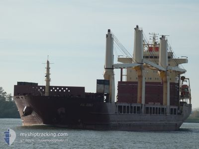
AAL GENOA
General Cargo
Current Trip
| Time Travelled | 13 days |
|---|---|
| Remaining Time | 3 days |
| Distance Travelled | 3393.18 nm |
| Remaining Distance | 982.30 nm |
| AVG Speed | 11.1 Knots |
| MAX Speed | 14.8 Knots |
| AVG Wind | 11.6 knots |
| MAX Wind | 24 knots |
| MIN Temp | 10.5°C / 50.9°F |
| MAX Temp | 24.7°C / 76.46°F |
| Draught | 9.9 m |
| Position Received | 25 m ago |
Current Position
| Longitude | 13.90265° |
|---|---|
| Latitude | 36.53499° |
| Status | Under way using engine |
| Speed | 11.6 Knots |
| Course | 112° |
| Area | Mediterranean Sea - Eastern Basin |
| Station | T-AIS |
| Position Received | 25 m ago |
Info
Information
The current position of AAL GENOA is in Mediterranean Sea - Eastern Basin with coordinates 36.53499° / 13.90265° as reported on 2024-05-29 01:00 by AIS to our vessel tracker app. The vessel's current speed is 11.6 Knots and is heading at the port of SUEZ CANAL. The estimated time of arrival as calculated by vessel tracking app is 2024-06-01 15:05 LT
The vessel AAL GENOA (IMO: 9393553, MMSI: 210843000) is a General Cargo that was built in 2009 ( 15 years old ). It's sailing under the flag of [CY] Cyprus.
In this page you can find informations about the vessels current position, last detected port calls, and current voyage information. If the vessels is not in coverage by AIS you will find the latest position.
The current position of AAL GENOA is detected by our AIS receivers and we are not responsible for the reliability of the data. The last position was recorded while the vessel was in Coverage by the Ais receivers of our vessel tracking app.
The current draught of AAL GENOA as reported by AIS is 9.9 meters
Weather
| Temperature | 21.1°C / 69.98°F |
|---|---|
| Wind Speed | 3 knots |
| Direction | 289° WNW |
| Pressure | 1014.6 hPa |
| Humidity | 67.2 % |
| Cloud Coverage | 75 % |
Featured Company
Most Visited Ports (Last year)
| Port | Arrivals | |
|---|---|---|
| 3 | ||
| 2 | ||
| 2 | ||
| 2 | ||
| 1 | ||
| 1 |
Events
| Time | Event | Details | Position / Dest | Info |
|---|---|---|---|---|
| 2024-05-29 01:02 | Status Changed | Default Under way using engine |
36.53258 / 13.91009
SUEZ CANAL
|
Speed: 11.6 kn Course: 112° |
| 2024-05-29 00:55 | Detected in Sea | Maltese part of the Mediterranean Sea - Eastern Basin |
36.54090 / 13.88470
Mediterranean Sea - Eastern Basin
SUEZ CANAL
|
Speed: 11.6 kn Course: 112.2° |
| 2024-05-29 00:55 | Status Changed | Under way using engine Default |
36.54090 / 13.88470
SUEZ CANAL
|
Speed: 11.5 kn Course: 112° |
| 2024-05-29 00:50 | Status Changed | Default Under way using engine |
36.54784 / 13.86363
SUEZ CANAL
|
Speed: 11.5 kn Course: 112.9° |
| 2024-05-29 00:21 | Status Changed | Under way using engine Default |
36.58365 / 13.75791
SUEZ CANAL
|
Speed: 11 kn Course: 113° |
| 2024-05-29 00:17 | Status Changed | Default Under way using engine |
36.58833 / 13.74167
SUEZ CANAL
|
Speed: 11.6 kn Course: 113° |
| 2024-05-28 23:55 | Status Changed | Under way using engine Default |
36.61521 / 13.66215
SUEZ CANAL
|
Speed: 11.5 kn Course: 108° |
| 2024-05-28 23:47 | Status Changed | Default Under way using engine |
36.62359 / 13.63045
SUEZ CANAL
|
Speed: 11.5 kn Course: 108.4° |
| 2024-05-28 23:40 | Status Changed | Under way using engine Default |
36.63047 / 13.60461
SUEZ CANAL
|
Speed: 11.3 kn Course: 108° |
| 2024-05-28 23:22 | Status Changed | Default Under way using engine |
36.64900 / 13.53529
SUEZ CANAL
|
Speed: 11.3 kn Course: 108.6° |