
ABHRA
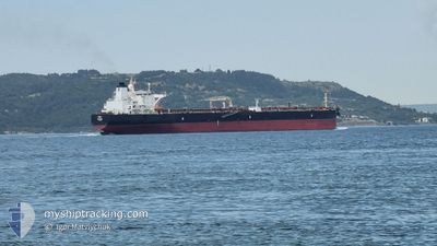
Crude Oil Tanker
Current Trip
| Time Travelled | 4 days |
|---|---|
| Remaining Time | --- |
| Distance Travelled | 579.14 nm |
| Remaining Distance | --- |
| AVG Speed | 14 Knots |
| MAX Speed | 14 Knots |
| AVG Wind | 13.1 knots |
| MAX Wind | 19 knots |
| MIN Temp | 20°C / 68°F |
| MAX Temp | 30.7°C / 87.26°F |
| Draught | 8.1 m |
| Position Received | 3 h, 48 m ago |
Current Position
| Longitude | 29.13425° |
|---|---|
| Latitude | 41.41924° |
| Status | Under way using engine |
| Speed | 0.3 Knots |
| Course | 275° |
| Area | Black Sea |
| Station | T-AIS |
| Position Received | 3 h, 48 m ago |
Info
Information
The current position of ABHRA is in Black Sea with coordinates 41.41924° / 29.13425° as reported on 2024-06-21 16:46 by AIS to our vessel tracker app. The vessel's current speed is 0.3 Knots and is heading at the port of MUNDRA. The estimated time of arrival as calculated by vessel tracking app is 2024-06-23 12:00 LT
The vessel ABHRA (IMO: 9282041, MMSI: 352001312) is a Crude Oil Tanker that was built in 2004 ( 20 years old ). It's sailing under the flag of [PA] Panama.
In this page you can find informations about the vessels current position, last detected port calls, and current voyage information. If the vessels is not in coverage by AIS you will find the latest position.
The current position of ABHRA is detected by our AIS receivers and we are not responsible for the reliability of the data. The last position was recorded while the vessel was in Coverage by the Ais receivers of our vessel tracking app.
The current draught of ABHRA as reported by AIS is 8.1 meters
Weather
| Temperature | 22.6°C / 72.68°F |
|---|---|
| Wind Speed | 18 knots |
| Direction | 64° ENE |
| Pressure | 1015.6 hPa |
| Humidity | 80.5 % |
| Cloud Coverage | --- |
Featured Company
Last Port Calls
| Port | Arrival | Departure | Time In Port |
|---|---|---|---|
| 2024-06-15 11:55 | 2024-06-17 15:13 | 2 d | |
| 2024-06-08 03:53 | |||
| 2024-04-22 04:54 | 2024-04-24 04:19 | 1 d | |
| 2024-04-05 15:48 | 2024-04-07 17:56 | 2 d |
Most Visited Ports (Last year)
| Port | Arrivals | |
|---|---|---|
| 5 | ||
| 3 | ||
| 2 | ||
| 1 | ||
| 1 | ||
| 1 |
Last Trips
| Origin | Departure | Destination | Arrival | Distance | |
|---|---|---|---|---|---|
| 2024-04-24 12:19 | 2024-06-15 14:55 | 7197.66 nm | |||
| 2024-04-24 12:19 | 2024-06-08 05:53 | 5810.52 nm | |||
| 2024-04-08 01:56 | 2024-04-22 12:54 | 1672.94 nm | |||
| 2024-03-12 17:19 | 2024-04-05 23:48 | 373.07 nm |
Events
| Time | Event | Details | Position / Dest | Info |
|---|---|---|---|---|
| 2024-06-21 16:53 | Status Changed | Default Under way using engine |
41.41817 / 29.13442
MUNDRA(INDIA)
|
Speed: 0.3 kn Course: 275° |
| 2024-06-21 16:46 | OUT of Coverage |
41.41924 / 29.13425
Black Sea
MUNDRA(INDIA)
|
Speed: 0.3 kn Course: 156.4° |
|
| 2024-06-21 16:10 | Status Changed | Under way using engine Default |
41.42251 / 29.13224
MUNDRA(INDIA)
|
Speed: 0.1 kn Course: 19° |
| 2024-06-21 16:09 | Status Changed | Default Under way using engine |
41.42254 / 29.13222
MUNDRA(INDIA)
|
Speed: 0.1 kn Course: 10° |
| 2024-06-21 15:55 | STOP Moving | 11.47 nm, North of RUMELI FENERI |
41.42202 / 29.13255
MUNDRA(INDIA)
|
Speed: 0.3 kn Course: 355° |
| 2024-06-21 15:53 | Status Changed | Under way using engine Default |
41.42182 / 29.13256
MUNDRA(INDIA)
|
Speed: 0.9 kn Course: 349° |
| 2024-06-21 15:45 | Status Changed | Default Under way using engine |
41.41995 / 29.13266
MUNDRA(INDIA)
|
Speed: 2.4 kn Course: 351° |
| 2024-06-21 15:38 | Status Changed | Under way using engine Default |
41.41560 / 29.13285
MUNDRA(INDIA)
|
Speed: 3.3 kn Course: 353° |
| 2024-06-21 15:17 | Status Changed | Default Under way using engine |
41.38920 / 29.13341
MUNDRA(INDIA)
|
Speed: 4.6 kn Course: 319° |
| 2024-06-21 15:05 | START Moving | 8.64 nm, North of RUMELI FENERI |
41.37360 / 29.14286
MUNDRA(INDIA)
|
Speed: 3.9 kn Course: 330° |