
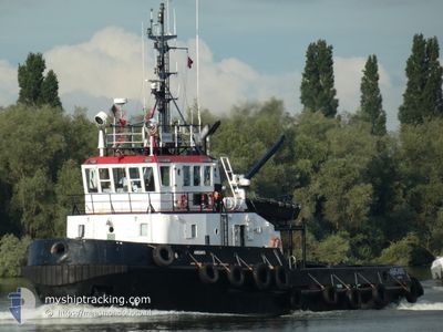
ABRAMIS
Tug
Current Trip
| Time Travelled | 7 days |
|---|---|
| Remaining Time | 14 h, 21 mins |
| Distance Travelled | 95.30 nm |
| Remaining Distance | 109.50 nm |
| AVG Speed | 5.3 Knots |
| MAX Speed | 8.9 Knots |
| AVG Wind | 6.6 knots |
| MAX Wind | 13 knots |
| MIN Temp | 25.6°C / 78.08°F |
| MAX Temp | 28.7°C / 83.66°F |
| Draught | 5 m |
| Position Received | 18 h, 42 m ago |
Current Position
| Longitude | -78.55178° |
|---|---|
| Latitude | 26.53183° |
| Status | Under way using engine |
| Speed | 4 Knots |
| Course | 283° |
| Area | North Atlantic Ocean |
| Station | T-AIS |
| Position Received | 18 h, 42 m ago |
Info
Information
The current position of ABRAMIS is in North Atlantic Ocean with coordinates 26.53183° / -78.55178° as reported on 2024-05-27 23:47 by AIS to our vessel tracker app. The vessel's current speed is 4 Knots and is heading at the port of NASSAU. The estimated time of arrival as calculated by vessel tracking app is 2024-05-29 08:51 LT
The vessel ABRAMIS (IMO: 8112196, MMSI: 259582000) is a Tug that was built in 1982 ( 42 years old ). It's sailing under the flag of [NO] Norway.
In this page you can find informations about the vessels current position, last detected port calls, and current voyage information. If the vessels is not in coverage by AIS you will find the latest position.
The current position of ABRAMIS is detected by our AIS receivers and we are not responsible for the reliability of the data. The last position was recorded while the vessel was in Coverage by the Ais receivers of our vessel tracking app.
The current draught of ABRAMIS as reported by AIS is 5 meters
Weather
| Temperature | 28.4°C / 83.12°F |
|---|---|
| Wind Speed | 8 knots |
| Direction | 190° S |
| Pressure | 1017 hPa |
| Humidity | 70.2 % |
| Cloud Coverage | 10 % |
Featured Company
Last Port Calls
| Port | Arrival | Departure | Time In Port |
|---|---|---|---|
| 2024-05-20 12:26 | 2024-05-21 09:58 | 21 h | |
| 2024-05-19 18:02 | 2024-05-20 10:06 | 16 h | |
| 2024-05-16 06:02 | 2024-05-17 09:26 | 1 d | |
| 2024-05-15 09:22 | 2024-05-15 17:34 | 8 h | |
| 2024-05-13 14:30 | 2024-05-14 05:06 | 14 h | |
| 2024-05-09 20:37 | 2024-05-12 09:46 | 2 d | |
| 2024-05-07 11:16 | 2024-05-08 23:37 | 1 d | |
| 2024-05-03 04:37 | 2024-05-06 17:03 | 3 d | |
| 2024-04-26 01:58 | 2024-05-01 06:42 | 5 d | |
| 2024-04-23 12:10 | 2024-04-25 02:30 | 1 d |
Most Visited Ports (Last year)
| Port | Arrivals | |
|---|---|---|
| 42 | ||
| 15 | ||
| 7 | ||
| 5 | ||
| 1 | ||
| 1 |
Last Trips
| Origin | Departure | Destination | Arrival | Distance | |
|---|---|---|---|---|---|
| 2024-05-20 06:06 | 2024-05-20 08:26 | 19.11 nm | |||
| 2024-05-17 05:26 | 2024-05-19 14:02 | 52.78 nm | |||
| 2024-05-15 13:34 | 2024-05-16 02:02 | 119.53 nm | |||
| 2024-05-14 01:06 | 2024-05-15 05:22 | 119.91 nm | |||
| 2024-05-12 05:46 | 2024-05-13 10:30 | 40.73 nm | |||
| 2024-05-08 19:37 | 2024-05-09 16:37 | 127.17 nm | |||
| 2024-05-06 13:03 | 2024-05-07 07:16 | 125.54 nm | |||
| 2024-05-01 02:42 | 2024-05-03 00:37 | 148.58 nm | |||
| 2024-04-24 22:30 | 2024-04-25 21:58 | 126.76 nm | |||
| 2024-04-22 13:46 | 2024-04-23 08:10 | 127.01 nm |
Events
| Time | Event | Details | Position / Dest | Info |
|---|---|---|---|---|
| 2024-05-28 14:03 | STOP Moving | 15.51 nm, East of FREEPORT (BS) |
26.56745 / -78.49017
NASSAU
|
Speed: 0.1 kn Course: 126° |
| 2024-05-28 13:11 | START Moving | 11.94 nm, East of FREEPORT (BS) |
26.53143 / -78.55248
NASSAU
|
Speed: 4 kn Course: 58° |
| 2024-05-27 23:55 | Status Changed | Default Under way using engine |
26.53014 / -78.54977
NASSAU
|
Speed: 4 kn Course: 283° |
| 2024-05-27 23:55 | STOP Moving | 12.09 nm, East of FREEPORT (BS) |
26.53014 / -78.54977
NASSAU
|
Speed: 0.1 kn Course: 79° |
| 2024-05-27 23:47 | OUT of Coverage |
26.53183 / -78.55178
North Atlantic Ocean
|
Speed: 4 kn Course: 271.7° |
|
| 2024-05-27 23:06 | START Moving | 15.49 nm, East of FREEPORT (BS) |
26.56694 / -78.49041
NASSAU
|
Speed: 3.8 kn Course: 197° |
| 2024-05-27 23:06 | Status Changed | Under way using engine Default |
26.56771 / -78.49043
NASSAU
|
Speed: 0.1 kn Course: 123° |
| 2024-05-27 22:55 | IN Coverage |
26.56585 / -78.49063
North Atlantic Ocean
|
Speed: 3.8 kn Course: 204.6° |
|
| 2024-05-27 14:00 | STOP Moving | 15.6 nm, East of FREEPORT (BS) |
26.56667 / -78.48834
NASSAU
|
Speed: Course: -1° |
| 2024-05-27 13:03 | START Moving | 11.79 nm, East of FREEPORT (BS) |
26.53121 / -78.55527
NASSAU
|
Speed: 5.5 kn Course: 18° |