
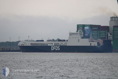
ACACIA SEAWAYS
Cargo A
Current Trip
| Trip Time | 7 h, 17 mins |
|---|---|
| Trip Distance | 120.75 nm |
| AVG Speed | 14.9 Knots |
| MAX Speed | 19.3 Knots |
| Draught | 5.9 m |
| AVG Wind | 19.4 knots |
| MAX Wind | 26 knots |
| MIN Temp | 12.9°C / 55.22°F |
| MAX Temp | 13.7°C / 56.66°F |
| Position Received | 3 m ago |
Current Position
| Longitude | 4.36230° |
|---|---|
| Latitude | 51.90781° |
| Status | Moored |
| Speed | 0.1 Knots |
| Course | 155° |
| Area | North Sea |
| Station | T-AIS |
| Position Received | 3 m ago |
Info
Information
The current position of ACACIA SEAWAYS is in North Sea with coordinates 51.90781° / 4.36230° as reported on 2024-06-01 21:02 by AIS to our vessel tracker app. The vessel's current speed is 0.1 Knots and is currently inside the port of VLAARDINGEN - ROTTERDAM.
The vessel ACACIA SEAWAYS (IMO: 9809112, MMSI: 277574000) is a Cargo A It's sailing under the flag of [LT] Lithuania.
In this page you can find informations about the vessels current position, last detected port calls, and current voyage information. If the vessels is not in coverage by AIS you will find the latest position.
The current position of ACACIA SEAWAYS is detected by our AIS receivers and we are not responsible for the reliability of the data. The last position was recorded while the vessel was in Coverage by the Ais receivers of our vessel tracking app.
The current draught of ACACIA SEAWAYS as reported by AIS is 5.9 meters
Weather
| Temperature | 13.4°C / 56.12°F |
|---|---|
| Wind Speed | 14 knots |
| Direction | 2° N |
| Pressure | 1021.9 hPa |
| Humidity | 84.6 % |
| Cloud Coverage | 73 % |
Featured Company
Last Port Calls
| Port | Arrival | Departure | Time In Port |
|---|---|---|---|
| 2024-06-01 01:24 | |||
| 2024-05-31 13:50 | 2024-05-31 18:07 | 4 h | |
| 2024-05-31 01:26 | 2024-05-31 06:01 | 4 h | |
| 2024-05-30 13:45 | 2024-05-30 18:09 | 4 h | |
| 2024-05-30 01:34 | 2024-05-30 06:43 | 5 h | |
| 2024-05-29 13:47 | 2024-05-29 18:15 | 4 h | |
| 2024-05-29 01:41 | 2024-05-29 05:56 | 4 h | |
| 2024-05-28 13:49 | 2024-05-28 18:03 | 4 h | |
| 2024-05-28 01:46 | 2024-05-28 06:00 | 4 h | |
| 2024-05-26 21:05 | 2024-05-27 17:51 | 20 h |
Most Visited Ports (Last year)
| Port | Arrivals | |
|---|---|---|
| 231 | ||
| 228 | ||
| 3 | ||
| 1 |
Last Trips
| Origin | Departure | Destination | Arrival | Distance | |
|---|---|---|---|---|---|
| 2024-05-31 19:07 | 2024-06-01 03:24 | 120.75 nm | |||
| 2024-05-31 08:01 | 2024-05-31 14:50 | 119.64 nm | |||
| 2024-05-30 19:09 | 2024-05-31 03:26 | 120.91 nm | |||
| 2024-05-30 08:43 | 2024-05-30 14:45 | 119.71 nm | |||
| 2024-05-29 19:15 | 2024-05-30 03:34 | 121.07 nm | |||
| 2024-05-29 07:56 | 2024-05-29 14:47 | 119.57 nm | |||
| 2024-05-28 19:03 | 2024-05-29 03:41 | 120.80 nm | |||
| 2024-05-28 08:00 | 2024-05-28 14:49 | 118.54 nm | |||
| 2024-05-27 18:51 | 2024-05-28 03:46 | 121.25 nm | |||
| 2024-05-26 13:30 | 2024-05-26 22:05 | 120.07 nm |
Events
| Time | Event | Details | Position / Dest | Info |
|---|---|---|---|---|
| 2024-06-01 02:00 | ETA Changed | 2025/05/21 03:00 2025/05/31 23:45 |
51.90781 / 4.36231
[NL] VLAARDINGEN - ROTTERDAM
|
Speed: 0.1 kn Course: 155° |
| 2024-06-01 01:59 | Status Changed | Moored Under way using engine |
51.90781 / 4.36231
[NL] VLAARDINGEN - ROTTERDAM
|
Speed: Course: 155° |
| 2024-06-01 01:24 | STOP Moving |
51.90090 / 4.36592
[NL] VLAARDINGEN - ROTTERDAM
|
Speed: 0.3 kn Course: 132° |
|
| 2024-06-01 01:24 | PORT ARRIVAL |
|
51.90088 / 4.36587
[NL] VLAARDINGEN - ROTTERDAM
|
Speed: 0.6 kn Course: 127° |
| 2024-06-01 00:05 | ETA Changed | 2025/05/31 23:45 2024/05/31 23:45 |
51.99284 / 4.04267
GB FXT
|
Speed: 17.2 kn Course: 111.4° |
| 2024-05-31 21:07 | Change Sea Area | Dutch part of the North Sea United Kingdom part of the North Sea |
51.94478 / 2.61206
North Sea
GB FXT
|
Speed: 18.8 kn Course: 102.1° |
| 2024-05-31 18:07 | PORT DEPARTURE |
|
51.95187 / 1.30800
GB FXT
|
Speed: 5.1 kn Course: 208° |
| 2024-05-31 18:07 | START Moving |
51.95226 / 1.30883
[GB] FELIXSTOWE
|
Speed: 4.7 kn Course: 222° |
|
| 2024-05-31 17:34 | Destination Changed | GB FXT NL RTM |
51.95293 / 1.31200
[GB] FELIXSTOWE
|
Speed: 0.1 kn Course: 306° |
| 2024-05-31 17:34 | ETA Changed | 2024/05/31 23:45 2024/05/21 03:00 |
51.95293 / 1.31200
[GB] FELIXSTOWE
|
Speed: 0.1 kn Course: 306° |