
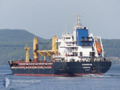
ADAMOON
Bulk Carrier
Current Trip
MACAS > TNSFA
| Time Travelled | 1 day |
|---|---|
| Remaining Time | --- |
| Distance Travelled | 121.43 nm |
| Remaining Distance | --- |
| AVG Speed | 10 Knots |
| MAX Speed | 12.2 Knots |
| AVG Wind | 12.2 knots |
| MAX Wind | 22 knots |
| MIN Temp | 21.8°C / 71.24°F |
| MAX Temp | 26.4°C / 79.52°F |
| Draught | 6.5 m |
| Position Received | 11 h, 38 m ago |
Current Position
| Longitude | 11.41210° |
|---|---|
| Latitude | 34.46859° |
| Status | Under way using engine |
| Speed | 10.1 Knots |
| Course | 65° |
| Area | Mediterranean Sea - Eastern Basin |
| Station | T-AIS |
| Position Received | 11 h, 38 m ago |
Info
Information
The current position of ADAMOON is in Mediterranean Sea - Eastern Basin with coordinates 34.46859° / 11.41210° as reported on 2024-06-11 23:26 by AIS to our vessel tracker app. The vessel's current speed is 10.1 Knots
The vessel ADAMOON (IMO: 9521758, MMSI: 636015272) is a Bulk Carrier that was built in 2011 ( 13 years old ). It's sailing under the flag of [LR] Liberia.
In this page you can find informations about the vessels current position, last detected port calls, and current voyage information. If the vessels is not in coverage by AIS you will find the latest position.
The current position of ADAMOON is detected by our AIS receivers and we are not responsible for the reliability of the data. The last position was recorded while the vessel was in Coverage by the Ais receivers of our vessel tracking app.
The current draught of ADAMOON as reported by AIS is 6.5 meters
Weather
| Temperature | 21.8°C / 71.24°F |
|---|---|
| Wind Speed | 21 knots |
| Direction | 357° N |
| Pressure | 1012.1 hPa |
| Humidity | 88.9 % |
| Cloud Coverage | 100 % |
Featured Company
Last Port Calls
| Port | Arrival | Departure | Time In Port |
|---|---|---|---|
| 2024-06-08 06:20 | 2024-06-11 07:09 | 3 d | |
| 2024-05-23 15:51 | 2024-05-30 14:59 | 6 d | |
| 2024-04-29 08:39 | 2024-05-03 11:32 | 4 d | |
| 2024-04-10 16:02 | 2024-04-13 04:25 | 2 d | |
| 2024-04-02 08:04 | 2024-04-04 10:16 | 2 d |
Most Visited Ports (Last year)
| Port | Arrivals | |
|---|---|---|
| 5 | ||
| 2 | ||
| 2 | ||
| 1 | ||
| 1 | ||
| 1 |
Last Trips
| Origin | Departure | Destination | Arrival | Distance | |
|---|---|---|---|---|---|
| 2024-05-30 15:59 | 2024-06-08 07:20 | 1291.88 nm | |||
| 2024-05-03 14:32 | 2024-05-23 16:51 | 2975.20 nm | |||
| 2024-04-13 06:25 | 2024-04-29 11:39 | 3473.62 nm | |||
| 2024-04-04 12:16 | 2024-04-10 18:02 | 357.22 nm | |||
| 2024-03-28 06:59 | 2024-04-02 10:04 | 649.82 nm |
Events
| Time | Event | Details | Position / Dest | Info |
|---|---|---|---|---|
| 2024-06-11 23:42 | Status Changed | Default Under way using engine |
34.48999 / 11.46537
MACAS > TNSFA
|
Speed: 10.1 kn Course: 65° |
| 2024-06-11 23:26 | OUT of Coverage |
34.46859 / 11.41210
Mediterranean Sea - Eastern Basin
|
Speed: 10.1 kn Course: 65° |
|
| 2024-06-11 23:15 | Status Changed | Under way using engine Default |
34.45927 / 11.38772
MACAS > TNSFA
|
Speed: 0.4 kn Course: 40° |
| 2024-06-11 23:15 | START Moving |
34.45927 / 11.38772
MACAS > TNSFA
|
Speed: 4.6 kn Course: 65° |
|
| 2024-06-11 23:15 | IN Coverage |
34.45927 / 11.38772
Mediterranean Sea - Eastern Basin
|
Speed: 4.6 kn Course: 64° |
|
| 2024-06-11 22:19 | Status Changed | Default Under way using engine |
34.45557 / 11.38157
MACAS > TNSFA
|
Speed: 0.1 kn Course: 65° |
| 2024-06-11 22:14 | OUT of Coverage |
34.45580 / 11.38148
Mediterranean Sea - Eastern Basin
|
Speed: 0.1 kn Course: 134° |
|
| 2024-06-11 22:07 | Status Changed | Under way using engine Default |
34.45578 / 11.38122
MACAS > TNSFA
|
Speed: 0.1 kn Course: 60° |
| 2024-06-11 21:57 | Status Changed | Default Under way using engine |
34.45594 / 11.38144
MACAS > TNSFA
|
Speed: Course: 67° |
| 2024-06-11 21:51 | Status Changed | Under way using engine Default |
34.45610 / 11.38157
MACAS > TNSFA
|
Speed: Course: 68° |