
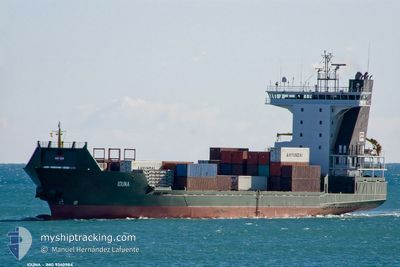
ADMIRAL MARS
Container Ship
Current Trip
| Time Travelled | 2 days |
|---|---|
| Remaining Time | --- |
| Distance Travelled | 572.91 nm |
| Remaining Distance | --- |
| AVG Speed | 11 Knots |
| MAX Speed | 14.6 Knots |
| AVG Wind | 4.6 knots |
| MAX Wind | 12.4 knots |
| MIN Temp | 16.1°C / 60.98°F |
| MAX Temp | 24.6°C / 76.28°F |
| Draught | 7.1 m |
| Position Received | 20 h, 31 m ago |
Current Position
| Longitude | 26.97913° |
|---|---|
| Latitude | 40.52674° |
| Status | Under way using engine |
| Speed | 12.1 Knots |
| Course | 247° |
| Area | Sea of Marmara |
| Station | T-AIS |
| Position Received | 20 h, 31 m ago |
Info
Information
The current position of ADMIRAL MARS is in Sea of Marmara with coordinates 40.52674° / 26.97913° as reported on 2024-05-31 05:34 by AIS to our vessel tracker app. The vessel's current speed is 12.1 Knots and is heading at the port of ALEXANDRIA. The estimated time of arrival as calculated by vessel tracking app is 2024-06-02 05:30 LT
The vessel ADMIRAL MARS (IMO: 9360984, MMSI: 636020280) is a Container Ship that was built in 2007 ( 17 years old ). It's sailing under the flag of [LR] Liberia.
In this page you can find informations about the vessels current position, last detected port calls, and current voyage information. If the vessels is not in coverage by AIS you will find the latest position.
The current position of ADMIRAL MARS is detected by our AIS receivers and we are not responsible for the reliability of the data. The last position was recorded while the vessel was in Coverage by the Ais receivers of our vessel tracking app.
The current draught of ADMIRAL MARS as reported by AIS is 7.1 meters
Weather
| Temperature | 19.5°C / 67.1°F |
|---|---|
| Wind Speed | 1 knots |
| Direction | 159° SSE |
| Pressure | 1016 hPa |
| Humidity | 75.1 % |
| Cloud Coverage | 100 % |
Featured Company
Last Port Calls
| Port | Arrival | Departure | Time In Port |
|---|---|---|---|
| 2024-05-29 05:41 | |||
| 2024-05-24 11:58 | 2024-05-24 22:30 | 10 h | |
| 2024-05-23 20:28 | 2024-05-24 04:08 | 7 h | |
| 2024-05-22 12:48 | 2024-05-22 23:50 | 11 h | |
| 2024-05-19 08:35 | 2024-05-20 04:20 | 19 h | |
| 2024-05-12 14:48 | 2024-05-14 15:00 | 2 d | |
| 2024-05-08 02:56 | 2024-05-08 16:17 | 13 h | |
| 2024-05-06 20:09 | 2024-05-07 01:07 | 4 h | |
| 2024-05-04 04:59 | 2024-05-04 19:07 | 14 h | |
| 2024-04-30 10:30 | 2024-04-30 19:32 | 9 h |
Most Visited Ports (Last year)
| Port | Arrivals | |
|---|---|---|
| 19 | ||
| 12 | ||
| 11 | ||
| 11 | ||
| 10 | ||
| 9 |
Last Trips
| Origin | Departure | Destination | Arrival | Distance | |
|---|---|---|---|---|---|
| 2024-05-24 07:08 | 2024-05-24 14:58 | 60.25 nm | |||
| 2024-05-23 02:50 | 2024-05-23 23:28 | 257.62 nm | |||
| 2024-05-20 06:20 | 2024-05-22 15:48 | 562.94 nm | |||
| 2024-05-14 18:00 | 2024-05-19 10:35 | 1218.38 nm | |||
| 2024-05-08 19:17 | 2024-05-12 17:48 | 910.25 nm | |||
| 2024-05-07 04:07 | 2024-05-08 05:56 | 298.49 nm | |||
| 2024-05-04 21:07 | 2024-05-06 23:09 | 553.80 nm | |||
| 2024-04-30 22:32 | 2024-05-04 06:59 | 792.07 nm | |||
| 2024-04-27 23:31 | 2024-04-30 13:30 | 597.88 nm | |||
| 2024-04-24 03:23 | 2024-04-27 00:50 | 604.61 nm |
Events
| Time | Event | Details | Position / Dest | Info |
|---|---|---|---|---|
| 2024-05-31 06:07 | STOP Moving | 8.72 nm, North West of KEMER |
40.51359 / 26.90946
EGALY
|
Speed: 0.2 kn Course: 272° |
| 2024-05-31 05:39 | Status Changed | Default Under way using engine |
40.52116 / 26.96131
EGALY
|
Speed: 12.1 kn Course: 247° |
| 2024-05-31 05:34 | OUT of Coverage |
40.52674 / 26.97913
Sea of Marmara
EGALY
|
Speed: 12.1 kn Course: 247° |
|
| 2024-05-30 22:11 | ETA Changed | 2024/06/02 05:30 2024/06/01 21:00 |
40.96272 / 28.95281
EGALY
|
Speed: 14 kn Course: 234° |
| 2024-05-30 20:29 | Change Sea Area | Turkish part of the Sea of Marmara Turkish part of the Black Sea |
41.22701 / 29.12854
Sea of Marmara
EGALY
|
Speed: 8.8 kn Course: 204° |
| 2024-05-30 18:55 | START Moving | 6.63 nm, North West of RUMELI FENERI |
41.29982 / 28.99813
EGALY
|
Speed: 6.2 kn Course: 7.4° |
| 2024-05-30 18:34 | Status Changed | Under way using engine At anchor |
41.27881 / 29.00103
EGALY
|
Speed: 0.2 kn Course: 299° |
| 2024-05-30 17:55 | Status Changed | At anchor Default |
41.27974 / 29.00018
EGALY
|
Speed: 0.2 kn Course: -1° |
| 2024-05-30 17:19 | Status Changed | Default At anchor |
41.28001 / 28.99945
EGALY
|
Speed: 0.1 kn Course: 186° |
| 2024-05-30 17:16 | Status Changed | At anchor Default |
41.28005 / 28.99932
EGALY
|
Speed: 0.1 kn Course: -1° |