
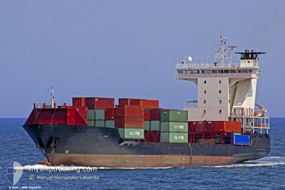
ADMIRAL STAR
Container Ship
Current Trip
| Time Travelled | 2 days |
|---|---|
| Remaining Time | --- |
| Distance Travelled | 379.95 nm |
| Remaining Distance | --- |
| AVG Speed | 11.3 Knots |
| MAX Speed | 12.2 Knots |
| AVG Wind | 6.9 knots |
| MAX Wind | 12 knots |
| MIN Temp | 15.5°C / 59.9°F |
| MAX Temp | 19.4°C / 66.92°F |
| Draught | 7.2 m |
| Position Received | 1 d ago |
Current Position
| Longitude | 26.00650° |
|---|---|
| Latitude | 34.84083° |
| Status | Under way using engine |
| Speed | 11.4 Knots |
| Course | 254° |
| Area | Mediterranean Sea - Eastern Basin |
| Station | T-AIS |
| Position Received | 1 d ago |
Info
Information
The current position of ADMIRAL STAR is in Mediterranean Sea - Eastern Basin with coordinates 34.84083° / 26.00650° as reported on 2024-05-07 22:34 by AIS to our vessel tracker app. The vessel's current speed is 11.4 Knots
The vessel ADMIRAL STAR (IMO: 9360972, MMSI: 636021459) is a Container Ship that was built in 2006 ( 18 years old ). It's sailing under the flag of [LR] Liberia.
In this page you can find informations about the vessels current position, last detected port calls, and current voyage information. If the vessels is not in coverage by AIS you will find the latest position.
The current position of ADMIRAL STAR is detected by our AIS receivers and we are not responsible for the reliability of the data. The last position was recorded while the vessel was in Coverage by the Ais receivers of our vessel tracking app.
The current draught of ADMIRAL STAR as reported by AIS is 7.2 meters
Weather
| Temperature | 19.6°C / 67.28°F |
|---|---|
| Wind Speed | 15 knots |
| Direction | 104° ESE |
| Pressure | 1011.8 hPa |
| Humidity | 78 % |
| Cloud Coverage | 73 % |
Featured Company
Last Port Calls
| Port | Arrival | Departure | Time In Port |
|---|---|---|---|
| 2024-05-06 06:42 | 2024-05-06 17:28 | 10 h | |
| 2024-04-30 20:30 | 2024-04-30 20:52 | 22 m | |
| 2024-04-30 16:24 | 2024-04-30 20:24 | 4 h | |
| 2024-04-30 01:56 | 2024-04-30 16:19 | 14 h | |
| 2024-04-30 01:07 | 2024-04-30 01:46 | 38 m | |
| 2024-04-29 21:38 | 2024-04-30 01:00 | 3 h | |
| 2024-04-29 19:37 | 2024-04-29 21:32 | 1 h | |
| 2024-04-29 19:22 | 2024-04-29 19:29 | 7 m | |
| 2024-04-29 17:33 | 2024-04-29 18:26 | 53 m | |
| 2024-04-29 16:33 | 2024-04-29 17:24 | 51 m |
Most Visited Ports (Last year)
| Port | Arrivals | |
|---|---|---|
| 25 | ||
| 17 | ||
| 12 | ||
| 12 | ||
| 9 | ||
| 9 |
Last Trips
| Origin | Departure | Destination | Arrival | Distance | |
|---|---|---|---|---|---|
| 2024-04-30 23:52 | 2024-05-06 09:42 | 999.40 nm | |||
| 2024-04-30 23:24 | 2024-04-30 23:30 | 1.31 nm | |||
| 2024-04-30 19:19 | 2024-04-30 19:24 | 0.44 nm | |||
| 2024-04-30 04:46 | 2024-04-30 04:56 | 1.81 nm | |||
| 2024-04-30 04:00 | 2024-04-30 04:07 | 1.15 nm | |||
| 2024-04-30 00:32 | 2024-04-30 00:38 | 1.17 nm | |||
| 2024-04-29 22:29 | 2024-04-29 22:37 | 0.54 nm | |||
| 2024-04-29 21:26 | 2024-04-29 22:22 | 17.56 nm | |||
| 2024-04-29 20:24 | 2024-04-29 20:33 | 5.94 nm | |||
| 2024-04-29 19:31 | 2024-04-29 19:33 | 0.34 nm |
Events
| Time | Event | Details | Position / Dest | Info |
|---|---|---|---|---|
| 2024-05-07 22:34 | OUT of Coverage |
34.84083 / 26.00650
Mediterranean Sea - Eastern Basin
EGALY
|
Speed: 11.4 kn Course: 254° |
|
| 2024-05-07 21:45 | Status Changed | Under way using engine Default |
34.89267 / 26.17900
EGALY
|
Speed: 11 kn Course: 226° |
| 2024-05-07 21:45 | IN Coverage |
34.89267 / 26.17900
Mediterranean Sea - Eastern Basin
EGALY
|
Speed: 10.9 kn Course: 231° |
|
| 2024-05-07 20:50 | Status Changed | Default Under way using engine |
35.00167 / 26.33367
EGALY
|
Speed: 11.1 kn Course: 226° |
| 2024-05-07 20:42 | OUT of Coverage |
35.01983 / 26.35650
Mediterranean Sea - Eastern Basin
EGALY
|
Speed: 11.1 kn Course: 226° |
|
| 2024-05-07 18:44 | Change Sea Area | Greek part of the Mediterranean Sea - Eastern Basin Greek part of the Aegean Sea |
35.32233 / 26.62033
Mediterranean Sea - Eastern Basin
EGALY
|
Speed: 11.5 kn Course: 209° |
| 2024-05-07 17:35 | IN Coverage |
35.51050 / 26.74200
Aegean Sea
EGALY
|
Speed: 11.6 kn Course: 205° |
|
| 2024-05-07 16:10 | OUT of Coverage |
35.76133 / 26.89617
Aegean Sea
EGALY
|
Speed: 11.1 kn Course: 209° |
|
| 2024-05-07 13:33 | ETA Changed | 2024/05/08 23:00 2024/05/08 19:00 |
36.17300 / 27.06467
EGALY
|
Speed: 11.2 kn Course: 137° |
| 2024-05-07 13:14 | Status Changed | Under way using engine Default |
36.21967 / 27.01883
EGALY
|
Speed: 11.6 kn Course: 145° |