
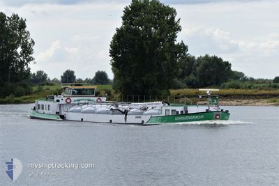
ADMIRALENGRACHT
Tanker
Current Trip
| Time Travelled | 6 days |
|---|---|
| Remaining Time | --- |
| Distance Travelled | 203.60 nm |
| Remaining Distance | --- |
| AVG Speed | 8.2 Knots |
| MAX Speed | 10.3 Knots |
| AVG Wind | 5.8 knots |
| MAX Wind | 9.1 knots |
| MIN Temp | 10.8°C / 51.44°F |
| MAX Temp | 20.1°C / 68.18°F |
| Draught | 2 m |
| Position Received | 1 m ago |
Current Position
| Longitude | 5.54861° |
|---|---|
| Latitude | 51.79086° |
| Status | Under way using engine |
| Speed | |
| Course | --- |
| Area | North Sea |
| Station | T-AIS |
| Position Received | 1 m ago |
Info
Information
The current position of ADMIRALENGRACHT is in North Sea with coordinates 51.79086° / 5.54861° as reported on 2024-05-21 07:36 by AIS to our vessel tracker app. The vessel's current speed is 0 Knots and is heading at the port of OSS.
The vessel ADMIRALENGRACHT (MMSI: 244660256) is a Tanker It's sailing under the flag of [NL] Netherlands.
In this page you can find informations about the vessels current position, last detected port calls, and current voyage information. If the vessels is not in coverage by AIS you will find the latest position.
The current position of ADMIRALENGRACHT is detected by our AIS receivers and we are not responsible for the reliability of the data. The last position was recorded while the vessel was in Coverage by the Ais receivers of our vessel tracking app.
The current draught of ADMIRALENGRACHT as reported by AIS is 2 meters
Weather
| Temperature | 16.8°C / 62.24°F |
|---|---|
| Wind Speed | 8 knots |
| Direction | 77° ENE |
| Pressure | 1008.3 hPa |
| Humidity | 80.4 % |
| Cloud Coverage | 100 % |
Featured Company
Last Port Calls
| Port | Arrival | Departure | Time In Port |
|---|---|---|---|
| 2024-05-13 12:22 | 2024-05-15 05:14 | 1 d | |
| 2024-05-08 11:37 | 2024-05-13 11:32 | 4 d | |
| 2024-05-08 08:07 | 2024-05-08 08:19 | 11 m | |
| 2024-05-07 17:04 | 2024-05-07 17:20 | 16 m | |
| 2024-05-07 12:48 | 2024-05-07 13:27 | 39 m | |
| 2024-05-07 09:38 | 2024-05-07 12:31 | 2 h | |
| 2024-05-06 17:25 | 2024-05-07 05:54 | 12 h | |
| 2024-05-06 08:42 | 2024-05-06 12:09 | 3 h | |
| 2024-05-03 12:41 | 2024-05-06 04:45 | 2 d | |
| 2024-05-03 11:20 | 2024-05-03 12:11 | 51 m |
Most Visited Ports (Last year)
| Port | Arrivals | |
|---|---|---|
| 30 | ||
| 26 | ||
| 17 | ||
| 15 | ||
| 9 | ||
| 9 |
Last Trips
| Origin | Departure | Destination | Arrival | Distance | |
|---|---|---|---|---|---|
| 2024-05-13 13:32 | 2024-05-13 14:22 | 7.22 nm | |||
| 2024-05-08 10:19 | 2024-05-08 13:37 | 29.17 nm | |||
| 2024-05-07 19:20 | 2024-05-08 10:07 | 3.85 nm | |||
| 2024-05-07 15:27 | 2024-05-07 19:04 | 28.16 nm | |||
| 2024-05-07 14:31 | 2024-05-07 14:48 | 1.61 nm | |||
| 2024-05-07 07:54 | 2024-05-07 11:38 | 31.07 nm | |||
| 2024-05-06 14:09 | 2024-05-06 19:25 | 39.84 nm | |||
| 2024-05-06 06:45 | 2024-05-06 10:42 | 25.97 nm | |||
| 2024-05-03 14:11 | 2024-05-03 14:41 | 3.97 nm | |||
| 2024-05-03 11:18 | 2024-05-03 13:20 | 10.65 nm |
Events
| Time | Event | Details | Position / Dest | Info |
|---|---|---|---|---|
| 2024-05-17 11:07 | STOP Moving | 0.65 nm, North of OSS |
51.79095 / 5.54800
OSS
|
Speed: 0.1 kn Course: 511° |
| 2024-05-17 09:35 | START Moving | 0.68 nm, North of GRAVE |
51.77043 / 5.73687
OSS
|
Speed: 4 kn Course: 320.2° |
| 2024-05-17 09:22 | STOP Moving | 0.59 nm, North of GRAVE |
51.76895 / 5.73873
OSS
|
Speed: 0.1 kn Course: 511° |
| 2024-05-17 07:43 | START Moving | 1.73 nm, South East of BOXMEER |
51.64263 / 5.97643
OSS
|
Speed: 7.5 kn Course: 303.5° |
| 2024-05-17 07:29 | STOP Moving | 1.94 nm, South East of BOXMEER |
51.64046 / 5.98207
OSS
|
Speed: 0.1 kn Course: 511° |
| 2024-05-17 06:45 | Status Changed | Under way using engine Default |
51.55761 / 6.05567
OSS
|
Speed: 9 kn Course: 307° |
| 2024-05-17 06:33 | IN Coverage |
51.55761 / 6.05567
North Sea
|
Speed: 9.2 kn Course: 276.7° |
|
| 2024-05-17 04:51 | START Moving | 2.81 nm, South West of VENLO |
51.33500 / 6.11667
OSS
|
Speed: 8 kn Course: 351° |
| 2024-05-17 04:39 | STOP Moving | 3.56 nm, South West of VENLO |
51.32167 / 6.11167
OSS
|
Speed: Course: -1° |
| 2024-05-17 03:06 | START Moving | 1.27 nm, South West of OOLDERHUUSKE |
51.18167 / 5.92333
OSS
|
Speed: 5 kn Course: 24° |