
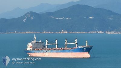
AE MARS
Bulk Carrier
Current Trip
| Time Travelled | 17 days |
|---|---|
| Remaining Time | --- |
| Distance Travelled | 4077.00 nm |
| Remaining Distance | --- |
| AVG Speed | 9.7 Knots |
| MAX Speed | 12.9 Knots |
| AVG Wind | 9.6 knots |
| MAX Wind | 24.9 knots |
| MIN Temp | 15.2°C / 59.36°F |
| MAX Temp | 30.9°C / 87.62°F |
| Draught | 12.6 m |
| Position Received | 5 d ago |
Current Position
| Longitude | 103.47773° |
|---|---|
| Latitude | 1.22085° |
| Status | Under way using engine |
| Speed | 11.6 Knots |
| Course | 283.6° |
| Area | Singapore Strait |
| Station | T-AIS |
| Position Received | 5 d ago |
Info
Information
The current position of AE MARS is in Singapore Strait with coordinates 1.22085° / 103.47773° as reported on 2024-06-11 01:40 by AIS to our vessel tracker app. The vessel's current speed is 11.6 Knots and is heading at the port of SOKHNA. The estimated time of arrival as calculated by vessel tracking app is 2024-06-28 16:00 LT
The vessel AE MARS (IMO: 9330111, MMSI: 636022154) is a Bulk Carrier that was built in 2006 ( 18 years old ). It's sailing under the flag of [LR] Liberia.
In this page you can find informations about the vessels current position, last detected port calls, and current voyage information. If the vessels is not in coverage by AIS you will find the latest position.
The current position of AE MARS is detected by our AIS receivers and we are not responsible for the reliability of the data. The last position was recorded while the vessel was in Coverage by the Ais receivers of our vessel tracking app.
The current draught of AE MARS as reported by AIS is 12.6 meters
Weather
| Temperature | 28.5°C / 83.3°F |
|---|---|
| Wind Speed | 20 knots |
| Direction | 236° SW |
| Pressure | 1008.9 hPa |
| Humidity | 84.6 % |
| Cloud Coverage | 40 % |
Featured Company
Last Port Calls
| Port | Arrival | Departure | Time In Port |
|---|---|---|---|
| 2024-05-28 09:21 | 2024-05-30 03:34 | 1 d | |
| 2024-05-25 00:36 | 2024-05-27 13:57 | 2 d | |
| 2024-04-30 22:17 | 2024-05-03 03:56 | 2 d | |
| 2024-04-24 22:21 | 2024-04-29 13:52 | 4 d | |
| 2024-04-19 13:18 | 2024-04-21 06:54 | 1 d | |
| 2024-04-11 02:22 | 2024-04-14 11:15 | 3 d | |
| 2024-04-10 00:42 |
Last Trips
| Origin | Departure | Destination | Arrival | Distance | |
|---|---|---|---|---|---|
| 2024-05-27 21:57 | 2024-05-28 17:21 | 213.69 nm | |||
| 2024-05-03 09:26 | 2024-05-25 08:36 | 5621.66 nm | |||
| 2024-04-29 19:22 | 2024-05-01 03:47 | 325.39 nm | |||
| 2024-04-21 10:54 | 2024-04-25 03:51 | 982.19 nm | |||
| 2024-04-14 14:15 | 2024-04-19 17:18 | 520.86 nm | |||
| 2024-04-10 03:42 | 2024-04-11 05:22 | 295.74 nm |
Events
| Time | Event | Details | Position / Dest | Info |
|---|---|---|---|---|
| 2024-06-11 01:45 | Status Changed | Default Under way using engine |
1.22444 / 103.46307
EG AIS
|
Speed: 11.6 kn Course: 283.6° |
| 2024-06-11 01:40 | OUT of Coverage |
1.22085 / 103.47773
Singapore Strait
EG AIS
|
Speed: 11.6 kn Course: 283.6° |
|
| 2024-06-11 01:04 | Change Sea Area | Malaysian part of the Singapore Strait Indonesian part of the Singapore Strait |
1.19657 / 103.58844
Singapore Strait
EG AIS
|
Speed: 10.8 kn Course: 280.8° |
| 2024-06-11 00:31 | Change Sea Area | Indonesian part of the Singapore Strait Singaporean part of the Singapore Strait |
1.17374 / 103.67753
Singapore Strait
EG AIS
|
Speed: 9.7 kn Course: 295.9° |
| 2024-06-10 22:58 | Change Sea Area | Singaporean part of the Singapore Strait Indonesian part of the Singapore Strait |
1.18879 / 103.84281
Singapore Strait
EG AIS
|
Speed: 4.3 kn Course: 253.1° |
| 2024-06-10 22:43 | Change Sea Area | Indonesian part of the Singapore Strait Singaporean part of the Singapore Strait |
1.19736 / 103.86367
Singapore Strait
EG AIS
|
Speed: 5.2 kn Course: 237.9° |
| 2024-06-10 21:15 | START Moving | 1.35 nm, South of TANAH MERAH |
1.29056 / 104.01158
EG AIS
|
Speed: 3.6 kn Course: 215° |
| 2024-06-10 21:14 | Draught Changed | 12.6 12.5 |
1.29161 / 104.01167
EG AIS
|
Speed: 2.8 kn Course: 214° |
| 2024-06-10 21:07 | Status Changed | Under way using engine At anchor |
1.29290 / 104.01212
EG AIS
|
Speed: 0.3 kn Course: 267° |
| 2024-06-10 19:10 | Status Changed | At anchor Default |
1.29296 / 104.01260
EG AIS
|
Speed: 0.1 kn Course: 274° |