
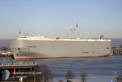
AEGEAN HIGHWAY
Vehicles Carrier
Current Trip
| Time Travelled | 11 days |
|---|---|
| Remaining Time | 4 days |
| Distance Travelled | 3696.09 nm |
| Remaining Distance | 1677.02 nm |
| AVG Speed | 14.6 Knots |
| MAX Speed | 19.3 Knots |
| AVG Wind | 8.4 knots |
| MAX Wind | 20.5 knots |
| MIN Temp | 11.8°C / 53.24°F |
| MAX Temp | 30.8°C / 87.44°F |
| Draught | 8.2 m |
| Position Received | 4 d ago |
Current Position
| Longitude | -79.49713° |
|---|---|
| Latitude | 8.85707° |
| Status | Under way using engine |
| Speed | 11.5 Knots |
| Course | 142° |
| Area | North Pacific Ocean |
| Station | T-AIS |
| Position Received | 4 d ago |
Info
Information
The current position of AEGEAN HIGHWAY is in North Pacific Ocean with coordinates 8.85707° / -79.49713° as reported on 2024-05-28 00:59 by AIS to our vessel tracker app. The vessel's current speed is 11.5 Knots and is heading at the port of CRISTOBAL. The estimated time of arrival as calculated by vessel tracking app is 2024-06-05 13:02 LT
The vessel AEGEAN HIGHWAY (IMO: 9464388, MMSI: 432666000) is a Vehicles Carrier that was built in 2008 ( 16 years old ). It's sailing under the flag of [JP] Japan.
In this page you can find informations about the vessels current position, last detected port calls, and current voyage information. If the vessels is not in coverage by AIS you will find the latest position.
The current position of AEGEAN HIGHWAY is detected by our AIS receivers and we are not responsible for the reliability of the data. The last position was recorded while the vessel was in Coverage by the Ais receivers of our vessel tracking app.
The current draught of AEGEAN HIGHWAY as reported by AIS is 8.2 meters
Weather
| Temperature | 27.8°C / 82.04°F |
|---|---|
| Wind Speed | 15 knots |
| Direction | 289° WNW |
| Pressure | 1008.2 hPa |
| Humidity | 76.6 % |
| Cloud Coverage | 24 % |
Featured Company
Last Port Calls
| Port | Arrival | Departure | Time In Port |
|---|---|---|---|
| 2024-05-20 01:46 | 2024-05-21 01:31 | 23 h | |
| 2024-05-16 22:54 | 2024-05-17 21:46 | 22 h | |
| 2024-04-19 05:55 | 2024-04-22 08:56 | 3 d |
Most Visited Ports (Last year)
| Port | Arrivals | |
|---|---|---|
| 7 | ||
| 4 | ||
| 4 | ||
| 3 | ||
| 3 | ||
| 3 |
Last Trips
| Origin | Departure | Destination | Arrival | Distance | |
|---|---|---|---|---|---|
| 2024-05-17 17:46 | 2024-05-19 21:46 | 824.23 nm | |||
| 2024-04-22 17:56 | 2024-05-16 18:54 | 9544.21 nm | |||
| 2024-03-22 02:07 | 2024-04-19 14:55 | 10083.03 nm |
Events
| Time | Event | Details | Position / Dest | Info |
|---|---|---|---|---|
| 2024-05-28 01:08 | Status Changed | Default Under way using engine |
8.83602 / -79.48132
PA CTB
|
Speed: 11.5 kn Course: 142° |
| 2024-05-28 00:59 | OUT of Coverage |
8.85707 / -79.49713
North Pacific Ocean
|
Speed: 11.5 kn Course: 142° |
|
| 2024-05-28 00:56 | Detected in Sea | Panamanian part of the North Pacific Ocean |
8.86660 / -79.50441
North Pacific Ocean
|
Speed: 11 kn Course: 142° |
| 2024-05-28 00:54 | Status Changed | Under way using engine Default |
8.87193 / -79.50863
PA CTB
|
Speed: 10.3 kn Course: 141° |
| 2024-05-28 00:54 | IN Coverage |
8.86660 / -79.50441
North Pacific Ocean
|
Speed: 11 kn Course: 142° |
|
| 2024-05-27 23:51 | START Moving | 2.2 nm, North of RODMAN |
8.99025 / -79.58588
PA CTB
|
Speed: 4.2 kn Course: 134° |
| 2024-05-27 20:54 | STOP Moving | 4.3 nm, North West of RODMAN |
9.01637 / -79.61240
PA CTB
|
Speed: Course: 132° |
| 2024-05-27 15:03 | START Moving | 5.16 nm, South of CRISTOBAL |
9.26133 / -79.92460
PA CTB
|
Speed: 3.8 kn Course: 186° |
| 2024-05-27 13:23 | STOP Moving | 4.05 nm, South of CRISTOBAL |
9.27967 / -79.92194
PA CTB
|
Speed: Course: 188° |
| 2024-05-27 11:03 | START Moving | 4.37 nm, North West of COLON |
9.42797 / -79.93745
PA CTB
|
Speed: 4.3 kn Course: 65° |