
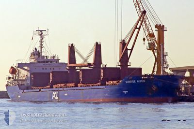
AFRICAN JOSEPH R
Bulk Carrier
Current Trip
| Time Travelled | 1 day |
|---|---|
| Remaining Time | 8 days |
| Distance Travelled | 348.62 nm |
| Remaining Distance | 2441.24 nm |
| AVG Speed | 11.8 Knots |
| MAX Speed | 13 Knots |
| AVG Wind | 8.7 knots |
| MAX Wind | 12.1 knots |
| MIN Temp | 14.7°C / 58.46°F |
| MAX Temp | 17.7°C / 63.86°F |
| Draught | 8.9 m |
| Position Received | 1 m ago |
Current Position
| Longitude | 11.77715° |
|---|---|
| Latitude | 54.43430° |
| Status | Under way using engine |
| Speed | 11.9 Knots |
| Course | 297° |
| Area | Baltic Sea |
| Station | T-AIS |
| Position Received | 1 m ago |
Info
Information
The current position of AFRICAN JOSEPH R is in Baltic Sea with coordinates 54.43430° / 11.77715° as reported on 2024-06-25 23:56 by AIS to our vessel tracker app. The vessel's current speed is 11.9 Knots and is heading at the port of LAS PALMAS. The estimated time of arrival as calculated by vessel tracking app is 2024-07-04 11:24 LT
The vessel AFRICAN JOSEPH R (IMO: 9333711, MMSI: 636016043) is a Bulk Carrier that was built in 2006 ( 18 years old ). It's sailing under the flag of [LR] Liberia.
In this page you can find informations about the vessels current position, last detected port calls, and current voyage information. If the vessels is not in coverage by AIS you will find the latest position.
The current position of AFRICAN JOSEPH R is detected by our AIS receivers and we are not responsible for the reliability of the data. The last position was recorded while the vessel was in Coverage by the Ais receivers of our vessel tracking app.
The current draught of AFRICAN JOSEPH R as reported by AIS is 8.9 meters
Weather
| Temperature | 17.8°C / 64.04°F |
|---|---|
| Wind Speed | 11 knots |
| Direction | 106° ESE |
| Pressure | 1017.4 hPa |
| Humidity | 86.5 % |
| Cloud Coverage | --- |
Featured Company
Last Port Calls
| Port | Arrival | Departure | Time In Port |
|---|---|---|---|
| 2024-06-21 17:24 | 2024-06-24 19:00 | 3 d | |
| 2024-06-08 14:55 | |||
| 2024-05-25 12:15 | 2024-05-29 02:24 | 3 d | |
| 2024-05-15 15:54 | 2024-05-21 10:52 | 5 d | |
| 2024-05-08 08:39 | 2024-05-11 12:59 | 3 d | |
| 2024-04-12 19:43 | 2024-04-18 05:21 | 5 d |
Most Visited Ports (Last year)
| Port | Arrivals | |
|---|---|---|
| 4 | ||
| 3 | ||
| 2 | ||
| 2 | ||
| 1 | ||
| 1 |
Last Trips
| Origin | Departure | Destination | Arrival | Distance | |
|---|---|---|---|---|---|
| 2024-06-08 14:55 | 2024-06-21 20:24 | 3435.86 nm | |||
| 2024-05-21 11:52 | 2024-05-25 13:15 | 214.55 nm | |||
| 2024-05-11 13:59 | 2024-05-15 16:54 | 247.42 nm | |||
| 2024-04-18 02:21 | 2024-05-08 09:39 | 4519.57 nm | |||
| 2024-03-24 00:11 | 2024-04-12 16:43 | 4868.53 nm |
Events
| Time | Event | Details | Position / Dest | Info |
|---|---|---|---|---|
| 2024-06-25 19:41 | Change Sea Area | Danish part of the Baltic Sea German part of the Baltic Sea |
54.84093 / 12.93218
Baltic Sea
ES LPA
|
Speed: 12.1 kn Course: 245° |
| 2024-06-25 17:08 | Change Sea Area | German part of the Baltic Sea Swedish part of the Baltic Sea |
55.01407 / 13.79083
Baltic Sea
ES LPA
|
Speed: 12.1 kn Course: 248° |
| 2024-06-25 13:37 | Detected in Sea | Swedish part of the Baltic Sea |
55.47168 / 14.70097
Baltic Sea
ES LPA
|
Speed: 12.4 kn Course: 244° |
| 2024-06-25 11:52 | Change Sea Area | Danish part of the Kattegat Swedish part of the Baltic Sea |
55.62378 / 15.27817
Kattegat
ES LPA
|
Speed: 12 kn Course: 256° |
| 2024-06-25 05:56 | Status Changed | Under way using engine Default |
55.92647 / 17.33445
ES LPA
|
Speed: 12.1 kn Course: 257° |
| 2024-06-25 05:46 | Status Changed | Default Under way using engine |
55.93305 / 17.39107
ES LPA
|
Speed: 12 kn Course: 257° |
| 2024-06-25 04:25 | Status Changed | Under way using engine Default |
55.96153 / 17.86567
ES LPA
|
Speed: 12.3 kn Course: 285° |
| 2024-06-25 04:22 | Status Changed | Default Under way using engine |
55.95907 / 17.88352
ES LPA
|
Speed: 12.3 kn Course: 285° |
| 2024-06-25 03:10 | Change Sea Area | Swedish part of the Baltic Sea Polish part of the Baltic Sea |
55.89932 / 18.29958
Baltic Sea
ES LPA
|
Speed: 12 kn Course: 284° |
| 2024-06-25 01:19 | Change Sea Area | Polish part of the Baltic Sea Russian part of the Baltic Sea |
55.81360 / 18.93988
Baltic Sea
ES LPA
|
Speed: 11.9 kn Course: 286° |