
AG SATURN
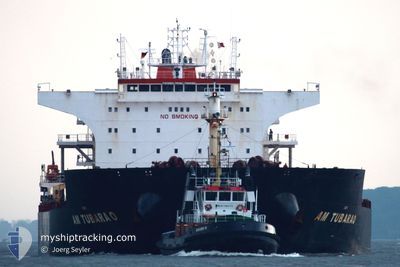
Bulk Carrier
Current Trip
| Time Travelled | 21 days |
|---|---|
| Remaining Time | --- |
| Distance Travelled | 3825.79 nm |
| Remaining Distance | 4.77 nm |
| AVG Speed | 11.2 Knots |
| MAX Speed | 15.9 Knots |
| AVG Wind | 11.6 knots |
| MAX Wind | 28 knots |
| MIN Temp | 10.7°C / 51.26°F |
| MAX Temp | 19.4°C / 66.92°F |
| Draught | 7.7 m |
| Position Received | 3 m ago |
Current Position
| Longitude | 10.75813° |
|---|---|
| Latitude | 57.70298° |
| Status | At anchor |
| Speed | |
| Course | 208° |
| Area | Kattegat |
| Station | T-AIS |
| Position Received | 3 m ago |
Info
Information
The current position of AG SATURN is in Kattegat with coordinates 57.70298° / 10.75813° as reported on 2024-05-19 03:58 by AIS to our vessel tracker app. The vessel's current speed is 0 Knots and is heading at the port of SKAGEN. The estimated time of arrival as calculated by vessel tracking app is 2024-05-12 23:00 LT
The vessel AG SATURN (IMO: 9593488, MMSI: 636015171) is a Bulk Carrier that was built in 2011 ( 13 years old ). It's sailing under the flag of [LR] Liberia.
In this page you can find informations about the vessels current position, last detected port calls, and current voyage information. If the vessels is not in coverage by AIS you will find the latest position.
The current position of AG SATURN is detected by our AIS receivers and we are not responsible for the reliability of the data. The last position was recorded while the vessel was in Coverage by the Ais receivers of our vessel tracking app.
The current draught of AG SATURN as reported by AIS is 7.7 meters
Weather
| Temperature | 13.5°C / 56.3°F |
|---|---|
| Wind Speed | 6 knots |
| Direction | 334° NNW |
| Pressure | 1012.8 hPa |
| Humidity | 69.2 % |
| Cloud Coverage | 5 % |
Featured Company
Most Visited Ports (Last year)
| Port | Arrivals | |
|---|---|---|
| 4 | ||
| 4 | ||
| 3 | ||
| 1 | ||
| 1 | ||
| 1 |
Last Trips
| Origin | Departure | Destination | Arrival | Distance | |
|---|---|---|---|---|---|
| 2024-03-31 12:59 | 2024-04-23 06:04 | 4829.34 nm | |||
| 2024-03-18 02:09 | 2024-03-25 01:42 | 1333.24 nm | |||
| 2024-03-07 03:27 | 2024-03-07 23:48 | 143.03 nm | |||
| 2024-02-16 04:00 | 2024-03-02 18:22 | 3116.58 nm |
Events
| Time | Event | Details | Position / Dest | Info |
|---|---|---|---|---|
| 2024-05-19 00:58 | Status Changed | At anchor Default |
57.70314 / 10.75734
SKAW
|
Speed: Course: 193° |
| 2024-05-19 00:55 | Status Changed | Default At anchor |
57.70314 / 10.75728
SKAW
|
Speed: Course: 192° |
| 2024-05-17 10:57 | Status Changed | At anchor Default |
57.70306 / 10.75784
SKAW
|
Speed: Course: 201° |
| 2024-05-17 10:54 | Status Changed | Default At anchor |
57.70307 / 10.75781
SKAW
|
Speed: Course: 201° |
| 2024-05-12 22:00 | Status Changed | At anchor Under way using engine |
57.70065 / 10.75275
SKAW
|
Speed: 0.2 kn Course: 90° |
| 2024-05-12 21:54 | STOP Moving | 5.14 nm, East of SKAGEN |
57.70050 / 10.75386
SKAW
|
Speed: 0.2 kn Course: 101° |
| 2024-05-12 20:44 | Change Sea Area | Danish part of the Kattegat Danish part of the Skaggerak |
57.76138 / 10.77960
Kattegat
SKAW
|
Speed: 7.7 kn Course: 212.3° |
| 2024-05-12 13:05 | Change Sea Area | Danish part of the Skaggerak Danish part of the North Sea |
57.36971 / 8.16742
Skaggerak
SKAW
|
Speed: 12.4 kn Course: 63.6° |
| 2024-05-12 03:58 | Status Changed | Under way using engine Default |
55.90434 / 6.34447
SKAW
|
Speed: 11.9 kn Course: 39° |
| 2024-05-12 03:52 | Status Changed | Default Under way using engine |
55.88893 / 6.32090
SKAW
|
Speed: 11.9 kn Course: 27.6° |