
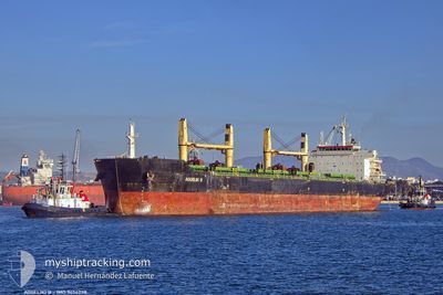
AGGELIKI B
Bulk Carrier
Current Trip
| Time Travelled | 6 days |
|---|---|
| Remaining Time | --- |
| Distance Travelled | 46.97 nm |
| Remaining Distance | --- |
| AVG Speed | 10.6 Knots |
| MAX Speed | 12.3 Knots |
| AVG Wind | 9 knots |
| MAX Wind | 21 knots |
| MIN Temp | 17.7°C / 63.86°F |
| MAX Temp | 25.2°C / 77.36°F |
| Draught | 12.5 m |
| Position Received | 1 d ago |
Current Position
| Longitude | -48.08306° |
|---|---|
| Latitude | -25.67336° |
| Status | At anchor |
| Speed | 0.1 Knots |
| Course | 49° |
| Area | South Atlantic Ocean |
| Station | T-AIS |
| Position Received | 1 d ago |
Info
Information
The current position of AGGELIKI B is in South Atlantic Ocean with coordinates -25.67336° / -48.08306° as reported on 2024-06-23 19:41 by AIS to our vessel tracker app. The vessel's current speed is 0.1 Knots
The vessel AGGELIKI B (IMO: 9456238, MMSI: 538007006) is a Bulk Carrier that was built in 2011 ( 13 years old ). It's sailing under the flag of [MH] Marshall Is.
In this page you can find informations about the vessels current position, last detected port calls, and current voyage information. If the vessels is not in coverage by AIS you will find the latest position.
The current position of AGGELIKI B is detected by our AIS receivers and we are not responsible for the reliability of the data. The last position was recorded while the vessel was in Coverage by the Ais receivers of our vessel tracking app.
The current draught of AGGELIKI B as reported by AIS is 12.5 meters
Weather
| Temperature | 18.6°C / 65.48°F |
|---|---|
| Wind Speed | 20 knots |
| Direction | 178° S |
| Pressure | 1019.7 hPa |
| Humidity | 88 % |
| Cloud Coverage | 100 % |
Featured Company
Last Port Calls
| Port | Arrival | Departure | Time In Port |
|---|---|---|---|
| 2024-06-13 03:59 | 2024-06-19 02:54 | 5 d | |
| 2024-05-04 04:34 | 2024-05-04 04:37 | 2 m | |
| 2024-04-26 15:41 | 2024-04-29 18:25 | 3 d | |
| 2024-04-19 10:02 | 2024-04-20 06:41 | 20 h | |
| 2024-04-15 04:19 | 2024-04-16 12:52 | 1 d | |
| 2024-04-08 10:35 | 2024-04-11 10:32 | 2 d | |
| 2024-04-06 05:02 | 2024-04-06 16:38 | 11 h | |
| 2024-04-02 05:54 | 2024-04-05 18:16 | 3 d |
Most Visited Ports (Last year)
| Port | Arrivals | |
|---|---|---|
| 2 | ||
| 2 | ||
| 2 | ||
| 1 | ||
| 1 | ||
| 1 |
Last Trips
| Origin | Departure | Destination | Arrival | Distance | |
|---|---|---|---|---|---|
| 2024-05-04 06:37 | 2024-06-13 00:59 | 7886.09 nm | |||
| 2024-04-29 20:25 | 2024-05-04 06:34 | 1101.06 nm | |||
| 2024-04-20 08:41 | 2024-04-26 17:41 | 1374.28 nm | |||
| 2024-04-16 14:52 | 2024-04-19 12:02 | 718.85 nm | |||
| 2024-04-11 12:32 | 2024-04-15 06:19 | 732.96 nm | |||
| 2024-04-06 18:38 | 2024-04-08 12:35 | 92.50 nm | |||
| 2024-04-05 20:16 | 2024-04-06 07:02 | 90.97 nm | |||
| 2024-02-11 23:00 | 2024-04-02 07:54 | 4503.39 nm |
Events
| Time | Event | Details | Position / Dest | Info |
|---|---|---|---|---|
| 2024-06-23 19:50 | Status Changed | Default At anchor |
-25.67334 / -48.08306
BR PNG
|
Speed: 0.1 kn Course: 49° |
| 2024-06-23 19:41 | Status Changed | At anchor Default |
-25.67336 / -48.08306
BR PNG
|
Speed: 0.1 kn Course: 47° |
| 2024-06-23 19:41 | OUT of Coverage |
-25.67336 / -48.08306
South Atlantic Ocean
BR PNG
|
Speed: 0.1 kn Course: 135° |
|
| 2024-06-23 19:23 | IN Coverage |
-25.67336 / -48.08306
South Atlantic Ocean
BR PNG
|
Speed: 0.1 kn Course: 135° |
|
| 2024-06-22 20:26 | STOP Moving | 14.45 nm, South East of ILHA DO MEL |
-25.67373 / -48.08196
BR PNG
|
Speed: 0.1 kn Course: 2° |
| 2024-06-22 19:26 | START Moving | 19.64 nm, East of ILHA DO MEL |
-25.64990 / -47.96378
BR PNG
|
Speed: 3.6 kn Course: 298° |
| 2024-06-22 18:48 | Status Changed | Default At anchor |
-25.65142 / -47.96456
BR PNG
|
Speed: 0.1 kn Course: 43° |
| 2024-06-22 18:42 | Status Changed | At anchor Default |
-25.65128 / -47.96457
BR PNG
|
Speed: Course: 41° |
| 2024-06-22 18:42 | IN Coverage |
-25.65128 / -47.96457
South Atlantic Ocean
BR PNG
|
Speed: 0.1 kn Course: 156° |
|
| 2024-06-22 18:42 | OUT of Coverage |
-25.65128 / -47.96457
South Atlantic Ocean
BR PNG
|
Speed: 0.1 kn Course: 156° |