
AGITOS
Tanker
Current Trip
| Time Travelled | 7 days |
|---|---|
| Remaining Time | --- |
| Distance Travelled | 2072.79 nm |
| Remaining Distance | --- |
| AVG Speed | 11.7 Knots |
| MAX Speed | 15.2 Knots |
| AVG Wind | 9.3 knots |
| MAX Wind | 18.9 knots |
| MIN Temp | 26.4°C / 79.52°F |
| MAX Temp | 30°C / 86°F |
| Draught | 11.2 m |
| Position Received | 7 d ago |
Current Position
| Longitude | 103.57253° |
|---|---|
| Latitude | 1.19785° |
| Status | Under way using engine |
| Speed | 13.1 Knots |
| Course | 274.6° |
| Area | Singapore Strait |
| Station | T-AIS |
| Position Received | 7 d ago |
Info
Information
The current position of AGITOS is in Singapore Strait with coordinates 1.19785° / 103.57253° as reported on 2024-06-02 18:59 by AIS to our vessel tracker app. The vessel's current speed is 13.1 Knots
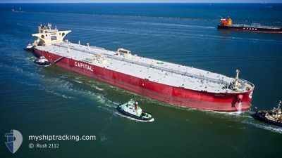
The vessel AGITOS (IMO: 9830824, MMSI: 636018814) is a Tanker It's sailing under the flag of [LR] Liberia.
In this page you can find informations about the vessels current position, last detected port calls, and current voyage information. If the vessels is not in coverage by AIS you will find the latest position.
The current position of AGITOS is detected by our AIS receivers and we are not responsible for the reliability of the data. The last position was recorded while the vessel was in Coverage by the Ais receivers of our vessel tracking app.
The current draught of AGITOS as reported by AIS is 11.2 meters
Weather
| Temperature | 29°C / 84.2°F |
|---|---|
| Wind Speed | 15 knots |
| Direction | 281° W |
| Pressure | 1009.8 hPa |
| Humidity | 79.8 % |
| Cloud Coverage | 100 % |
Featured Company
Last Port Calls
| Port | Arrival | Departure | Time In Port |
|---|---|---|---|
| 2024-05-30 08:52 | 2024-06-02 10:11 | 3 d |
Most Visited Ports (Last year)
| Port | Arrivals | |
|---|---|---|
| 2 | ||
| 2 | ||
| 1 | ||
| 1 | ||
| 1 | ||
| 1 |
Last Trips
| Origin | Departure | Destination | Arrival | Distance | |
|---|---|---|---|---|---|
| 2024-03-28 08:23 | 2024-05-30 16:52 | 13255.03 nm |
Events
| Time | Event | Details | Position / Dest | Info |
|---|---|---|---|---|
| 2024-06-02 19:06 | Status Changed | Default Under way using engine |
1.20058 / 103.54686
PWBGB
|
Speed: 13.1 kn Course: 274.6° |
| 2024-06-02 18:59 | OUT of Coverage |
1.19785 / 103.57253
Singapore Strait
|
Speed: 13.1 kn Course: 274.6° |
|
| 2024-06-02 18:55 | Change Sea Area | Malaysian part of the Singapore Strait Indonesian part of the Singapore Strait |
1.19673 / 103.58623
Singapore Strait
|
Speed: 12.9 kn Course: 274.4° |
| 2024-06-02 18:45 | Status Changed | Under way using engine Default |
1.19292 / 103.62134
PWBGB
|
Speed: 10.4 kn Course: 279° |
| 2024-06-02 18:42 | Status Changed | Default Under way using engine |
1.19158 / 103.62987
PWBGB
|
Speed: 6.7 kn Course: 271.6° |
| 2024-06-02 18:30 | Change Sea Area | Indonesian part of the Singapore Strait Singaporean part of the Singapore Strait |
1.19437 / 103.65019
Singapore Strait
|
Speed: 4.1 kn Course: 217° |
| 2024-06-02 18:04 | START Moving | 3.02 nm, South West of JURONG ISLAND |
1.22239 / 103.65564
PWBGB
|
Speed: 3.1 kn Course: 149° |
| 2024-06-02 17:56 | Status Changed | Under way using engine At anchor |
1.22083 / 103.65195
PWBGB
|
Speed: 0.2 kn Course: 55° |
| 2024-06-02 17:53 | Status Changed | At anchor Default |
1.22085 / 103.65207
PWBGB
|
Speed: 0.3 kn Course: 63° |
| 2024-06-02 17:50 | Status Changed | Default At anchor |
1.22104 / 103.65218
PWBGB
|
Speed: 0.3 kn Course: 68° |