
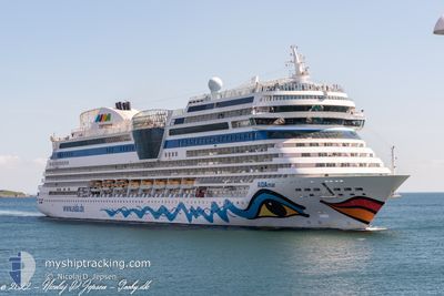
AIDAMAR
Passengers Ship
Current Trip
| Trip Time | 1 day |
|---|---|
| Trip Distance | 304.90 nm |
| AVG Speed | 8.6 Knots |
| MAX Speed | 8.6 Knots |
| Draught | 7.3 m |
| AVG Wind | 16.2 knots |
| MAX Wind | 20 knots |
| MIN Temp | 10.3°C / 50.54°F |
| MAX Temp | 15.4°C / 59.72°F |
| Position Received | 2 m ago |
Current Position
| Longitude | 12.09387° |
|---|---|
| Latitude | 54.17635° |
| Status | Moored |
| Speed | |
| Course | 341° |
| Area | Baltic Sea |
| Station | T-AIS |
| Position Received | 2 m ago |
Info
Information
The current position of AIDAMAR is in Baltic Sea with coordinates 54.17635° / 12.09387° as reported on 2024-05-17 09:58 by AIS to our vessel tracker app. The vessel's current speed is 0 Knots and is currently inside the port of ROSTOCK.
The vessel AIDAMAR (IMO: 9490052, MMSI: 247312900) is a Passengers Ship that was built in 2012 ( 12 years old ). It's sailing under the flag of [IT] Italy.
In this page you can find informations about the vessels current position, last detected port calls, and current voyage information. If the vessels is not in coverage by AIS you will find the latest position.
The current position of AIDAMAR is detected by our AIS receivers and we are not responsible for the reliability of the data. The last position was recorded while the vessel was in Coverage by the Ais receivers of our vessel tracking app.
The current draught of AIDAMAR as reported by AIS is 7.3 meters
Weather
| Temperature | 16°C / 60.8°F |
|---|---|
| Wind Speed | 15 knots |
| Direction | 104° ESE |
| Pressure | 1013.3 hPa |
| Humidity | 68.3 % |
| Cloud Coverage | 14 % |
Featured Company
Last Port Calls
| Port | Arrival | Departure | Time In Port |
|---|---|---|---|
| 2024-05-17 04:32 | |||
| 2024-05-15 05:28 | 2024-05-15 16:20 | 10 h | |
| 2024-05-14 05:32 | 2024-05-14 16:03 | 10 h | |
| 2024-05-13 04:42 | 2024-05-13 16:19 | 11 h | |
| 2024-05-12 06:55 | 2024-05-12 18:09 | 11 h | |
| 2024-05-11 07:12 | 2024-05-11 18:16 | 11 h | |
| 2024-05-10 07:15 | 2024-05-10 18:16 | 11 h | |
| 2024-05-09 04:43 | 2024-05-09 16:11 | 11 h | |
| 2024-05-08 05:41 | 2024-05-08 16:09 | 10 h | |
| 2024-05-07 05:20 | 2024-05-07 16:23 | 11 h |
Last Trips
| Origin | Departure | Destination | Arrival | Distance | |
|---|---|---|---|---|---|
| 2024-05-15 18:20 | 2024-05-17 06:32 | 304.90 nm | |||
| 2024-05-14 18:03 | 2024-05-15 07:28 | 190.50 nm | |||
| 2024-05-13 18:19 | 2024-05-14 07:32 | 117.49 nm | |||
| 2024-05-12 20:09 | 2024-05-13 06:42 | 106.17 nm | |||
| 2024-05-11 20:16 | 2024-05-12 08:55 | 132.35 nm | |||
| 2024-05-10 20:16 | 2024-05-11 09:12 | 139.98 nm | |||
| 2024-05-09 18:11 | 2024-05-10 09:15 | 168.97 nm | |||
| 2024-05-08 18:09 | 2024-05-09 06:43 | 125.66 nm | |||
| 2024-05-07 18:23 | 2024-05-08 07:41 | 191.52 nm | |||
| 2024-05-05 18:11 | 2024-05-07 07:20 | 293.72 nm |
Events
| Time | Event | Details | Position / Dest | Info |
|---|---|---|---|---|
| 2024-05-17 06:16 | Status Changed | Moored Default |
54.17635 / 12.09387
[DE] ROSTOCK
|
Speed: Course: 341° |
| 2024-05-17 06:10 | Status Changed | Default Moored |
54.17635 / 12.09387
[DE] ROSTOCK
|
Speed: Course: 341° |
| 2024-05-17 05:23 | Status Changed | Moored Under way using engine |
54.17636 / 12.09386
[DE] ROSTOCK
|
Speed: Course: 341° |
| 2024-05-17 05:13 | STOP Moving |
54.17617 / 12.09426
[DE] ROSTOCK
|
Speed: 0.3 kn Course: 341° |
|
| 2024-05-17 04:32 | PORT ARRIVAL |
|
54.18846 / 12.08879
[DE] ROSTOCK
|
Speed: 8.7 kn Course: 161.5° |
| 2024-05-17 03:05 | Change Sea Area | German part of the Baltic Sea Danish part of the Baltic Sea |
54.37083 / 11.96569
Baltic Sea
DE WAR
|
Speed: 8.2 kn Course: 166° |
| 2024-05-16 22:08 | Detected in Sea | Danish part of the Baltic Sea |
54.79400 / 12.81707
Baltic Sea
DE WAR
|
Speed: 9 kn Course: 276.1° |
| 2024-05-16 16:31 | Status Changed | Under way using engine Restricted manoeuverability |
54.63940 / 14.08773
DE WAR
|
Speed: 8 kn Course: 265° |
| 2024-05-16 15:43 | Status Changed | Restricted manoeuverability Under way using engine |
54.63881 / 14.34473
DE WAR
|
Speed: 19.8 kn Course: 285.9° |
| 2024-05-16 15:32 | Change Sea Area | German part of the Baltic Sea Danish part of the Kattegat |
54.63101 / 14.44605
Baltic Sea
DE WAR
|
Speed: 19.7 kn Course: 262.1° |