
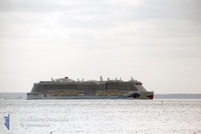
AIDANOVA
Passenger
Current Trip
| Time Travelled | 10 h, 57 mins |
|---|---|
| Remaining Time | 13 h, 14 mins |
| Distance Travelled | 29.00 nm |
| Remaining Distance | 138.41 nm |
| AVG Speed | 8.6 Knots |
| MAX Speed | 14.1 Knots |
| AVG Wind | 11.4 knots |
| MAX Wind | 14.9 knots |
| MIN Temp | 12.4°C / 54.32°F |
| MAX Temp | 16.5°C / 61.7°F |
| Draught | 8.6 m |
| Position Received | Now |
Current Position
| Longitude | 10.81024° |
|---|---|
| Latitude | 54.61823° |
| Status | Under way using engine |
| Speed | 0.2 Knots |
| Course | 99° |
| Area | Baltic Sea |
| Station | T-AIS |
| Position Received | Now |
Info
Information
The current position of AIDANOVA is in Baltic Sea with coordinates 54.61823° / 10.81024° as reported on 2024-05-19 03:24 by AIS to our vessel tracker app. The vessel's current speed is 0.2 Knots and is heading at the port of COPENHAGEN. The estimated time of arrival as calculated by vessel tracking app is 2024-05-19 16:38 LT
The vessel AIDANOVA (IMO: 9781865, MMSI: 247389200) is a Passenger It's sailing under the flag of [IT] Italy.
In this page you can find informations about the vessels current position, last detected port calls, and current voyage information. If the vessels is not in coverage by AIS you will find the latest position.
The current position of AIDANOVA is detected by our AIS receivers and we are not responsible for the reliability of the data. The last position was recorded while the vessel was in Coverage by the Ais receivers of our vessel tracking app.
The current draught of AIDANOVA as reported by AIS is 8.6 meters
Weather
| Temperature | 12.7°C / 54.86°F |
|---|---|
| Wind Speed | 9 knots |
| Direction | 51° NE |
| Pressure | 1010.3 hPa |
| Humidity | 84.6 % |
| Cloud Coverage | 74 % |
Featured Company
Last Port Calls
| Port | Arrival | Departure | Time In Port |
|---|---|---|---|
| 2024-05-18 03:16 | 2024-05-18 16:27 | 13 h | |
| 2024-05-16 06:00 | 2024-05-16 18:17 | 12 h | |
| 2024-05-15 04:02 | 2024-05-15 14:17 | 10 h | |
| 2024-05-14 04:37 | 2024-05-14 18:17 | 13 h | |
| 2024-05-13 04:52 | 2024-05-13 16:17 | 11 h | |
| 2024-05-11 03:04 | 2024-05-11 16:24 | 13 h | |
| 2024-05-09 06:56 | 2024-05-09 18:15 | 11 h | |
| 2024-05-08 04:08 | 2024-05-08 14:28 | 10 h | |
| 2024-05-07 04:29 | 2024-05-07 18:21 | 13 h | |
| 2024-05-06 05:54 | 2024-05-06 15:56 | 10 h |
Last Trips
| Origin | Departure | Destination | Arrival | Distance | |
|---|---|---|---|---|---|
| 2024-05-16 20:17 | 2024-05-18 05:16 | 493.15 nm | |||
| 2024-05-15 16:17 | 2024-05-16 08:00 | 277.74 nm | |||
| 2024-05-14 20:17 | 2024-05-15 06:02 | 92.73 nm | |||
| 2024-05-13 18:17 | 2024-05-14 06:37 | 199.87 nm | |||
| 2024-05-11 18:24 | 2024-05-13 06:52 | 519.38 nm | |||
| 2024-05-09 20:15 | 2024-05-11 05:04 | 488.02 nm | |||
| 2024-05-08 16:28 | 2024-05-09 08:56 | 279.32 nm | |||
| 2024-05-07 20:21 | 2024-05-08 06:08 | 92.19 nm | |||
| 2024-05-06 17:56 | 2024-05-07 06:29 | 146.55 nm | |||
| 2024-05-04 18:49 | 2024-05-06 07:54 | 548.22 nm |
Events
| Time | Event | Details | Position / Dest | Info |
|---|---|---|---|---|
| 2024-05-18 22:07 | STOP Moving | 16.21 nm, North West of PUTTGARDEN |
54.61928 / 10.81023
DKCPH
|
Speed: 0.3 kn Course: 75° |
| 2024-05-18 18:56 | Change Sea Area | Danish part of the Baltic Sea German part of the Baltic Sea |
54.55521 / 10.60861
Baltic Sea
DKCPH
|
Speed: 7.2 kn Course: 55.2° |
| 2024-05-18 16:27 | PORT DEPARTURE |
|
54.36410 / 10.17303
DKCPH
|
Speed: 8.4 kn Course: 30° |
| 2024-05-18 16:09 | Status Changed | Under way using engine Moored |
54.32935 / 10.15495
[DE] KIEL
|
Speed: 5 kn Course: 44° |
| 2024-05-18 16:06 | START Moving |
54.32716 / 10.15130
[DE] KIEL
|
Speed: 3.2 kn Course: 44° |
|
| 2024-05-18 11:59 | Destination Changed | DKCPH DEKEL |
54.32626 / 10.14817
[DE] KIEL
|
Speed: Course: 31° |
| 2024-05-18 11:59 | ETA Changed | 2024/05/20 04:45 2024/05/18 02:15 |
54.32626 / 10.14817
[DE] KIEL
|
Speed: Course: 31° |
| 2024-05-18 03:55 | Status Changed | Moored Under way using engine |
54.32623 / 10.14819
[DE] KIEL
|
Speed: Course: 32° |
| 2024-05-18 03:51 | STOP Moving |
54.32634 / 10.14841
[DE] KIEL
|
Speed: 0.3 kn Course: 32° |
|
| 2024-05-18 03:16 | PORT ARRIVAL |
|
54.36260 / 10.16893
[DE] KIEL
|
Speed: 9.2 kn Course: 199.6° |