
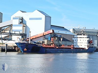
AKDENIZ S
General Cargo
Current Trip
| Time Travelled | 13 h, 48 mins |
|---|---|
| Remaining Time | --- |
| Distance Travelled | 124.08 nm |
| Remaining Distance | --- |
| AVG Speed | 9.1 Knots |
| MAX Speed | 10 Knots |
| AVG Wind | 10 knots |
| MAX Wind | 16.5 knots |
| MIN Temp | 17.2°C / 62.96°F |
| MAX Temp | 23.2°C / 73.76°F |
| Draught | 4.1 m |
| Position Received | 1 m ago |
Current Position
| Longitude | 33.72254° |
|---|---|
| Latitude | 36.06628° |
| Status | Under way using engine |
| Speed | 8.9 Knots |
| Course | 260.3° |
| Area | Mediterranean Sea - Eastern Basin |
| Station | T-AIS |
| Position Received | 1 m ago |
Info
Information
The current position of AKDENIZ S is in Mediterranean Sea - Eastern Basin with coordinates 36.06628° / 33.72254° as reported on 2024-05-25 05:49 by AIS to our vessel tracker app. The vessel's current speed is 8.9 Knots and is heading at the port of SAMSUN. The estimated time of arrival as calculated by vessel tracking app is 2024-05-26 21:00 LT
The vessel AKDENIZ S (IMO: 9519377, MMSI: 352009000) is a General Cargo that was built in 2008 ( 16 years old ). It's sailing under the flag of [PA] Panama.
In this page you can find informations about the vessels current position, last detected port calls, and current voyage information. If the vessels is not in coverage by AIS you will find the latest position.
The current position of AKDENIZ S is detected by our AIS receivers and we are not responsible for the reliability of the data. The last position was recorded while the vessel was in Coverage by the Ais receivers of our vessel tracking app.
The current draught of AKDENIZ S as reported by AIS is 4.1 meters
Weather
| Temperature | 23°C / 73.4°F |
|---|---|
| Wind Speed | 11 knots |
| Direction | 315° NW |
| Pressure | 1007.3 hPa |
| Humidity | 58.7 % |
| Cloud Coverage | 6 % |
Featured Company
Last Port Calls
| Port | Arrival | Departure | Time In Port |
|---|---|---|---|
| 2024-05-23 03:12 | 2024-05-24 16:03 | 1 d | |
| 2024-05-18 04:27 | 2024-05-18 05:57 | 1 h | |
| 2024-05-11 21:56 | 2024-05-15 13:48 | 3 d | |
| 2024-05-05 03:08 | 2024-05-05 04:08 | 1 h | |
| 2024-05-02 21:23 | 2024-05-04 02:49 | 1 d | |
| 2024-04-21 14:40 | 2024-04-23 06:36 | 1 d | |
| 2024-04-05 08:31 | 2024-04-10 14:49 | 5 d | |
| 2024-03-30 09:36 | 2024-04-04 12:46 | 5 d | |
| 2024-03-23 13:11 | 2024-03-23 14:31 | 1 h | |
| 2024-03-21 05:48 |
Most Visited Ports (Last year)
| Port | Arrivals | |
|---|---|---|
| 6 | ||
| 4 | ||
| 2 | ||
| 2 | ||
| 2 | ||
| 2 |
Last Trips
| Origin | Departure | Destination | Arrival | Distance | |
|---|---|---|---|---|---|
| 2024-05-18 08:57 | 2024-05-23 06:12 | 879.57 nm | |||
| 2024-05-15 16:48 | 2024-05-18 07:27 | 483.81 nm | |||
| 2024-05-05 07:08 | 2024-05-12 00:56 | 263.38 nm | |||
| 2024-05-04 05:49 | 2024-05-05 06:08 | 206.67 nm | |||
| 2024-04-23 09:36 | 2024-05-03 00:23 | 783.72 nm | |||
| 2024-04-10 16:49 | 2024-04-21 17:40 | 978.12 nm | |||
| 2024-04-04 14:46 | 2024-04-05 10:31 | 164.80 nm | |||
| 2024-03-23 17:31 | 2024-03-30 10:36 | 1136.76 nm | |||
| 2024-03-21 07:48 | 2024-03-23 16:11 | 380.62 nm | |||
| 2024-02-27 07:18 | 2024-03-04 21:22 | 633.00 nm |
Events
| Time | Event | Details | Position / Dest | Info |
|---|---|---|---|---|
| 2024-05-25 02:57 | Draught Changed | 4.1 6.8 |
36.21613 / 34.22858
SAMSUN
|
Speed: 10 kn Course: 243.9° |
| 2024-05-25 02:57 | Destination Changed | SAMSUN TR ISK |
36.21613 / 34.22858
SAMSUN
|
Speed: 10 kn Course: 243.9° |
| 2024-05-25 02:57 | ETA Changed | 2024/05/26 21:00 2024/05/22 21:00 |
36.21613 / 34.22858
SAMSUN
|
Speed: 10 kn Course: 243.9° |
| 2024-05-25 02:10 | Status Changed | Under way using engine Default |
36.26649 / 34.37808
TR ISK
|
Speed: 9.8 kn Course: 249° |
| 2024-05-25 02:10 | IN Coverage |
36.26649 / 34.37808
Mediterranean Sea - Eastern Basin
|
Speed: 9.8 kn Course: 256.8° |
|
| 2024-05-24 20:30 | Status Changed | Default Under way using engine |
36.48373 / 35.46915
TR ISK
|
Speed: 9.3 kn Course: 257.6° |
| 2024-05-24 20:21 | OUT of Coverage |
36.48839 / 35.49691
Mediterranean Sea - Eastern Basin
|
Speed: 9.3 kn Course: 257.6° |
|
| 2024-05-24 19:19 | Status Changed | Under way using engine Default |
36.55656 / 35.65722
TR ISK
|
Speed: 9 kn Course: 226° |
| 2024-05-24 19:08 | IN Coverage |
36.55656 / 35.65722
Mediterranean Sea - Eastern Basin
|
Speed: 9.1 kn Course: 224.8° |
|
| 2024-05-24 16:03 | PORT DEPARTURE |
|
36.78214 / 36.12618
TR ISK
|
Speed: 7.3 kn Course: 275° |