
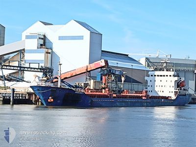
AKDENIZ S
General Cargo
Current Trip
| Time Travelled | 4 days |
|---|---|
| Remaining Time | 22 h, 24 mins |
| Distance Travelled | 1003.66 nm |
| Remaining Distance | 348.88 nm |
| AVG Speed | 8.5 Knots |
| MAX Speed | 12.5 Knots |
| AVG Wind | 8.3 knots |
| MAX Wind | 22.3 knots |
| MIN Temp | 10.4°C / 50.72°F |
| MAX Temp | 24.2°C / 75.56°F |
| Draught | 4.1 m |
| Position Received | 11 h, 19 m ago |
Current Position
| Longitude | 29.52780° |
|---|---|
| Latitude | 41.32837° |
| Status | Under way using engine |
| Speed | 10.3 Knots |
| Course | 76.8° |
| Area | Black Sea |
| Station | T-AIS |
| Position Received | 11 h, 19 m ago |
Info
Information
The current position of AKDENIZ S is in Black Sea with coordinates 41.32837° / 29.52780° as reported on 2024-05-28 18:54 by AIS to our vessel tracker app. The vessel's current speed is 10.3 Knots and is heading at the port of SAMSUN. The estimated time of arrival as calculated by vessel tracking app is 2024-05-30 04:38 LT
The vessel AKDENIZ S (IMO: 9519377, MMSI: 352009000) is a General Cargo that was built in 2008 ( 16 years old ). It's sailing under the flag of [PA] Panama.
In this page you can find informations about the vessels current position, last detected port calls, and current voyage information. If the vessels is not in coverage by AIS you will find the latest position.
The current position of AKDENIZ S is detected by our AIS receivers and we are not responsible for the reliability of the data. The last position was recorded while the vessel was in Coverage by the Ais receivers of our vessel tracking app.
The current draught of AKDENIZ S as reported by AIS is 4.1 meters
Weather
| Temperature | 15.9°C / 60.62°F |
|---|---|
| Wind Speed | 6 knots |
| Direction | 180° S |
| Pressure | 1014 hPa |
| Humidity | 78.5 % |
| Cloud Coverage | --- |
Featured Company
Last Port Calls
| Port | Arrival | Departure | Time In Port |
|---|---|---|---|
| 2024-05-23 03:12 | 2024-05-24 16:03 | 1 d | |
| 2024-05-18 04:27 | 2024-05-18 05:57 | 1 h | |
| 2024-05-11 21:56 | 2024-05-15 13:48 | 3 d | |
| 2024-05-05 03:08 | 2024-05-05 04:08 | 1 h | |
| 2024-05-02 21:23 | 2024-05-04 02:49 | 1 d | |
| 2024-04-21 14:40 | 2024-04-23 06:36 | 1 d | |
| 2024-04-05 08:31 | 2024-04-10 14:49 | 5 d | |
| 2024-03-30 09:36 | 2024-04-04 12:46 | 5 d | |
| 2024-03-23 13:11 | 2024-03-23 14:31 | 1 h | |
| 2024-03-21 05:48 |
Last Trips
| Origin | Departure | Destination | Arrival | Distance | |
|---|---|---|---|---|---|
| 2024-05-18 08:57 | 2024-05-23 06:12 | 879.57 nm | |||
| 2024-05-15 16:48 | 2024-05-18 07:27 | 483.81 nm | |||
| 2024-05-05 07:08 | 2024-05-12 00:56 | 263.38 nm | |||
| 2024-05-04 05:49 | 2024-05-05 06:08 | 206.67 nm | |||
| 2024-04-23 09:36 | 2024-05-03 00:23 | 783.72 nm | |||
| 2024-04-10 16:49 | 2024-04-21 17:40 | 978.12 nm | |||
| 2024-04-04 14:46 | 2024-04-05 10:31 | 164.80 nm | |||
| 2024-03-23 17:31 | 2024-03-30 10:36 | 1136.76 nm | |||
| 2024-03-21 07:48 | 2024-03-23 16:11 | 380.62 nm | |||
| 2024-02-27 07:18 | 2024-03-04 21:22 | 633.00 nm |
Events
| Time | Event | Details | Position / Dest | Info |
|---|---|---|---|---|
| 2024-05-28 19:32 | Status Changed | Default Under way using engine |
41.34667 / 29.66833
SAMSUN
|
Speed: 10.3 kn Course: 76.8° |
| 2024-05-28 18:54 | OUT of Coverage |
41.32837 / 29.52780
Black Sea
|
Speed: 10.3 kn Course: 76.8° |
|
| 2024-05-28 18:42 | Status Changed | Under way using engine Default |
41.32032 / 29.48301
SAMSUN
|
Speed: 10.4 kn Course: 76° |
| 2024-05-28 18:32 | Status Changed | Default Under way using engine |
41.31323 / 29.44548
SAMSUN
|
Speed: 10.4 kn Course: 75.3° |
| 2024-05-28 17:11 | Change Sea Area | Turkish part of the Black Sea Turkish part of the Sea of Marmara |
41.23255 / 29.14623
Black Sea
|
Speed: 9.7 kn Course: 42.5° |
| 2024-05-28 09:49 | Status Changed | Under way using engine Default |
40.78097 / 28.19470
SAMSUN
|
Speed: 10.4 kn Course: 78° |
| 2024-05-28 09:39 | Status Changed | Default Under way using engine |
40.77459 / 28.15548
SAMSUN
|
Speed: 10.5 kn Course: 78.5° |
| 2024-05-28 09:12 | Status Changed | Under way using engine Default |
40.75981 / 28.05332
SAMSUN
|
Speed: 10 kn Course: 81° |
| 2024-05-28 09:05 | Status Changed | Default Under way using engine |
40.75500 / 28.02667
SAMSUN
|
Speed: 10.3 kn Course: 81.6° |
| 2024-05-28 05:31 | Status Changed | Under way using engine Default |
40.60290 / 27.26908
SAMSUN
|
Speed: 10.1 kn Course: 65° |