
AKRANES
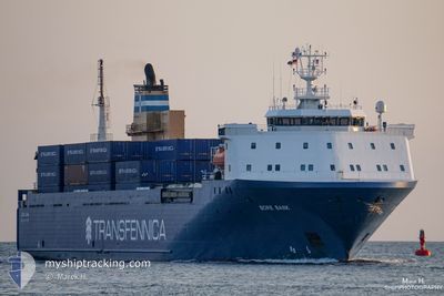
Vehicles Carrier
Current Trip
| Time Travelled | 11 h, 51 mins |
|---|---|
| Remaining Time | 1 day |
| Distance Travelled | 203.64 nm |
| Remaining Distance | 511.32 nm |
| AVG Speed | 17.3 Knots |
| MAX Speed | 20 Knots |
| AVG Wind | 12.9 knots |
| MAX Wind | 19 knots |
| MIN Temp | 6.8°C / 44.24°F |
| MAX Temp | 10.6°C / 51.08°F |
| Draught | 6 m |
| Position Received | Now |
Current Position
| Longitude | -3.57249° |
|---|---|
| Latitude | 58.94647° |
| Status | Under way using engine |
| Speed | 18 Knots |
| Course | 158.2° |
| Area | North Atlantic Ocean |
| Station | T-AIS |
| Position Received | Now |
Info
Information
The current position of AKRANES is in North Atlantic Ocean with coordinates 58.94647° / -3.57249° as reported on 2024-05-10 10:16 by AIS to our vessel tracker app. The vessel's current speed is 18 Knots and is heading at the port of ROTTERDAM. The estimated time of arrival as calculated by vessel tracking app is 2024-05-11 15:53 LT
The vessel AKRANES (IMO: 9160774, MMSI: 231852000) is a Vehicles Carrier that was built in 1998 ( 26 years old ). It's sailing under the flag of [FO] Faroe Is.
In this page you can find informations about the vessels current position, last detected port calls, and current voyage information. If the vessels is not in coverage by AIS you will find the latest position.
The current position of AKRANES is detected by our AIS receivers and we are not responsible for the reliability of the data. The last position was recorded while the vessel was in Coverage by the Ais receivers of our vessel tracking app.
The current draught of AKRANES as reported by AIS is 6 meters
Weather
| Temperature | 9.8°C / 49.64°F |
|---|---|
| Wind Speed | 11 knots |
| Direction | 135° SE |
| Pressure | 1020.2 hPa |
| Humidity | 96.6 % |
| Cloud Coverage | 100 % |
Featured Company
Last Port Calls
| Port | Arrival | Departure | Time In Port |
|---|---|---|---|
| 2024-05-09 20:12 | 2024-05-09 22:25 | 2 h | |
| 2024-05-08 07:56 | 2024-05-08 18:41 | 10 h | |
| 2024-05-04 23:24 | 2024-05-05 00:07 | 43 m | |
| 2024-05-04 16:27 | 2024-05-04 23:24 | 6 h | |
| 2024-05-04 15:42 | 2024-05-04 16:20 | 38 m | |
| 2024-05-02 14:48 | 2024-05-02 21:42 | 6 h | |
| 2024-05-01 08:08 | 2024-05-01 13:53 | 5 h | |
| 2024-05-01 07:49 | 2024-05-01 08:01 | 12 m | |
| 2024-04-27 16:52 | 2024-04-28 00:36 | 7 h | |
| 2024-04-27 15:43 | 2024-04-27 16:43 | 1 h |
Last Trips
| Origin | Departure | Destination | Arrival | Distance | |
|---|---|---|---|---|---|
| 2024-05-08 18:41 | 2024-05-09 21:12 | 429.89 nm | |||
| 2024-05-05 02:07 | 2024-05-08 07:56 | 1099.34 nm | |||
| 2024-05-05 01:24 | 2024-05-05 01:24 | 0.05 nm | |||
| 2024-05-04 18:20 | 2024-05-04 18:27 | 0.37 nm | |||
| 2024-05-02 22:42 | 2024-05-04 17:42 | 716.05 nm | |||
| 2024-05-01 13:53 | 2024-05-02 15:48 | 427.09 nm | |||
| 2024-05-01 08:01 | 2024-05-01 08:08 | 0.33 nm | |||
| 2024-04-28 02:36 | 2024-05-01 07:49 | 1106.55 nm | |||
| 2024-04-27 18:43 | 2024-04-27 18:52 | 0.39 nm | |||
| 2024-04-25 22:07 | 2024-04-27 17:43 | 714.19 nm |
Events
| Time | Event | Details | Position / Dest | Info |
|---|---|---|---|---|
| 2024-05-10 08:32 | Draught Changed | 6 5.6 |
59.39922 / -3.97904
ROTTERDAM
|
Speed: 18.2 kn Course: 151.5° |
| 2024-05-10 08:32 | Destination Changed | ROTTERDAM TORSHAVN |
59.39922 / -3.97904
ROTTERDAM
|
Speed: 18.2 kn Course: 151.5° |
| 2024-05-10 08:32 | ETA Changed | 2024/05/11 18:00 2024/05/09 19:00 |
59.39922 / -3.97904
ROTTERDAM
|
Speed: 18.2 kn Course: 151.5° |
| 2024-05-10 08:28 | Status Changed | Under way using engine Default |
59.41696 / -3.99805
TORSHAVN
|
Speed: 17.1 kn Course: 151° |
| 2024-05-10 08:26 | Status Changed | Default Under way using engine |
59.42358 / -4.00531
TORSHAVN
|
Speed: 17.2 kn Course: 151° |
| 2024-05-10 07:40 | Status Changed | Under way using engine Default |
59.61864 / -4.21762
TORSHAVN
|
Speed: 17.7 kn Course: 152° |
| 2024-05-10 07:26 | IN Coverage |
59.61864 / -4.21762
North Atlantic Ocean
|
Speed: 17.7 kn Course: 152.2° |
|
| 2024-05-09 22:38 | Status Changed | Default Moored |
61.95167 / -6.68333
TORSHAVN
|
Speed: 17 kn Course: 124.4° |
| 2024-05-09 22:29 | OUT of Coverage |
61.98917 / -6.73564
North Atlantic Ocean
TORSHAVN
|
Speed: 17 kn Course: 124.4° |
|
| 2024-05-09 22:25 | PORT DEPARTURE |
|
61.99710 / -6.76187
TORSHAVN
|
Speed: 7.9 kn Course: 132° |