
AKRANES
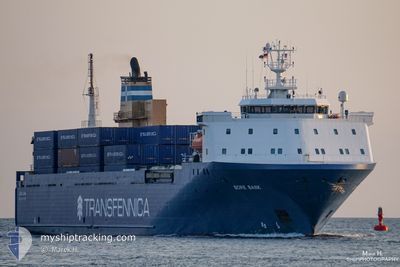
Vehicles Carrier
Current Trip
| Time Travelled | 1 day |
|---|---|
| Remaining Time | 1 day |
| Distance Travelled | 562.95 nm |
| Remaining Distance | 531.88 nm |
| AVG Speed | 13.3 Knots |
| MAX Speed | 21.5 Knots |
| AVG Wind | 9.7 knots |
| MAX Wind | 19.6 knots |
| MIN Temp | 9.6°C / 49.28°F |
| MAX Temp | 14.3°C / 57.74°F |
| Draught | 5.8 m |
| Position Received | 1 h, 45 m ago |
Current Position
| Longitude | -4.63675° |
|---|---|
| Latitude | 59.30127° |
| Status | Under way using engine |
| Speed | 13.6 Knots |
| Course | 306.5° |
| Area | North Atlantic Ocean |
| Station | T-AIS |
| Position Received | 1 h, 45 m ago |
Info
Information
The current position of AKRANES is in North Atlantic Ocean with coordinates 59.30127° / -4.63675° as reported on 2024-05-20 14:52 by AIS to our vessel tracker app. The vessel's current speed is 13.6 Knots and is heading at the port of HERJOLFUR. The estimated time of arrival as calculated by vessel tracking app is 2024-05-22 07:42 LT
The vessel AKRANES (IMO: 9160774, MMSI: 231852000) is a Vehicles Carrier that was built in 1998 ( 26 years old ). It's sailing under the flag of [FO] Faroe Is.
In this page you can find informations about the vessels current position, last detected port calls, and current voyage information. If the vessels is not in coverage by AIS you will find the latest position.
The current position of AKRANES is detected by our AIS receivers and we are not responsible for the reliability of the data. The last position was recorded while the vessel was in Coverage by the Ais receivers of our vessel tracking app.
The current draught of AKRANES as reported by AIS is 5.8 meters
Weather
| Temperature | 11.2°C / 52.16°F |
|---|---|
| Wind Speed | 16 knots |
| Direction | 132° SE |
| Pressure | 1015.6 hPa |
| Humidity | 78.1 % |
| Cloud Coverage | 68 % |
Featured Company
Last Port Calls
| Port | Arrival | Departure | Time In Port |
|---|---|---|---|
| 2024-05-18 21:41 | 2024-05-18 22:20 | 39 m | |
| 2024-05-18 10:33 | 2024-05-18 21:40 | 11 h | |
| 2024-05-18 09:44 | 2024-05-18 10:25 | 41 m | |
| 2024-05-15 07:52 | 2024-05-15 18:38 | 10 h | |
| 2024-05-11 22:35 | 2024-05-11 23:15 | 40 m | |
| 2024-05-11 16:18 | 2024-05-11 22:34 | 6 h | |
| 2024-05-11 15:15 | 2024-05-11 16:08 | 52 m | |
| 2024-05-09 20:12 | 2024-05-09 22:25 | 2 h | |
| 2024-05-08 07:56 | 2024-05-08 18:41 | 10 h | |
| 2024-05-04 23:24 | 2024-05-05 00:07 | 43 m |
Last Trips
| Origin | Departure | Destination | Arrival | Distance | |
|---|---|---|---|---|---|
| 2024-05-18 23:40 | 2024-05-18 23:41 | 0.38 nm | |||
| 2024-05-18 12:25 | 2024-05-18 12:33 | 0.41 nm | |||
| 2024-05-15 18:38 | 2024-05-18 11:44 | 1098.57 nm | |||
| 2024-05-12 01:15 | 2024-05-15 07:52 | 1095.52 nm | |||
| 2024-05-12 00:34 | 2024-05-12 00:35 | 0.40 nm | |||
| 2024-05-11 18:08 | 2024-05-11 18:18 | 0.40 nm | |||
| 2024-05-09 23:25 | 2024-05-11 17:15 | 714.32 nm | |||
| 2024-05-08 18:41 | 2024-05-09 21:12 | 429.89 nm | |||
| 2024-05-05 02:07 | 2024-05-08 07:56 | 1099.34 nm | |||
| 2024-05-05 01:24 | 2024-05-05 01:24 | 0.05 nm |
Events
| Time | Event | Details | Position / Dest | Info |
|---|---|---|---|---|
| 2024-05-20 14:59 | Status Changed | Default Under way using engine |
59.31685 / -4.67760
TORLAKSHOFN
|
Speed: 13.6 kn Course: 306.5° |
| 2024-05-20 14:52 | Status Changed | Under way using engine Default |
59.30127 / -4.63675
TORLAKSHOFN
|
Speed: 13.5 kn Course: 306° |
| 2024-05-20 14:52 | OUT of Coverage |
59.30127 / -4.63675
North Atlantic Ocean
TORLAKSHOFN
|
Speed: 13.6 kn Course: 306.5° |
|
| 2024-05-20 14:35 | IN Coverage |
59.30127 / -4.63675
North Atlantic Ocean
TORLAKSHOFN
|
Speed: 13.6 kn Course: 306.5° |
|
| 2024-05-20 13:15 | Status Changed | Default Under way using engine |
59.06742 / -4.07370
TORLAKSHOFN
|
Speed: 13.7 kn Course: 307.7° |
| 2024-05-20 13:07 | OUT of Coverage |
59.04975 / -4.02944
North Atlantic Ocean
TORLAKSHOFN
|
Speed: 13.7 kn Course: 307.7° |
|
| 2024-05-20 11:31 | Status Changed | Under way using engine Default |
58.82247 / -3.48498
TORLAKSHOFN
|
Speed: 13.3 kn Course: 312° |
| 2024-05-20 11:30 | Status Changed | Default Under way using engine |
58.82078 / -3.48151
TORLAKSHOFN
|
Speed: 13.8 kn Course: 310.1° |
| 2024-05-20 11:23 | Change Sea Area | United Kingdom part of the North Atlantic Ocean United Kingdom part of the North Sea |
58.80219 / -3.44075
North Atlantic Ocean
TORLAKSHOFN
|
Speed: 13.8 kn Course: 310.1° |
| 2024-05-20 11:22 | Status Changed | Under way using engine Default |
58.80116 / -3.43839
TORLAKSHOFN
|
Speed: 15.1 kn Course: 309° |