
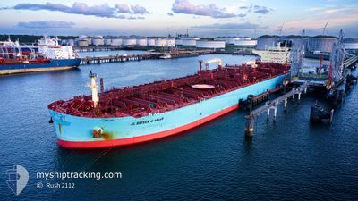
AL BATEEN
Tanker
Current Trip
| Time Travelled | 2 days |
|---|---|
| Remaining Time | 2 days |
| Distance Travelled | 699.12 nm |
| Remaining Distance | 748.27 nm |
| AVG Speed | 12.8 Knots |
| MAX Speed | 17.1 Knots |
| AVG Wind | 10.8 knots |
| MAX Wind | 22 knots |
| MIN Temp | 12.7°C / 54.86°F |
| MAX Temp | 15.4°C / 59.72°F |
| Draught | 9 m |
| Position Received | 1 d ago |
Current Position
| Longitude | -4.19441° |
|---|---|
| Latitude | 49.50808° |
| Status | Under way using engine |
| Speed | 13.9 Knots |
| Course | 239.9° |
| Area | English Channel |
| Station | T-AIS |
| Position Received | 1 d ago |
Info
Information
The current position of AL BATEEN is in English Channel with coordinates 49.50808° / -4.19441° as reported on 2024-06-05 09:12 by AIS to our vessel tracker app. The vessel's current speed is 13.9 Knots and is heading at the port of GIBRALTAR. The estimated time of arrival as calculated by vessel tracking app is 2024-06-09 00:20 LT
The vessel AL BATEEN (IMO: 9828376, MMSI: 636020891) is a Tanker It's sailing under the flag of [LR] Liberia.
In this page you can find informations about the vessels current position, last detected port calls, and current voyage information. If the vessels is not in coverage by AIS you will find the latest position.
The current position of AL BATEEN is detected by our AIS receivers and we are not responsible for the reliability of the data. The last position was recorded while the vessel was in Coverage by the Ais receivers of our vessel tracking app.
The current draught of AL BATEEN as reported by AIS is 9 meters
Weather
| Temperature | 14.8°C / 58.64°F |
|---|---|
| Wind Speed | 17 knots |
| Direction | 55° NE |
| Pressure | 1020.8 hPa |
| Humidity | 78.3 % |
| Cloud Coverage | 100 % |
Featured Company
Most Visited Ports (Last year)
| Port | Arrivals | |
|---|---|---|
| 6 | ||
| 3 | ||
| 2 | ||
| 1 | ||
| 1 | ||
| 1 |
Events
| Time | Event | Details | Position / Dest | Info |
|---|---|---|---|---|
| 2024-06-05 09:17 | Status Changed | Default Under way using engine |
49.49955 / -4.21736
GI GIB
|
Speed: 13.9 kn Course: 239.9° |
| 2024-06-05 09:12 | OUT of Coverage |
49.50808 / -4.19441
English Channel
GI GIB
|
Speed: 13.9 kn Course: 239.9° |
|
| 2024-06-05 09:05 | Detected in Sea | French part of the English Channel |
49.52283 / -4.15497
English Channel
GI GIB
|
Speed: 13.8 kn Course: 240° |
| 2024-06-05 08:57 | Status Changed | Under way using engine Default |
49.53745 / -4.11585
GI GIB
|
Speed: 13.7 kn Course: 240° |
| 2024-06-05 08:22 | Status Changed | Default Under way using engine |
49.60344 / -3.93886
GI GIB
|
Speed: 13.2 kn Course: 240.3° |
| 2024-06-05 05:58 | Status Changed | Under way using engine Default |
49.85096 / -3.27912
GI GIB
|
Speed: 10.8 kn Course: 245° |
| 2024-06-05 05:46 | Status Changed | Default Under way using engine |
49.86749 / -3.22908
GI GIB
|
Speed: 10.9 kn Course: 239.9° |
| 2024-06-05 05:36 | Status Changed | Under way using engine Default |
49.88244 / -3.18842
GI GIB
|
Speed: 10.9 kn Course: 240° |
| 2024-06-05 05:34 | Status Changed | Default Under way using engine |
49.88522 / -3.18099
GI GIB
|
Speed: 10.8 kn Course: 240° |
| 2024-06-05 05:01 | Detected in Sea | United Kingdom part of the English Channel |
49.93439 / -3.04778
English Channel
GI GIB
|
Speed: 10.9 kn Course: 239.9° |