
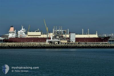
AL GHARIYA
Lng Tanker
Current Trip
| Time Travelled | --- |
|---|---|
| Remaining Time | --- |
| Distance Travelled | 14446.87 nm |
| Remaining Distance | --- |
| AVG Speed | 15.7 Knots |
| MAX Speed | 22.5 Knots |
| AVG Wind | 10.3 knots |
| MAX Wind | 35 knots |
| MIN Temp | 10.6°C / 51.08°F |
| MAX Temp | 29.8°C / 85.64°F |
| Draught | 9.6 m |
| Position Received | 1 d ago |
Current Position
| Longitude | 4.28050° |
|---|---|
| Latitude | -17.38996° |
| Status | Under way using engine |
| Speed | 15.2 Knots |
| Course | 140.5° |
| Area | South Atlantic Ocean |
| Station | T-AIS |
| Position Received | 1 d ago |
Info
Information
The current position of AL GHARIYA is in South Atlantic Ocean with coordinates -17.38996° / 4.28050° as reported on 2024-05-16 21:25 by AIS to our vessel tracker app. The vessel's current speed is 15.2 Knots and is heading at the port of RAS LAFFAN. The estimated time of arrival as calculated by vessel tracking app is 2024-06-02 09:00 LT
The vessel AL GHARIYA (IMO: 9337987, MMSI: 308248000) is a Lng Tanker that was built in 2008 ( 16 years old ). It's sailing under the flag of [BS] Bahamas.
In this page you can find informations about the vessels current position, last detected port calls, and current voyage information. If the vessels is not in coverage by AIS you will find the latest position.
The current position of AL GHARIYA is detected by our AIS receivers and we are not responsible for the reliability of the data. The last position was recorded while the vessel was in Coverage by the Ais receivers of our vessel tracking app.
The current draught of AL GHARIYA as reported by AIS is 9.6 meters
Weather
| Temperature | 18.5°C / 65.3°F |
|---|---|
| Wind Speed | 14 knots |
| Direction | 155° SSE |
| Pressure | 1018.4 hPa |
| Humidity | 91.9 % |
| Cloud Coverage | --- |
Featured Company
Last Port Calls
Most Visited Ports (Last year)
| Port | Arrivals | |
|---|---|---|
| 6 | ||
| 5 | ||
| 2 | ||
| 1 |
Last Trips
| Origin | Departure | Destination | Arrival | Distance |
|---|
Events
| Time | Event | Details | Position / Dest | Info |
|---|---|---|---|---|
| 2024-05-16 21:32 | Status Changed | Default Under way using engine |
-17.41286 / 4.29844
QA RLF
|
Speed: 15.2 kn Course: 140.5° |
| 2024-05-16 21:25 | OUT of Coverage |
-17.38996 / 4.28050
South Atlantic Ocean
QA RLF
|
Speed: 15.2 kn Course: 140.5° |
|
| 2024-05-16 21:15 | Status Changed | Under way using engine Default |
-17.35885 / 4.25475
QA RLF
|
Speed: 15.1 kn Course: 145° |
| 2024-05-16 21:11 | Status Changed | Default Under way using engine |
-17.34314 / 4.24278
QA RLF
|
Speed: 15.1 kn Course: 145.2° |
| 2024-05-16 21:04 | Status Changed | Under way using engine Default |
-17.32080 / 4.22712
QA RLF
|
Speed: 15 kn Course: 140° |
| 2024-05-16 21:03 | Status Changed | Default Under way using engine |
-17.31774 / 4.22483
QA RLF
|
Speed: 15.3 kn Course: 140.9° |
| 2024-05-16 20:58 | Status Changed | Under way using engine Default |
-17.30090 / 4.21060
QA RLF
|
Speed: 15.3 kn Course: 142° |
| 2024-05-16 20:39 | IN Coverage |
-17.30090 / 4.21060
South Atlantic Ocean
QA RLF
|
Speed: 15.3 kn Course: 140.9° |
|
| 2024-05-16 16:21 | Status Changed | Default Under way using engine |
-16.40206 / 3.42720
QA RLF
|
Speed: 14.9 kn Course: 148.7° |
| 2024-05-16 16:17 | OUT of Coverage |
-16.38825 / 3.41842
South Atlantic Ocean
QA RLF
|
Speed: 14.9 kn Course: 148.7° |