
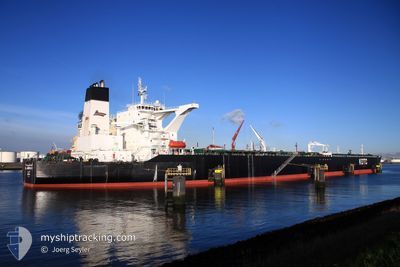
AL JABRIYAH II
Crude Oil Tanker
Current Trip
| Time Travelled | --- |
|---|---|
| Remaining Time | 2 days |
| Distance Travelled | 9500.46 nm |
| Remaining Distance | 762.53 nm |
| AVG Speed | 12.4 Knots |
| MAX Speed | 15.7 Knots |
| AVG Wind | 11.6 knots |
| MAX Wind | 29.6 knots |
| MIN Temp | 24.5°C / 76.1°F |
| MAX Temp | 35.5°C / 95.9°F |
| Draught | 20.4 m |
| Position Received | 8 d ago |
Current Position
| Longitude | 57.29594° |
|---|---|
| Latitude | 24.89872° |
| Status | Under way using engine |
| Speed | 13.4 Knots |
| Course | 125.4° |
| Area | Gulf of Oman |
| Station | T-AIS |
| Position Received | 8 d ago |
Info
Information
The current position of AL JABRIYAH II is in Gulf of Oman with coordinates 24.89872° / 57.29594° as reported on 2024-05-15 06:36 by AIS to our vessel tracker app. The vessel's current speed is 13.4 Knots and is heading at the port of PENGERANG. The estimated time of arrival as calculated by vessel tracking app is 2024-05-26 04:28 LT
The vessel AL JABRIYAH II (IMO: 9329708, MMSI: 447163000) is a Crude Oil Tanker that was built in 2007 ( 17 years old ). It's sailing under the flag of [KW] Kuwait.
In this page you can find informations about the vessels current position, last detected port calls, and current voyage information. If the vessels is not in coverage by AIS you will find the latest position.
The current position of AL JABRIYAH II is detected by our AIS receivers and we are not responsible for the reliability of the data. The last position was recorded while the vessel was in Coverage by the Ais receivers of our vessel tracking app.
The current draught of AL JABRIYAH II as reported by AIS is 20.4 meters
Weather
| Temperature | 29.2°C / 84.56°F |
|---|---|
| Wind Speed | 8 knots |
| Direction | 184° S |
| Pressure | 1005.4 hPa |
| Humidity | 74.6 % |
| Cloud Coverage | 100 % |
Featured Company
Last Port Calls
Most Visited Ports (Last year)
| Port | Arrivals | |
|---|---|---|
| 1 |
Last Trips
| Origin | Departure | Destination | Arrival | Distance |
|---|
Events
| Time | Event | Details | Position / Dest | Info |
|---|---|---|---|---|
| 2024-05-15 06:42 | Status Changed | Default Under way using engine |
24.88575 / 57.31580
MY PGG
|
Speed: 13.4 kn Course: 125.4° |
| 2024-05-15 06:36 | OUT of Coverage |
24.89872 / 57.29594
Gulf of Oman
MY PGG
|
Speed: 13.4 kn Course: 125.4° |
|
| 2024-05-15 05:17 | Change Sea Area | Omani part of the Gulf of Oman United Arab Emirates part of the Gulf of Oman |
25.10054 / 57.07412
Gulf of Oman
MY PGG
|
Speed: 13.1 kn Course: 152.7° |
| 2024-05-15 03:56 | Change Sea Area | United Arab Emirates part of the Gulf of Oman Iranian part of the Gulf of Oman |
25.37276 / 56.94812
Gulf of Oman
MY PGG
|
Speed: 13 kn Course: 165.5° |
| 2024-05-15 02:29 | Change Sea Area | Iranian part of the Gulf of Oman Omani part of the Gulf of Oman |
25.67626 / 56.84653
Gulf of Oman
MY PGG
|
Speed: 13 kn Course: 162.7° |
| 2024-05-15 02:00 | Status Changed | Under way using engine Default |
25.77833 / 56.82165
MY PGG
|
Speed: 13.2 kn Course: 168° |
| 2024-05-15 01:44 | Status Changed | Default Under way using engine |
25.83525 / 56.81000
MY PGG
|
Speed: 13.2 kn Course: 172° |
| 2024-05-15 01:26 | Change Sea Area | Omani part of the Gulf of Oman Omani part of the Persian Gulf |
25.90191 / 56.79961
Gulf of Oman
MY PGG
|
Speed: 13.1 kn Course: 172.3° |
| 2024-05-15 01:25 | Status Changed | Under way using engine Default |
25.90503 / 56.79912
MY PGG
|
Speed: 12.9 kn Course: 172° |
| 2024-05-15 01:25 | IN Coverage |
25.90191 / 56.79961
Gulf of Oman
MY PGG
|
Speed: 13.1 kn Course: 172.3° |