
AL MANAMAH
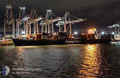
Container Ship
Current Trip
| Time Travelled | 3 days |
|---|---|
| Remaining Time | --- |
| Distance Travelled | 1550.77 nm |
| Remaining Distance | --- |
| AVG Speed | 16.1 Knots |
| MAX Speed | 21.9 Knots |
| AVG Wind | 14.6 knots |
| MAX Wind | 28 knots |
| MIN Temp | 8.4°C / 47.12°F |
| MAX Temp | 12.5°C / 54.5°F |
| Draught | 12.6 m |
| Position Received | 2 d ago |
Current Position
| Longitude | -4.39549° |
|---|---|
| Latitude | 58.74782° |
| Status | Under way using engine |
| Speed | 14.5 Knots |
| Course | 270.2° |
| Area | North Atlantic Ocean |
| Station | T-AIS |
| Position Received | 2 d ago |
Info
Information
The current position of AL MANAMAH is in North Atlantic Ocean with coordinates 58.74782° / -4.39549° as reported on 2024-05-07 03:41 by AIS to our vessel tracker app. The vessel's current speed is 14.5 Knots and is heading at the port of VERACRUZ. The estimated time of arrival as calculated by vessel tracking app is 2024-05-18 11:00 LT
The vessel AL MANAMAH (IMO: 9349538, MMSI: 636093140) is a Container Ship that was built in 2008 ( 16 years old ). It's sailing under the flag of [LR] Liberia.
In this page you can find informations about the vessels current position, last detected port calls, and current voyage information. If the vessels is not in coverage by AIS you will find the latest position.
The current position of AL MANAMAH is detected by our AIS receivers and we are not responsible for the reliability of the data. The last position was recorded while the vessel was in Coverage by the Ais receivers of our vessel tracking app.
The current draught of AL MANAMAH as reported by AIS is 12.6 meters
Weather
| Temperature | 12°C / 53.6°F |
|---|---|
| Wind Speed | 13 knots |
| Direction | 215° SW |
| Pressure | 1006.5 hPa |
| Humidity | 87.4 % |
| Cloud Coverage | 100 % |
Featured Company
Last Port Calls
| Port | Arrival | Departure | Time In Port |
|---|---|---|---|
| 2024-05-05 06:53 | 2024-05-05 14:38 | 7 h | |
| 2024-05-03 11:18 | 2024-05-04 20:58 | 1 d | |
| 2024-04-29 01:56 | 2024-04-29 20:15 | 18 h | |
| 2024-04-27 10:09 | 2024-04-28 08:15 | 22 h | |
| 2024-04-25 04:07 | 2024-04-26 02:43 | 22 h | |
| 2024-04-22 05:19 | 2024-04-22 22:24 | 17 h | |
| 2024-04-14 07:48 | 2024-04-15 06:56 | 23 h | |
| 2024-03-19 08:10 | 2024-03-20 00:16 | 16 h | |
| 2024-03-18 11:12 | |||
| 2024-03-14 00:10 |
Most Visited Ports (Last year)
| Port | Arrivals | |
|---|---|---|
| 5 | ||
| 5 | ||
| 5 | ||
| 5 | ||
| 5 | ||
| 4 |
Last Trips
| Origin | Departure | Destination | Arrival | Distance | |
|---|---|---|---|---|---|
| 2024-05-04 22:58 | 2024-05-05 08:53 | 126.46 nm | |||
| 2024-04-29 22:15 | 2024-05-03 13:18 | 416.39 nm | |||
| 2024-04-28 09:15 | 2024-04-29 03:56 | 220.62 nm | |||
| 2024-04-26 04:43 | 2024-04-27 11:09 | 275.09 nm | |||
| 2024-04-23 00:24 | 2024-04-25 06:07 | 275.14 nm | |||
| 2024-04-15 08:56 | 2024-04-22 07:19 | 1819.07 nm | |||
| 2024-03-20 05:46 | 2024-04-14 09:48 | 10046.88 nm | |||
| 2024-03-18 16:42 | 2024-03-19 13:40 | 332.55 nm | |||
| 2024-03-13 01:53 | 2024-03-14 05:40 | 326.29 nm | |||
| 2024-02-15 08:04 | 2024-03-12 15:18 | 10226.10 nm |
Events
| Time | Event | Details | Position / Dest | Info |
|---|---|---|---|---|
| 2024-05-07 03:47 | Status Changed | Default Under way using engine |
58.74786 / -4.43806
DEWVN>>MXVER
|
Speed: 14.5 kn Course: 270.2° |
| 2024-05-07 03:41 | OUT of Coverage |
58.74782 / -4.39549
North Atlantic Ocean
DEWVN>>MXVER
|
Speed: 14.5 kn Course: 270.2° |
|
| 2024-05-07 03:39 | Status Changed | Under way using engine Default |
58.74772 / -4.38290
DEWVN>>MXVER
|
Speed: 14.6 kn Course: 270° |
| 2024-05-07 03:34 | Status Changed | Default Under way using engine |
58.74753 / -4.34155
DEWVN>>MXVER
|
Speed: 14.6 kn Course: 270° |
| 2024-05-07 01:43 | Change Sea Area | United Kingdom part of the North Atlantic Ocean United Kingdom part of the North Sea |
58.73857 / -3.43626
North Atlantic Ocean
DEWVN>>MXVER
|
Speed: 17 kn Course: 275.9° |
| 2024-05-06 22:59 | Status Changed | Under way using engine Default |
58.35857 / -2.31016
DEWVN>>MXVER
|
Speed: 12.9 kn Course: 312° |
| 2024-05-06 22:42 | IN Coverage |
58.36299 / -2.31959
North Sea
DEWVN>>MXVER
|
Speed: 12.9 kn Course: 312° |
|
| 2024-05-06 20:58 | Status Changed | Default Under way using engine |
58.06937 / -1.69868
DEWVN>>MXVER
|
Speed: 13.3 kn Course: 310.4° |
| 2024-05-06 20:52 | Status Changed | Under way using engine Default |
58.05317 / -1.66267
DEWVN>>MXVER
|
Speed: 13.3 kn Course: 310° |
| 2024-05-06 20:52 | OUT of Coverage |
58.05317 / -1.66267
North Sea
DEWVN>>MXVER
|
Speed: 13.3 kn Course: 310.4° |