
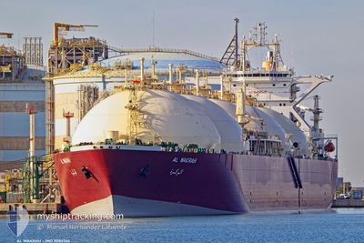
AL WAKRAH
Lng Tanker
Current Trip
NGB CN
| Time Travelled | 6 days |
|---|---|
| Remaining Time | --- |
| Distance Travelled | 2526.74 nm |
| Remaining Distance | --- |
| AVG Speed | 15.3 Knots |
| MAX Speed | 18 Knots |
| AVG Wind | 10.2 knots |
| MAX Wind | 28.7 knots |
| MIN Temp | 26.5°C / 79.7°F |
| MAX Temp | 35.3°C / 95.54°F |
| Draught | 10.9 m |
| Position Received | 1 d ago |
Current Position
| Longitude | 77.19469° |
|---|---|
| Latitude | 7.29989° |
| Status | Under way using engine |
| Speed | 13.9 Knots |
| Course | 117.3° |
| Area | Laccadive Sea |
| Station | T-AIS |
| Position Received | 1 d ago |
Info
Information
The current position of AL WAKRAH is in Laccadive Sea with coordinates 7.29989° / 77.19469° as reported on 2024-06-27 13:52 by AIS to our vessel tracker app. The vessel's current speed is 13.9 Knots
The vessel AL WAKRAH (IMO: 9086746, MMSI: 538009770) is a Lng Tanker that was built in 1998 ( 26 years old ). It's sailing under the flag of [MH] Marshall Is.
In this page you can find informations about the vessels current position, last detected port calls, and current voyage information. If the vessels is not in coverage by AIS you will find the latest position.
The current position of AL WAKRAH is detected by our AIS receivers and we are not responsible for the reliability of the data. The last position was recorded while the vessel was in Coverage by the Ais receivers of our vessel tracking app.
The current draught of AL WAKRAH as reported by AIS is 10.9 meters
Weather
| Temperature | 28.5°C / 83.3°F |
|---|---|
| Wind Speed | 16 knots |
| Direction | 220° SW |
| Pressure | 1008.5 hPa |
| Humidity | 79.9 % |
| Cloud Coverage | 100 % |
Featured Company
Last Port Calls
| Port | Arrival | Departure | Time In Port |
|---|---|---|---|
| 2024-06-20 12:15 | 2024-06-22 06:43 | 1 d | |
| 2024-06-08 00:09 | 2024-06-08 23:03 | 22 h | |
| 2024-05-25 08:14 | 2024-05-26 22:01 | 1 d | |
| 2024-05-06 21:24 | 2024-05-07 21:56 | 1 d | |
| 2024-04-18 19:14 | 2024-04-20 09:54 | 1 d |
Most Visited Ports (Last year)
| Port | Arrivals | |
|---|---|---|
| 10 | ||
| 3 | ||
| 2 | ||
| 1 | ||
| 1 | ||
| 1 |
Last Trips
| Origin | Departure | Destination | Arrival | Distance | |
|---|---|---|---|---|---|
| 2024-06-09 07:03 | 2024-06-20 15:15 | 3709.65 nm | |||
| 2024-05-27 01:01 | 2024-06-08 08:09 | 3706.96 nm | |||
| 2024-05-08 05:56 | 2024-05-25 11:14 | 5410.32 nm | |||
| 2024-04-20 12:54 | 2024-05-07 05:24 | 5473.19 nm | |||
| 2024-03-14 08:04 | 2024-04-18 22:14 | 10805.04 nm |
Events
| Time | Event | Details | Position / Dest | Info |
|---|---|---|---|---|
| 2024-06-27 14:04 | Status Changed | Default Under way using engine |
7.27812 / 77.23605
NGB CN
|
Speed: 13.9 kn Course: 117.3° |
| 2024-06-27 13:52 | OUT of Coverage |
7.29989 / 77.19469
Laccadive Sea
NGB CN
|
Speed: 13.9 kn Course: 117.3° |
|
| 2024-06-27 13:50 | Status Changed | Under way using engine Default |
7.30371 / 77.18741
NGB CN
|
Speed: 13.8 kn Course: 124° |
| 2024-06-27 13:34 | Status Changed | Default Under way using engine |
7.33538 / 77.13441
NGB CN
|
Speed: 13.7 kn Course: 121.8° |
| 2024-06-27 13:23 | Status Changed | Under way using engine Default |
7.35892 / 77.09831
NGB CN
|
Speed: 13.7 kn Course: 116° |
| 2024-06-27 13:23 | IN Coverage |
7.35892 / 77.09831
Laccadive Sea
NGB CN
|
Speed: 13.7 kn Course: 121.8° |
|
| 2024-06-27 10:30 | Status Changed | Default Under way using engine |
7.67616 / 76.51046
NGB CN
|
Speed: 14.1 kn Course: 123.7° |
| 2024-06-27 10:26 | Detected in Sea | Indian part of the Laccadive Sea |
7.68435 / 76.49794
Laccadive Sea
NGB CN
|
Speed: 14.1 kn Course: 123.7° |
| 2024-06-27 10:26 | Status Changed | Under way using engine Default |
7.68435 / 76.49794
NGB CN
|
Speed: 14.2 kn Course: 138° |
| 2024-06-27 10:26 | OUT of Coverage |
7.68435 / 76.49794
Laccadive Sea
NGB CN
|
Speed: 14.1 kn Course: 123.7° |