
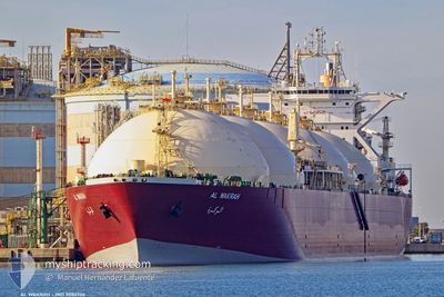
AL WAKRAH
Lng Tanker
Current Trip
SIN SG
| Time Travelled | 7 days |
|---|---|
| Remaining Time | --- |
| Distance Travelled | 2184.18 nm |
| Remaining Distance | --- |
| AVG Speed | 12.9 Knots |
| MAX Speed | 15.2 Knots |
| AVG Wind | 11.6 knots |
| MAX Wind | 23.3 knots |
| MIN Temp | 27.4°C / 81.32°F |
| MAX Temp | 35.2°C / 95.36°F |
| Draught | 10.6 m |
| Position Received | 1 d ago |
Current Position
| Longitude | 77.23072° |
|---|---|
| Latitude | 7.28984° |
| Status | Under way using engine |
| Speed | 12.7 Knots |
| Course | 123.3° |
| Area | Laccadive Sea |
| Station | T-AIS |
| Position Received | 1 d ago |
Info
Information
The current position of AL WAKRAH is in Laccadive Sea with coordinates 7.28984° / 77.23072° as reported on 2024-06-02 03:20 by AIS to our vessel tracker app. The vessel's current speed is 12.7 Knots
The vessel AL WAKRAH (IMO: 9086746, MMSI: 538009770) is a Lng Tanker that was built in 1998 ( 26 years old ). It's sailing under the flag of [MH] Marshall Is.
In this page you can find informations about the vessels current position, last detected port calls, and current voyage information. If the vessels is not in coverage by AIS you will find the latest position.
The current position of AL WAKRAH is detected by our AIS receivers and we are not responsible for the reliability of the data. The last position was recorded while the vessel was in Coverage by the Ais receivers of our vessel tracking app.
The current draught of AL WAKRAH as reported by AIS is 10.6 meters
Weather
| Temperature | 28.5°C / 83.3°F |
|---|---|
| Wind Speed | 15 knots |
| Direction | 201° SSW |
| Pressure | 1011.2 hPa |
| Humidity | 84.1 % |
| Cloud Coverage | 100 % |
Featured Company
Last Port Calls
| Port | Arrival | Departure | Time In Port |
|---|---|---|---|
| 2024-05-25 08:14 | 2024-05-26 22:01 | 1 d | |
| 2024-05-06 21:24 | 2024-05-07 21:56 | 1 d | |
| 2024-04-18 19:14 | 2024-04-20 09:54 | 1 d |
Most Visited Ports (Last year)
| Port | Arrivals | |
|---|---|---|
| 10 | ||
| 3 | ||
| 3 | ||
| 1 | ||
| 1 | ||
| 1 |
Last Trips
| Origin | Departure | Destination | Arrival | Distance | |
|---|---|---|---|---|---|
| 2024-05-08 05:56 | 2024-05-25 11:14 | 5410.32 nm | |||
| 2024-04-20 12:54 | 2024-05-07 05:24 | 5473.19 nm | |||
| 2024-03-14 08:04 | 2024-04-18 22:14 | 10805.04 nm |
Events
| Time | Event | Details | Position / Dest | Info |
|---|---|---|---|---|
| 2024-06-02 03:27 | Status Changed | Default Under way using engine |
7.27616 / 77.25140
SIN SG
|
Speed: 12.7 kn Course: 123.3° |
| 2024-06-02 03:20 | OUT of Coverage |
7.28984 / 77.23072
Laccadive Sea
SIN SG
|
Speed: 12.7 kn Course: 123.3° |
|
| 2024-06-02 02:26 | Status Changed | Under way using engine Default |
7.38421 / 77.06073
SIN SG
|
Speed: 12.2 kn Course: 119° |
| 2024-06-02 02:15 | Status Changed | Default Under way using engine |
7.40167 / 77.02500
SIN SG
|
Speed: 12.2 kn Course: 119.7° |
| 2024-06-02 02:13 | Status Changed | Under way using engine Default |
7.40597 / 77.02007
SIN SG
|
Speed: 12 kn Course: 117° |
| 2024-06-02 02:09 | Status Changed | Default Under way using engine |
7.41167 / 77.00667
SIN SG
|
Speed: 12.2 kn Course: 120.1° |
| 2024-06-02 01:36 | Status Changed | Under way using engine Default |
7.46678 / 76.90887
SIN SG
|
Speed: 12 kn Course: 118° |
| 2024-06-02 01:09 | Status Changed | Default Under way using engine |
7.51333 / 76.82166
SIN SG
|
Speed: 13 kn Course: 117.6° |
| 2024-06-01 23:47 | Status Changed | Under way using engine Default |
7.65643 / 76.55581
SIN SG
|
Speed: 13 kn Course: 119° |
| 2024-06-01 23:42 | Status Changed | Default Under way using engine |
7.66500 / 76.53833
SIN SG
|
Speed: 13.2 kn Course: 118.6° |