
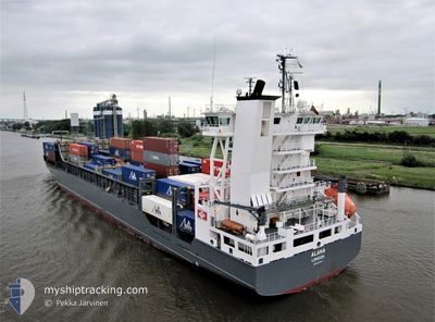
ALANA
Container Ship
Current Trip
| Time Travelled | 1 day |
|---|---|
| Remaining Time | 2 h, 53 mins |
| Distance Travelled | 420.01 nm |
| Remaining Distance | 36.25 nm |
| AVG Speed | 13.5 Knots |
| MAX Speed | 18.1 Knots |
| AVG Wind | 14.2 knots |
| MAX Wind | 20 knots |
| MIN Temp | 7.8°C / 46.04°F |
| MAX Temp | 18.5°C / 65.3°F |
| Draught | 7.7 m |
| Position Received | Now |
Current Position
| Longitude | -2.68783° |
|---|---|
| Latitude | 56.09645° |
| Status | Under way using engine |
| Speed | 12 Knots |
| Course | 272° |
| Area | North Sea |
| Station | T-AIS |
| Position Received | Now |
Info
Information
The current position of ALANA is in North Sea with coordinates 56.09645° / -2.68783° as reported on 2024-05-28 01:43 by AIS to our vessel tracker app. The vessel's current speed is 12 Knots and is heading at the port of GRANGEMOUTH. The estimated time of arrival as calculated by vessel tracking app is 2024-05-28 04:36 LT
The vessel ALANA (IMO: 9297589, MMSI: 255805557) is a Container Ship that was built in 2004 ( 20 years old ). It's sailing under the flag of [PT] Portugal.
In this page you can find informations about the vessels current position, last detected port calls, and current voyage information. If the vessels is not in coverage by AIS you will find the latest position.
The current position of ALANA is detected by our AIS receivers and we are not responsible for the reliability of the data. The last position was recorded while the vessel was in Coverage by the Ais receivers of our vessel tracking app.
The current draught of ALANA as reported by AIS is 7.7 meters
Weather
| Temperature | 7.9°C / 46.22°F |
|---|---|
| Wind Speed | 7 knots |
| Direction | 205° SSW |
| Pressure | 1010.4 hPa |
| Humidity | 88.2 % |
| Cloud Coverage | 100 % |
Featured Company
Last Port Calls
| Port | Arrival | Departure | Time In Port |
|---|---|---|---|
| 2024-05-25 22:14 | 2024-05-26 16:16 | 18 h | |
| 2024-05-21 00:18 | 2024-05-24 15:07 | 3 d | |
| 2024-05-18 04:23 | 2024-05-19 04:28 | 1 d | |
| 2024-05-14 18:38 | 2024-05-16 19:22 | 2 d | |
| 2024-05-08 10:55 | 2024-05-12 12:19 | 4 d | |
| 2024-05-04 21:56 | 2024-05-06 02:31 | 1 d | |
| 2024-05-02 09:11 | 2024-05-03 05:48 | 20 h | |
| 2024-04-29 18:22 | 2024-05-01 19:54 | 2 d | |
| 2024-04-26 22:30 | 2024-04-27 19:57 | 21 h | |
| 2024-04-25 04:14 | 2024-04-25 17:04 | 12 h |
Most Visited Ports (Last year)
| Port | Arrivals | |
|---|---|---|
| 45 | ||
| 43 | ||
| 35 | ||
| 1 | ||
| 1 | ||
| 1 |
Last Trips
| Origin | Departure | Destination | Arrival | Distance | |
|---|---|---|---|---|---|
| 2024-05-24 16:07 | 2024-05-26 00:14 | 436.82 nm | |||
| 2024-05-19 06:28 | 2024-05-21 01:18 | 436.42 nm | |||
| 2024-05-16 20:22 | 2024-05-18 06:23 | 436.78 nm | |||
| 2024-05-12 13:19 | 2024-05-14 19:38 | 157.05 nm | |||
| 2024-05-06 04:31 | 2024-05-08 11:55 | 326.67 nm | |||
| 2024-05-03 06:48 | 2024-05-04 23:56 | 332.32 nm | |||
| 2024-05-01 20:54 | 2024-05-02 10:11 | 146.68 nm | |||
| 2024-04-27 21:57 | 2024-04-29 19:22 | 440.17 nm | |||
| 2024-04-25 18:04 | 2024-04-27 00:30 | 321.57 nm | |||
| 2024-04-24 02:30 | 2024-04-25 05:14 | 152.14 nm |
Events
| Time | Event | Details | Position / Dest | Info |
|---|---|---|---|---|
| 2024-05-28 00:30 | Status Changed | Under way using engine Default |
56.03934 / -2.27688
GBGRG
|
Speed: 12.1 kn Course: 301° |
| 2024-05-28 00:17 | Status Changed | Default Under way using engine |
56.01846 / -2.20849
GBGRG
|
Speed: 12.1 kn Course: 299° |
| 2024-05-27 19:50 | Status Changed | Under way using engine Default |
55.35090 / -1.31681
GBGRG
|
Speed: 12.2 kn Course: 338° |
| 2024-05-27 19:39 | Status Changed | Default Under way using engine |
55.31556 / -1.29082
GBGRG
|
Speed: 12.2 kn Course: 337° |
| 2024-05-27 18:13 | Status Changed | Under way using engine Default |
55.07243 / -1.06257
GBGRG
|
Speed: 11.6 kn Course: 336° |
| 2024-05-27 18:03 | Status Changed | Default Under way using engine |
55.04409 / -1.03908
GBGRG
|
Speed: 11.8 kn Course: 331° |
| 2024-05-27 10:19 | ETA Changed | 2024/05/28 04:00 2024/05/28 03:00 |
53.81076 / .44769
GBGRG
|
Speed: 12 kn Course: 307° |
| 2024-05-27 00:05 | Change Sea Area | United Kingdom part of the North Sea Dutch part of the North Sea |
52.19391 / 2.80880
North Sea
GBGRG
|
Speed: 12.2 kn Course: 323° |
| 2024-05-26 21:57 | Draught Changed | 7.7 7.8 |
51.82015 / 3.16630
GBGRG
|
Speed: 12.1 kn Course: 330° |
| 2024-05-26 21:57 | ETA Changed | 2024/05/28 03:00 2024/05/28 06:00 |
51.82015 / 3.16630
GBGRG
|
Speed: 12.1 kn Course: 330° |