
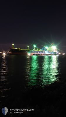
ALDABRA
Oil Products Tanker
Current Trip
| Time Travelled | 12 days |
|---|---|
| Remaining Time | --- |
| Distance Travelled | 1661.15 nm |
| Remaining Distance | --- |
| AVG Speed | 11.3 Knots |
| MAX Speed | 16.1 Knots |
| AVG Wind | 12.5 knots |
| MAX Wind | 26 knots |
| MIN Temp | 24.3°C / 75.74°F |
| MAX Temp | 30.7°C / 87.26°F |
| Draught | 11 m |
| Position Received | 10 d ago |
Current Position
| Longitude | 103.55991° |
|---|---|
| Latitude | 1.21573° |
| Status | Under way using engine |
| Speed | 11.8 Knots |
| Course | 283.3° |
| Area | Singapore Strait |
| Station | T-AIS |
| Position Received | 10 d ago |
Info
Information
The current position of ALDABRA is in Singapore Strait with coordinates 1.21573° / 103.55991° as reported on 2024-05-23 20:30 by AIS to our vessel tracker app. The vessel's current speed is 11.8 Knots
The vessel ALDABRA (IMO: 9367748, MMSI: 538010261) is a Oil Products Tanker that was built in 2008 ( 16 years old ). It's sailing under the flag of [MH] Marshall Is.
In this page you can find informations about the vessels current position, last detected port calls, and current voyage information. If the vessels is not in coverage by AIS you will find the latest position.
The current position of ALDABRA is detected by our AIS receivers and we are not responsible for the reliability of the data. The last position was recorded while the vessel was in Coverage by the Ais receivers of our vessel tracking app.
The current draught of ALDABRA as reported by AIS is 11 meters
Weather
| Temperature | 27.7°C / 81.86°F |
|---|---|
| Wind Speed | 12 knots |
| Direction | 201° SSW |
| Pressure | 1010.5 hPa |
| Humidity | 84.8 % |
| Cloud Coverage | 100 % |
Featured Company
Last Port Calls
| Port | Arrival | Departure | Time In Port |
|---|---|---|---|
| 2024-05-21 09:05 | 2024-05-22 02:47 | 17 h | |
| 2024-05-20 05:32 | 2024-05-20 21:01 | 15 h | |
| 2024-05-16 09:59 | 2024-05-17 19:11 | 1 d | |
| 2024-05-16 09:07 | 2024-05-16 09:51 | 44 m | |
| 2024-05-10 23:01 | 2024-05-13 04:56 | 2 d | |
| 2024-05-08 03:53 | 2024-05-09 06:43 | 1 d | |
| 2024-05-06 20:08 | 2024-05-08 01:10 | 1 d | |
| 2024-04-30 00:03 | 2024-05-01 07:43 | 1 d | |
| 2024-04-24 16:52 | 2024-04-26 12:40 | 1 d | |
| 2024-04-14 17:52 | 2024-04-17 00:46 | 2 d |
Most Visited Ports (Last year)
| Port | Arrivals | |
|---|---|---|
| 3 | ||
| 3 | ||
| 1 | ||
| 1 | ||
| 1 | ||
| 1 |
Last Trips
| Origin | Departure | Destination | Arrival | Distance | |
|---|---|---|---|---|---|
| 2024-05-21 05:01 | 2024-05-21 17:05 | 50.70 nm | |||
| 2024-05-18 03:11 | 2024-05-20 13:32 | 35.71 nm | |||
| 2024-05-16 17:51 | 2024-05-16 17:59 | 0.26 nm | |||
| 2024-05-13 12:56 | 2024-05-16 17:07 | 450.81 nm | |||
| 2024-05-09 14:43 | 2024-05-11 07:01 | 401.84 nm | |||
| 2024-05-08 09:10 | 2024-05-08 11:53 | 18.74 nm | |||
| 2024-05-01 15:43 | 2024-05-07 04:08 | 87.56 nm | |||
| 2024-04-26 20:40 | 2024-04-30 08:03 | 153.55 nm | |||
| 2024-04-17 08:46 | 2024-04-25 00:52 | 152.76 nm | |||
| 2024-03-26 10:05 | 2024-04-15 01:52 | 3414.68 nm |
Events
| Time | Event | Details | Position / Dest | Info |
|---|---|---|---|---|
| 2024-06-02 02:16 | STOP Moving | 9.29 nm, West of COLOMBO |
7.00382 / 79.68864
LK CMB
|
Speed: 0.3 kn Course: 199° |
| 2024-06-01 23:38 | START Moving | 4.3 nm, North of COLOMBO |
7.02525 / 79.81590
LK CMB
|
Speed: 3.6 kn Course: 218° |
| 2024-06-01 05:46 | STOP Moving | 4.52 nm, North of COLOMBO |
7.02880 / 79.81496
LK CMB
|
Speed: 0.1 kn Course: 252° |
| 2024-06-01 03:58 | START Moving | 7.2 nm, North West of COLOMBO |
7.03354 / 79.74425
LK CMB
|
Speed: 6.9 kn Course: 89° |
| 2024-05-31 13:14 | STOP Moving | 7.59 nm, North West of COLOMBO |
7.03703 / 79.73852
LK CMB
|
Speed: 0.3 kn Course: 318° |
| 2024-05-31 09:02 | START Moving | 7.43 nm, North West of COLOMBO |
7.04045 / 79.74521
LK CMB
|
Speed: 3.1 kn Course: 48° |
| 2024-05-29 02:10 | STOP Moving | 7.79 nm, North West of COLOMBO |
7.03668 / 79.73411
LK CMB
|
Speed: 0.2 kn Course: 268° |