
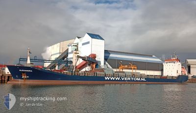
ALEXANDRA
General Cargo
Current Trip
| Time Travelled | 1 day |
|---|---|
| Remaining Time | 4 days |
| Distance Travelled | 177.63 nm |
| Remaining Distance | 1076.83 nm |
| AVG Speed | 8.9 Knots |
| MAX Speed | 12.5 Knots |
| AVG Wind | 9.7 knots |
| MAX Wind | 12.8 knots |
| MIN Temp | 12.3°C / 54.14°F |
| MAX Temp | 13.9°C / 57.02°F |
| Draught | 6.8 m |
| Position Received | 7 h, 42 m ago |
Current Position
| Longitude | -3.99232° |
|---|---|
| Latitude | 49.57074° |
| Status | Under way using engine |
| Speed | 11.2 Knots |
| Course | 241.6° |
| Area | English Channel |
| Station | T-AIS |
| Position Received | 7 h, 42 m ago |
Info
Information
The current position of ALEXANDRA is in English Channel with coordinates 49.57074° / -3.99232° as reported on 2024-06-06 11:41 by AIS to our vessel tracker app. The vessel's current speed is 11.2 Knots and is heading at the port of JORF LASFAR. The estimated time of arrival as calculated by vessel tracking app is 2024-06-11 01:04 LT
The vessel ALEXANDRA (IMO: 9196163, MMSI: 314512000) is a General Cargo that was built in 2000 ( 24 years old ). It's sailing under the flag of [BB] Barbados.
In this page you can find informations about the vessels current position, last detected port calls, and current voyage information. If the vessels is not in coverage by AIS you will find the latest position.
The current position of ALEXANDRA is detected by our AIS receivers and we are not responsible for the reliability of the data. The last position was recorded while the vessel was in Coverage by the Ais receivers of our vessel tracking app.
The current draught of ALEXANDRA as reported by AIS is 6.8 meters
Weather
| Temperature | 13.8°C / 56.84°F |
|---|---|
| Wind Speed | 12 knots |
| Direction | 322° NW |
| Pressure | 1020.2 hPa |
| Humidity | 65.9 % |
| Cloud Coverage | 22 % |
Featured Company
Events
| Time | Event | Details | Position / Dest | Info |
|---|---|---|---|---|
| 2024-06-06 11:47 | Status Changed | Default Under way using engine |
49.56128 / -4.01903
MAJFL
|
Speed: 11.2 kn Course: 241.6° |
| 2024-06-06 11:41 | Status Changed | Under way using engine Default |
49.57074 / -3.99232
MAJFL
|
Speed: 11.3 kn Course: 241° |
| 2024-06-06 11:41 | OUT of Coverage |
49.57074 / -3.99232
English Channel
MAJFL
|
Speed: 11.2 kn Course: 241.6° |
|
| 2024-06-06 11:07 | Status Changed | Default Under way using engine |
49.62229 / -3.85072
MAJFL
|
Speed: 11 kn Course: 239.8° |
| 2024-06-06 10:54 | Status Changed | Under way using engine Default |
49.64198 / -3.79739
MAJFL
|
Speed: 11 kn Course: 240° |
| 2024-06-06 10:23 | Status Changed | Default Under way using engine |
49.68787 / -3.66975
MAJFL
|
Speed: 10.5 kn Course: 243.4° |
| 2024-06-06 10:13 | Status Changed | Under way using engine Default |
49.70151 / -3.62867
MAJFL
|
Speed: 10.4 kn Course: 243° |
| 2024-06-06 09:59 | Status Changed | Default Under way using engine |
49.71965 / -3.57471
MAJFL
|
Speed: 10.2 kn Course: 243.3° |
| 2024-06-06 09:53 | Status Changed | Under way using engine Default |
49.72725 / -3.55188
MAJFL
|
Speed: 10.2 kn Course: 242° |
| 2024-06-06 09:43 | Status Changed | Default Under way using engine |
49.74106 / -3.51299
MAJFL
|
Speed: 9.9 kn Course: 238.3° |