
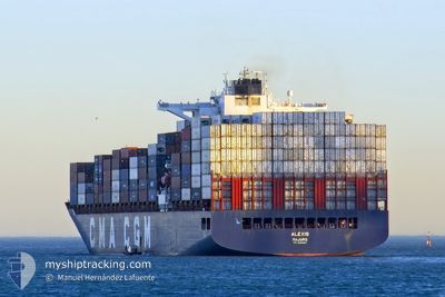
ALEXIS
Cargo A
Current Trip
| Time Travelled | 5 days |
|---|---|
| Remaining Time | --- |
| Distance Travelled | 1475.89 nm |
| Remaining Distance | --- |
| AVG Speed | 12 Knots |
| MAX Speed | 16.8 Knots |
| AVG Wind | 13.5 knots |
| MAX Wind | 23 knots |
| MIN Temp | 17.3°C / 63.14°F |
| MAX Temp | 24.1°C / 75.38°F |
| Draught | 13.6 m |
| Position Received | 2 d ago |
Current Position
| Longitude | -21.08238° |
|---|---|
| Latitude | 32.57578° |
| Status | Under way using engine |
| Speed | 11.8 Knots |
| Course | 251.1° |
| Area | North Atlantic Ocean |
| Station | T-AIS |
| Position Received | 2 d ago |
Info
Information
The current position of ALEXIS is in North Atlantic Ocean with coordinates 32.57578° / -21.08238° as reported on 2024-06-24 02:03 by AIS to our vessel tracker app. The vessel's current speed is 11.8 Knots and is heading at the port of FORT DE FRANCE. The estimated time of arrival as calculated by vessel tracking app is 2024-07-02 08:00 LT
The vessel ALEXIS (IMO: 9686900, MMSI: 538005958) is a Cargo A It's sailing under the flag of [MH] Marshall Is.
In this page you can find informations about the vessels current position, last detected port calls, and current voyage information. If the vessels is not in coverage by AIS you will find the latest position.
The current position of ALEXIS is detected by our AIS receivers and we are not responsible for the reliability of the data. The last position was recorded while the vessel was in Coverage by the Ais receivers of our vessel tracking app.
The current draught of ALEXIS as reported by AIS is 13.6 meters
Weather
| Temperature | 24.1°C / 75.38°F |
|---|---|
| Wind Speed | 9 knots |
| Direction | 59° ENE |
| Pressure | 1023 hPa |
| Humidity | 80.8 % |
| Cloud Coverage | 81 % |
Featured Company
Last Port Calls
| Port | Arrival | Departure | Time In Port |
|---|---|---|---|
| 2024-06-20 10:51 | 2024-06-21 06:38 | 19 h | |
| 2024-06-17 19:34 | 2024-06-19 11:02 | 1 d | |
| 2024-06-16 08:45 | 2024-06-17 00:39 | 15 h | |
| 2024-06-14 02:42 | 2024-06-14 17:19 | 14 h | |
| 2024-06-11 11:43 | 2024-06-12 07:39 | 19 h | |
| 2024-06-10 04:39 | 2024-06-11 07:03 | 1 d | |
| 2024-06-07 16:53 | 2024-06-08 16:53 | 1 d | |
| 2024-06-04 05:33 | 2024-06-05 09:43 | 1 d | |
| 2024-05-25 04:53 | 2024-05-26 00:15 | 19 h | |
| 2024-05-17 20:39 | 2024-05-20 01:03 | 2 d |
Last Trips
| Origin | Departure | Destination | Arrival | Distance | |
|---|---|---|---|---|---|
| 2024-06-19 13:02 | 2024-06-20 11:51 | 411.89 nm | |||
| 2024-06-17 02:39 | 2024-06-17 21:34 | 181.20 nm | |||
| 2024-06-14 19:19 | 2024-06-16 10:45 | 220.84 nm | |||
| 2024-06-12 09:39 | 2024-06-14 04:42 | 270.72 nm | |||
| 2024-06-11 09:03 | 2024-06-11 13:43 | 84.25 nm | |||
| 2024-06-08 18:53 | 2024-06-10 06:39 | 545.32 nm | |||
| 2024-06-05 11:43 | 2024-06-07 18:53 | 1008.90 nm | |||
| 2024-05-25 19:15 | 2024-06-04 07:33 | 4145.06 nm | |||
| 2024-05-19 20:03 | 2024-05-24 23:53 | 1493.66 nm | |||
| 2024-05-16 22:09 | 2024-05-17 15:39 | 42.29 nm |
Events
| Time | Event | Details | Position / Dest | Info |
|---|---|---|---|---|
| 2024-06-24 02:17 | Status Changed | Default Under way using engine |
32.56020 / -21.13490
MQFDF
|
Speed: 11.8 kn Course: 251.1° |
| 2024-06-24 02:03 | OUT of Coverage |
32.57578 / -21.08238
North Atlantic Ocean
MQFDF
|
Speed: 11.8 kn Course: 251.1° |
|
| 2024-06-24 01:55 | Status Changed | Under way using engine Default |
32.58522 / -21.05116
MQFDF
|
Speed: 11.6 kn Course: 250° |
| 2024-06-24 01:22 | Status Changed | Default Under way using engine |
32.62173 / -20.93376
MQFDF
|
Speed: 11.6 kn Course: 251.5° |
| 2024-06-24 01:01 | Status Changed | Under way using engine Default |
32.64453 / -20.85552
MQFDF
|
Speed: 11.7 kn Course: 249° |
| 2024-06-24 01:01 | IN Coverage |
32.64403 / -20.85734
North Atlantic Ocean
MQFDF
|
Speed: 11.6 kn Course: 251.5° |
|
| 2024-06-22 21:15 | Status Changed | Default Under way using engine |
34.31043 / -14.61024
MQFDF
|
Speed: 12.1 kn Course: 253.9° |
| 2024-06-22 21:07 | OUT of Coverage |
34.31756 / -14.58048
North Atlantic Ocean
MQFDF
|
Speed: 12.1 kn Course: 253.9° |
|
| 2024-06-22 20:49 | Status Changed | Under way using engine Default |
34.33488 / -14.51003
MQFDF
|
Speed: 12.1 kn Course: 255° |
| 2024-06-22 20:39 | IN Coverage |
34.33157 / -14.52451
North Atlantic Ocean
MQFDF
|
Speed: 12.1 kn Course: 254.5° |