
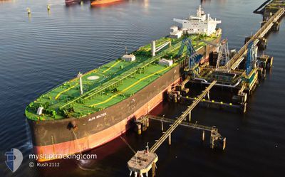
ALFA BALTICA
Tanker
Current Trip
DKFRC>DKKAL
| Time Travelled | 7 days |
|---|---|
| Remaining Time | --- |
| Distance Travelled | 7.76 nm |
| Remaining Distance | --- |
| AVG Speed | 6.2 Knots |
| MAX Speed | 8.8 Knots |
| AVG Wind | 12.9 knots |
| MAX Wind | 25.5 knots |
| MIN Temp | 9.5°C / 49.1°F |
| MAX Temp | 15.9°C / 60.62°F |
| Draught | 8.9 m |
| Position Received | 1 m ago |
Current Position
| Longitude | 10.97084° |
|---|---|
| Latitude | 55.68619° |
| Status | At anchor |
| Speed | |
| Course | 103° |
| Area | Kattegat |
| Station | T-AIS |
| Position Received | 1 m ago |
Info
Information
The current position of ALFA BALTICA is in Kattegat with coordinates 55.68619° / 10.97084° as reported on 2024-05-17 02:52 by AIS to our vessel tracker app. The vessel's current speed is 0 Knots
The vessel ALFA BALTICA (IMO: 9696773, MMSI: 311000306) is a Tanker It's sailing under the flag of [BS] Bahamas.
In this page you can find informations about the vessels current position, last detected port calls, and current voyage information. If the vessels is not in coverage by AIS you will find the latest position.
The current position of ALFA BALTICA is detected by our AIS receivers and we are not responsible for the reliability of the data. The last position was recorded while the vessel was in Coverage by the Ais receivers of our vessel tracking app.
The current draught of ALFA BALTICA as reported by AIS is 8.9 meters
Weather
| Temperature | 13.2°C / 55.76°F |
|---|---|
| Wind Speed | 21 knots |
| Direction | 103° ESE |
| Pressure | 1014.9 hPa |
| Humidity | 74.2 % |
| Cloud Coverage | 11 % |
Featured Company
Last Port Calls
| Port | Arrival | Departure | Time In Port |
|---|---|---|---|
| 2024-05-09 05:33 | 2024-05-10 01:16 | 19 h | |
| 2024-04-22 02:53 | 2024-04-24 02:32 | 1 d | |
| 2024-03-23 09:50 | 2024-03-24 12:56 | 1 d |
Last Trips
| Origin | Departure | Destination | Arrival | Distance | |
|---|---|---|---|---|---|
| 2024-04-24 04:32 | 2024-05-09 07:33 | 63.28 nm | |||
| 2024-03-24 13:56 | 2024-04-22 04:53 | 3256.67 nm | |||
| 2024-02-29 19:21 | 2024-03-23 10:50 | 1748.56 nm |
Events
| Time | Event | Details | Position / Dest | Info |
|---|---|---|---|---|
| 2024-05-13 00:22 | Status Changed | At anchor Default |
55.68640 / 10.97228
DKFRC>DKKAL
|
Speed: Course: 100° |
| 2024-05-13 00:19 | Status Changed | Default At anchor |
55.68642 / 10.97227
DKFRC>DKKAL
|
Speed: Course: 101° |
| 2024-05-10 05:10 | Destination Changed | DKFRC>DKKAL DKKAL>ANC |
55.68592 / 10.97927
DKFRC>DKKAL
|
Speed: Course: 276° |
| 2024-05-10 02:00 | STOP Moving | 4.09 nm, West of KALUNDBORG |
55.68511 / 10.97081
DKKAL>ANC
|
Speed: 0.3 kn Course: 71° |
| 2024-05-10 01:54 | Status Changed | At anchor Under way using engine |
55.68544 / 10.97311
DKKAL>ANC
|
Speed: 0.9 kn Course: 77° |
| 2024-05-10 01:16 | PORT DEPARTURE |
|
55.66817 / 11.06696
DKKAL>ANC
|
Speed: 6.2 kn Course: 296° |
| 2024-05-10 01:09 | START Moving |
55.66709 / 11.08294
[DK] KALUNDBORG
|
Speed: 3.1 kn Course: 268° |
|
| 2024-05-10 00:38 | Status Changed | Under way using engine Moored |
55.66723 / 11.09820
[DK] KALUNDBORG
|
Speed: Course: 97° |
| 2024-05-09 23:51 | Status Changed | Moored Default |
55.66720 / 11.09819
[DK] KALUNDBORG
|
Speed: Course: 98° |
| 2024-05-09 23:48 | Status Changed | Default Moored |
55.66718 / 11.09820
[DK] KALUNDBORG
|
Speed: Course: 98° |