
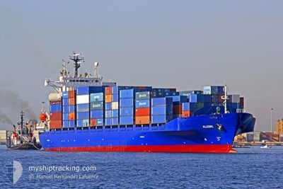
ALLEGRI
Container Ship
Current Trip
| Time Travelled | 2 days |
|---|---|
| Remaining Time | 1 day |
| Distance Travelled | 590.45 nm |
| Remaining Distance | 357.38 nm |
| AVG Speed | 12.8 Knots |
| MAX Speed | 14 Knots |
| AVG Wind | 13.5 knots |
| MAX Wind | 24.6 knots |
| MIN Temp | 22.6°C / 72.68°F |
| MAX Temp | 25.6°C / 78.08°F |
| Draught | 8 m |
| Position Received | 1 m ago |
Current Position
| Longitude | 18.91528° |
|---|---|
| Latitude | 36.61761° |
| Status | Under way using engine |
| Speed | 13.2 Knots |
| Course | 295.8° |
| Area | Ionian Sea |
| Station | T-AIS |
| Position Received | 1 m ago |
Info
Information
The current position of ALLEGRI is in Ionian Sea with coordinates 36.61761° / 18.91528° as reported on 2024-06-08 12:47 by AIS to our vessel tracker app. The vessel's current speed is 13.2 Knots and is heading at the port of SALERNO. The estimated time of arrival as calculated by vessel tracking app is 2024-06-09 15:13 LT
The vessel ALLEGRI (IMO: 9127459, MMSI: 256649000) is a Container Ship that was built in 1997 ( 27 years old ). It's sailing under the flag of [MT] Malta.
In this page you can find informations about the vessels current position, last detected port calls, and current voyage information. If the vessels is not in coverage by AIS you will find the latest position.
The current position of ALLEGRI is detected by our AIS receivers and we are not responsible for the reliability of the data. The last position was recorded while the vessel was in Coverage by the Ais receivers of our vessel tracking app.
The current draught of ALLEGRI as reported by AIS is 8 meters
Weather
| Temperature | 23.9°C / 75.02°F |
|---|---|
| Wind Speed | 8 knots |
| Direction | 325° NW |
| Pressure | 1014.4 hPa |
| Humidity | 73.7 % |
| Cloud Coverage | --- |
Featured Company
Last Port Calls
| Port | Arrival | Departure | Time In Port |
|---|---|---|---|
| 2024-06-05 04:49 | 2024-06-06 11:51 | 1 d | |
| 2024-06-03 03:24 | 2024-06-03 18:39 | 15 h | |
| 2024-06-02 02:18 | 2024-06-02 13:44 | 11 h | |
| 2024-05-30 18:01 | 2024-05-31 22:54 | 1 d | |
| 2024-05-26 00:27 | 2024-05-26 18:35 | 18 h | |
| 2024-05-22 14:03 | 2024-05-23 11:01 | 20 h | |
| 2024-05-21 08:25 | 2024-05-22 08:15 | 23 h | |
| 2024-05-20 03:24 | 2024-05-20 11:05 | 7 h | |
| 2024-05-15 17:25 | 2024-05-16 17:29 | 1 d | |
| 2024-05-13 13:53 | 2024-05-15 00:20 | 1 d |
Last Trips
| Origin | Departure | Destination | Arrival | Distance | |
|---|---|---|---|---|---|
| 2024-06-03 21:39 | 2024-06-05 06:49 | 402.88 nm | |||
| 2024-06-02 16:44 | 2024-06-03 06:24 | 129.18 nm | |||
| 2024-06-01 01:54 | 2024-06-02 05:18 | 102.71 nm | |||
| 2024-05-26 20:35 | 2024-05-30 21:01 | 1210.25 nm | |||
| 2024-05-23 13:01 | 2024-05-26 02:27 | 366.14 nm | |||
| 2024-05-22 10:15 | 2024-05-22 16:03 | 61.73 nm | |||
| 2024-05-20 13:05 | 2024-05-21 10:25 | 218.52 nm | |||
| 2024-05-16 18:29 | 2024-05-20 05:24 | 1031.72 nm | |||
| 2024-05-15 01:20 | 2024-05-15 18:25 | 231.27 nm | |||
| 2024-05-12 00:11 | 2024-05-13 14:53 | 498.60 nm |
Events
| Time | Event | Details | Position / Dest | Info |
|---|---|---|---|---|
| 2024-06-08 11:44 | Change Sea Area | Greek part of the Ionian Sea Greek part of the Mediterranean Sea - Eastern Basin |
36.50849 / 19.17637
Ionian Sea
ITSAL
|
Speed: 13.5 kn Course: 296.8° |
| 2024-06-08 11:22 | IN Coverage |
36.47282 / 19.26508
Mediterranean Sea - Eastern Basin
ITSAL
|
Speed: 13.7 kn Course: 295.8° |
|
| 2024-06-08 11:20 | Status Changed | Under way using engine Default |
36.46732 / 19.27927
ITSAL
|
Speed: 13.4 kn Course: 296° |
| 2024-06-08 10:25 | Status Changed | Default Under way using engine |
36.38093 / 19.50860
ITSAL
|
Speed: 13.3 kn Course: 295.1° |
| 2024-06-08 10:19 | OUT of Coverage |
36.37158 / 19.53342
Mediterranean Sea - Eastern Basin
ITSAL
|
Speed: 13.3 kn Course: 295.1° |
|
| 2024-06-08 10:07 | Status Changed | Under way using engine Default |
36.35298 / 19.58287
ITSAL
|
Speed: 13.3 kn Course: 295° |
| 2024-06-08 10:05 | Status Changed | Default Under way using engine |
36.34956 / 19.59191
ITSAL
|
Speed: 13.3 kn Course: 295° |
| 2024-06-08 09:51 | Status Changed | Under way using engine Default |
36.32730 / 19.65098
ITSAL
|
Speed: 13.3 kn Course: 295° |
| 2024-06-08 09:45 | Status Changed | Default Under way using engine |
36.31800 / 19.67534
ITSAL
|
Speed: 13.4 kn Course: 294.9° |
| 2024-06-08 09:39 | Status Changed | Under way using engine Default |
36.30882 / 19.69968
ITSAL
|
Speed: 13.4 kn Course: 295° |