
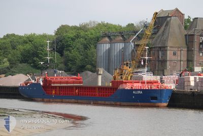
ALLORA
General Cargo
Current Trip
| Time Travelled | 11 h, 40 mins |
|---|---|
| Remaining Time | 1 h, 51 mins |
| Distance Travelled | 107.53 nm |
| Remaining Distance | 27.42 nm |
| AVG Speed | 9.3 Knots |
| MAX Speed | 10.5 Knots |
| AVG Wind | 5.1 knots |
| MAX Wind | 12.8 knots |
| MIN Temp | 12.4°C / 54.32°F |
| MAX Temp | 15.1°C / 59.18°F |
| Draught | 2.5 m |
| Position Received | 10 m ago |
Current Position
| Longitude | 3.67430° |
|---|---|
| Latitude | 51.93995° |
| Status | Under way using engine |
| Speed | 8 Knots |
| Course | 92° |
| Area | North Sea |
| Station | T-AIS |
| Position Received | 10 m ago |
Info
Information
The current position of ALLORA is in North Sea with coordinates 51.93995° / 3.67430° as reported on 2024-05-18 06:37 by AIS to our vessel tracker app. The vessel's current speed is 8 Knots and is heading at the port of ROTTERDAM. The estimated time of arrival as calculated by vessel tracking app is 2024-05-18 08:38 LT
The vessel ALLORA (IMO: 9226188, MMSI: 305844000) is a General Cargo that was built in 2003 ( 21 years old ). It's sailing under the flag of [AG] Antigua Barbuda.
In this page you can find informations about the vessels current position, last detected port calls, and current voyage information. If the vessels is not in coverage by AIS you will find the latest position.
The current position of ALLORA is detected by our AIS receivers and we are not responsible for the reliability of the data. The last position was recorded while the vessel was in Coverage by the Ais receivers of our vessel tracking app.
The current draught of ALLORA as reported by AIS is 2.5 meters
Weather
| Temperature | 12.9°C / 55.22°F |
|---|---|
| Wind Speed | 10 knots |
| Direction | 308° NW |
| Pressure | 1009.8 hPa |
| Humidity | 94.8 % |
| Cloud Coverage | 95 % |
Featured Company
Last Port Calls
| Port | Arrival | Departure | Time In Port |
|---|---|---|---|
| 2024-05-17 07:00 | 2024-05-17 19:07 | 12 h | |
| 2024-05-15 15:40 | 2024-05-16 18:19 | 1 d | |
| 2024-05-13 03:59 | 2024-05-14 10:04 | 1 d | |
| 2024-05-11 15:45 | 2024-05-11 16:16 | 30 m | |
| 2024-05-10 14:44 | 2024-05-10 15:04 | 20 m | |
| 2024-05-06 09:48 | 2024-05-08 11:19 | 2 d | |
| 2024-04-30 08:48 | 2024-05-03 13:23 | 3 d | |
| 2024-04-25 23:47 | 2024-04-26 11:42 | 11 h | |
| 2024-04-24 22:32 | 2024-04-25 11:32 | 13 h | |
| 2024-04-23 11:30 | 2024-04-24 12:00 | 1 d |
Last Trips
| Origin | Departure | Destination | Arrival | Distance | |
|---|---|---|---|---|---|
| 2024-05-16 20:19 | 2024-05-17 08:00 | 53.84 nm | |||
| 2024-05-14 11:04 | 2024-05-15 17:40 | 208.05 nm | |||
| 2024-05-11 18:16 | 2024-05-13 04:59 | 206.28 nm | |||
| 2024-05-10 17:04 | 2024-05-11 17:45 | 55.20 nm | |||
| 2024-05-08 12:19 | 2024-05-10 16:44 | 152.36 nm | |||
| 2024-05-03 14:23 | 2024-05-06 10:48 | 500.33 nm | |||
| 2024-04-26 12:42 | 2024-04-30 09:48 | 526.95 nm | |||
| 2024-04-25 13:32 | 2024-04-26 00:47 | 51.58 nm | |||
| 2024-04-24 13:00 | 2024-04-25 00:32 | 56.51 nm | |||
| 2024-04-22 12:40 | 2024-04-23 12:30 | 55.57 nm |
Events
| Time | Event | Details | Position / Dest | Info |
|---|---|---|---|---|
| 2024-05-18 06:26 | Status Changed | Under way using engine Default |
51.94111 / 3.63041
NLRTM
|
Speed: 9.8 kn Course: 91° |
| 2024-05-18 05:55 | Status Changed | Default Under way using engine |
51.92733 / 3.49587
NLRTM
|
Speed: 9.9 kn Course: 78.7° |
| 2024-05-18 05:52 | Status Changed | Under way using engine Default |
51.92559 / 3.48280
NLRTM
|
Speed: 9 kn Course: 71° |
| 2024-05-18 05:39 | Status Changed | Default Under way using engine |
51.91333 / 3.42667
NLRTM
|
Speed: 9.4 kn Course: 71.8° |
| 2024-05-18 05:34 | Status Changed | Under way using engine Default |
51.91058 / 3.40997
NLRTM
|
Speed: 9.8 kn Course: 72° |
| 2024-05-18 05:29 | Status Changed | Default Under way using engine |
51.90591 / 3.38663
NLRTM
|
Speed: 9.8 kn Course: 72.9° |
| 2024-05-18 05:27 | Status Changed | Under way using engine Default |
51.90455 / 3.37975
NLRTM
|
Speed: 9 kn Course: 72° |
| 2024-05-18 05:12 | Status Changed | Default Under way using engine |
51.89209 / 3.31819
NLRTM
|
Speed: 9.6 kn Course: 73.2° |
| 2024-05-18 02:22 | Change Sea Area | Dutch part of the North Sea Belgian part of the North Sea |
51.83550 / 2.66139
North Sea
NLRTM
|
Speed: 8.9 kn Course: 88.7° |
| 2024-05-18 02:22 | Status Changed | Under way using engine Default |
51.83550 / 2.66139
NLRTM
|
Speed: 9 kn Course: 88° |