
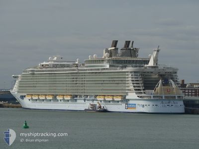
ALLURE OF THE SEAS
Passenger
Current Trip
| Time Travelled | 16 h, 53 mins |
|---|---|
| Remaining Time | --- |
| Distance Travelled | 167.02 nm |
| Remaining Distance | --- |
| AVG Speed | 14.9 Knots |
| MAX Speed | 17.6 Knots |
| AVG Wind | 12.4 knots |
| MAX Wind | 18.6 knots |
| MIN Temp | 27.1°C / 80.78°F |
| MAX Temp | 30.4°C / 86.72°F |
| Draught | 9 m |
| Position Received | 11 h, 56 m ago |
Current Position
| Longitude | -79.80607° |
|---|---|
| Latitude | 27.53398° |
| Status | Under way using engine |
| Speed | 12.6 Knots |
| Course | 145.3° |
| Area | North Atlantic Ocean |
| Station | T-AIS |
| Position Received | 11 h, 56 m ago |
Info
Information
The current position of ALLURE OF THE SEAS is in North Atlantic Ocean with coordinates 27.53398° / -79.80607° as reported on 2024-06-08 01:23 by AIS to our vessel tracker app. The vessel's current speed is 12.6 Knots
The vessel ALLURE OF THE SEAS (MMSI: 311020700) is a Passenger It's sailing under the flag of [BS] Bahamas.
In this page you can find informations about the vessels current position, last detected port calls, and current voyage information. If the vessels is not in coverage by AIS you will find the latest position.
The current position of ALLURE OF THE SEAS is detected by our AIS receivers and we are not responsible for the reliability of the data. The last position was recorded while the vessel was in Coverage by the Ais receivers of our vessel tracking app.
The current draught of ALLURE OF THE SEAS as reported by AIS is 9 meters
Weather
| Temperature | 28.3°C / 82.94°F |
|---|---|
| Wind Speed | 9 knots |
| Direction | 213° SSW |
| Pressure | 1012.8 hPa |
| Humidity | 77.9 % |
| Cloud Coverage | 100 % |
Featured Company
Last Port Calls
| Port | Arrival | Departure | Time In Port |
|---|---|---|---|
| 2024-06-07 09:34 | 2024-06-07 20:27 | 10 h | |
| 2024-06-05 11:04 | 2024-06-05 21:37 | 10 h | |
| 2024-06-03 09:35 | 2024-06-03 20:27 | 10 h | |
| 2024-06-01 12:20 | 2024-06-01 21:20 | 9 h | |
| 2024-05-31 09:39 | 2024-05-31 20:41 | 11 h | |
| 2024-05-28 12:31 | 2024-05-28 21:32 | 9 h | |
| 2024-05-27 09:32 | 2024-05-27 20:26 | 10 h | |
| 2024-05-25 11:50 | 2024-05-25 21:30 | 9 h | |
| 2024-05-24 09:36 | 2024-05-24 20:57 | 11 h | |
| 2024-05-21 12:17 | 2024-05-21 21:36 | 9 h |
Most Visited Ports (Last year)
| Port | Arrivals | |
|---|---|---|
| 64 | ||
| 54 | ||
| 21 | ||
| 20 | ||
| 13 | ||
| 10 |
Last Trips
| Origin | Departure | Destination | Arrival | Distance | |
|---|---|---|---|---|---|
| 2024-06-05 17:37 | 2024-06-07 05:34 | 387.29 nm | |||
| 2024-06-03 16:27 | 2024-06-05 07:04 | 276.13 nm | |||
| 2024-06-01 17:20 | 2024-06-03 05:35 | 280.24 nm | |||
| 2024-05-31 16:41 | 2024-06-01 08:20 | 272.40 nm | |||
| 2024-05-28 17:32 | 2024-05-31 05:39 | 435.28 nm | |||
| 2024-05-27 16:26 | 2024-05-28 08:31 | 273.74 nm | |||
| 2024-05-25 17:30 | 2024-05-27 05:32 | 276.10 nm | |||
| 2024-05-24 16:57 | 2024-05-25 07:50 | 272.31 nm | |||
| 2024-05-21 17:36 | 2024-05-24 05:36 | 438.30 nm | |||
| 2024-05-20 16:41 | 2024-05-21 08:17 | 272.75 nm |
Events
| Time | Event | Details | Position / Dest | Info |
|---|---|---|---|---|
| 2024-06-08 01:31 | Status Changed | Default Under way using engine |
27.50993 / -79.78738
COCOCAY
|
Speed: 12.6 kn Course: 145.3° |
| 2024-06-08 01:23 | OUT of Coverage |
27.53398 / -79.80607
North Atlantic Ocean
|
Speed: 12.6 kn Course: 145.3° |
|
| 2024-06-08 01:19 | Draught Changed | 9 9.3 |
27.54791 / -79.81706
COCOCAY
|
Speed: 12.5 kn Course: 145° |
| 2024-06-08 01:14 | Status Changed | Under way using engine Default |
27.55926 / -79.82620
COCOCAY
|
Speed: 12.4 kn Course: 145° |
| 2024-06-08 01:06 | Status Changed | Default Under way using engine |
27.58290 / -79.84520
COCOCAY
|
Speed: 12.3 kn Course: 144° |
| 2024-06-08 00:49 | Status Changed | Under way using engine Default |
27.62963 / -79.88293
COCOCAY
|
Speed: 12.6 kn Course: 143° |
| 2024-06-08 00:30 | IN Coverage |
27.62868 / -79.88218
North Atlantic Ocean
COCOCAY
|
Speed: 12.4 kn Course: 144° |
|
| 2024-06-07 23:39 | Status Changed | Default Under way using engine |
27.83527 / -80.05490
COCOCAY
|
Speed: 13.5 kn Course: 143.2° |
| 2024-06-07 23:34 | OUT of Coverage |
27.84942 / -80.06683
North Atlantic Ocean
COCOCAY
|
Speed: 13.5 kn Course: 143.2° |
|
| 2024-06-07 21:06 | Destination Changed | COCOCAY PORT CANAVERAL |
28.32173 / -80.46318
COCOCAY
|
Speed: 14.5 kn Course: 137.3° |