
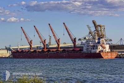
ALMERIA
Bulk Carrier
Current Trip
NEW ORLEANS
| Time Travelled | 3 days |
|---|---|
| Remaining Time | --- |
| Distance Travelled | 29.82 nm |
| Remaining Distance | --- |
| AVG Speed | 7.8 Knots |
| MAX Speed | 9.8 Knots |
| AVG Wind | 3 knots |
| MAX Wind | 6.1 knots |
| MIN Temp | 22.5°C / 72.5°F |
| MAX Temp | 34.3°C / 93.74°F |
| Draught | 7.2 m |
| Position Received | 11 h, 4 m ago |
Current Position
| Longitude | -90.78186° |
|---|---|
| Latitude | 30.01290° |
| Status | At anchor |
| Speed | |
| Course | 246° |
| Area | Gulf of Mexico |
| Station | T-AIS |
| Position Received | 11 h, 4 m ago |
Info
Information
The current position of ALMERIA is in Gulf of Mexico with coordinates 30.01290° / -90.78186° as reported on 2024-06-09 09:48 by AIS to our vessel tracker app. The vessel's current speed is 0 Knots
The vessel ALMERIA (IMO: 9592721, MMSI: 636014704) is a Bulk Carrier that was built in 2011 ( 13 years old ). It's sailing under the flag of [LR] Liberia.
In this page you can find informations about the vessels current position, last detected port calls, and current voyage information. If the vessels is not in coverage by AIS you will find the latest position.
The current position of ALMERIA is detected by our AIS receivers and we are not responsible for the reliability of the data. The last position was recorded while the vessel was in Coverage by the Ais receivers of our vessel tracking app.
The current draught of ALMERIA as reported by AIS is 7.2 meters
Weather
| Temperature | 35.8°C / 96.44°F |
|---|---|
| Wind Speed | 2 knots |
| Direction | 264° W |
| Pressure | 1010.4 hPa |
| Humidity | 35.1 % |
| Cloud Coverage | --- |
Featured Company
Last Port Calls
| Port | Arrival | Departure | Time In Port |
|---|---|---|---|
| 2024-06-03 12:44 | 2024-06-06 01:46 | 2 d | |
| 2024-05-23 17:43 | 2024-05-29 03:32 | 5 d | |
| 2024-05-14 07:41 | 2024-05-21 17:24 | 7 d | |
| 2024-04-01 07:49 |
Last Trips
| Origin | Departure | Destination | Arrival | Distance | |
|---|---|---|---|---|---|
| 2024-05-28 22:32 | 2024-06-03 07:44 | 1492.01 nm | |||
| 2024-05-21 13:24 | 2024-05-23 12:43 | 537.39 nm | |||
| 2024-04-01 15:49 | 2024-05-14 03:41 | 10170.92 nm |
Events
| Time | Event | Details | Position / Dest | Info |
|---|---|---|---|---|
| 2024-06-09 12:27 | STOP Moving | 0.78 nm, West of WELCOME |
30.06464 / -90.87478
NEW ORLEANS
|
Speed: 0.1 kn Course: 256° |
| 2024-06-09 10:43 | START Moving | 2.66 nm, East of CONVENT |
30.01074 / -90.78230
NEW ORLEANS
|
Speed: 3.4 kn Course: 221° |
| 2024-06-09 09:54 | Status Changed | Default At anchor |
30.01288 / -90.78184
NEW ORLEANS
|
Speed: Course: 246° |
| 2024-06-09 09:48 | Status Changed | At anchor Default |
30.01290 / -90.78186
NEW ORLEANS
|
Speed: 0.1 kn Course: 247° |
| 2024-06-09 09:48 | OUT of Coverage |
30.01290 / -90.78186
Gulf of Mexico
|
Speed: Course: 167.2° |
|
| 2024-06-09 09:30 | Status Changed | Default At anchor |
30.01292 / -90.78183
NEW ORLEANS
|
Speed: Course: 247° |
| 2024-06-09 09:21 | Status Changed | At anchor Default |
30.01289 / -90.78184
NEW ORLEANS
|
Speed: 0.1 kn Course: 245° |
| 2024-06-09 09:18 | Status Changed | Default At anchor |
30.01290 / -90.78185
NEW ORLEANS
|
Speed: 0.1 kn Course: 246° |
| 2024-06-09 09:06 | Status Changed | At anchor Default |
30.01289 / -90.78187
NEW ORLEANS
|
Speed: 0.1 kn Course: 248° |
| 2024-06-09 09:03 | Status Changed | Default At anchor |
30.01287 / -90.78182
NEW ORLEANS
|
Speed: Course: 246° |