
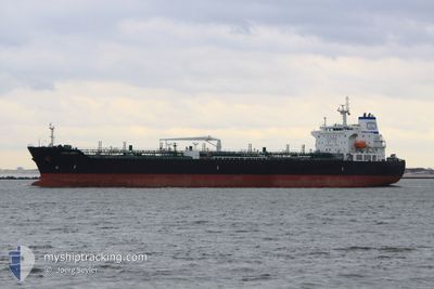
ALPINE LIBERTY
Oil/Chemical Tanker
Current Trip
| Time Travelled | 21 days |
|---|---|
| Remaining Time | --- |
| Distance Travelled | 4047.61 nm |
| Remaining Distance | 970.92 nm |
| AVG Speed | 11.2 Knots |
| MAX Speed | 16.6 Knots |
| AVG Wind | 8.9 knots |
| MAX Wind | 24 knots |
| MIN Temp | 21.2°C / 70.16°F |
| MAX Temp | 34.4°C / 93.92°F |
| Draught | 11.8 m |
| Position Received | 3 d ago |
Current Position
| Longitude | -84.03311° |
|---|---|
| Latitude | 8.30595° |
| Status | Under way using engine |
| Speed | 12.7 Knots |
| Course | 307.5° |
| Area | North Pacific Ocean |
| Station | T-AIS |
| Position Received | 3 d ago |
Info
Information
The current position of ALPINE LIBERTY is in North Pacific Ocean with coordinates 8.30595° / -84.03311° as reported on 2024-06-23 03:13 by AIS to our vessel tracker app. The vessel's current speed is 12.7 Knots and is heading at the port of CRISTOBAL. The estimated time of arrival as calculated by vessel tracking app is 2024-06-17 19:00 LT
The vessel ALPINE LIBERTY (IMO: 9478690, MMSI: 538003883) is a Oil/Chemical Tanker that was built in 2010 ( 14 years old ). It's sailing under the flag of [MH] Marshall Is.
In this page you can find informations about the vessels current position, last detected port calls, and current voyage information. If the vessels is not in coverage by AIS you will find the latest position.
The current position of ALPINE LIBERTY is detected by our AIS receivers and we are not responsible for the reliability of the data. The last position was recorded while the vessel was in Coverage by the Ais receivers of our vessel tracking app.
The current draught of ALPINE LIBERTY as reported by AIS is 11.8 meters
Weather
| Temperature | 30°C / 86°F |
|---|---|
| Wind Speed | 6 knots |
| Direction | 206° SSW |
| Pressure | 1011.1 hPa |
| Humidity | 73 % |
| Cloud Coverage | 53 % |
Featured Company
Last Port Calls
| Port | Arrival | Departure | Time In Port |
|---|---|---|---|
| 2024-06-02 22:35 | 2024-06-05 00:52 | 2 d | |
| 2024-05-26 22:43 | 2024-05-28 19:31 | 1 d | |
| 2024-05-17 15:54 | 2024-05-19 01:20 | 1 d | |
| 2024-05-14 17:29 | 2024-05-15 23:51 | 1 d | |
| 2024-04-26 09:03 | 2024-04-28 15:31 | 2 d | |
| 2024-04-25 17:05 | 2024-04-25 18:11 | 1 h | |
| 2024-04-16 18:17 | 2024-04-18 04:53 | 1 d | |
| 2024-04-11 12:28 | 2024-04-13 11:13 | 1 d |
Most Visited Ports (Last year)
| Port | Arrivals | |
|---|---|---|
| 4 | ||
| 3 | ||
| 3 | ||
| 3 | ||
| 3 | ||
| 2 |
Last Trips
| Origin | Departure | Destination | Arrival | Distance | |
|---|---|---|---|---|---|
| 2024-05-28 14:31 | 2024-06-02 17:35 | 1395.05 nm | |||
| 2024-05-18 20:20 | 2024-05-26 17:43 | 1202.21 nm | |||
| 2024-05-15 18:51 | 2024-05-17 10:54 | 19.31 nm | |||
| 2024-04-28 10:31 | 2024-05-14 12:29 | 838.49 nm | |||
| 2024-04-25 13:11 | 2024-04-26 04:03 | 19.81 nm | |||
| 2024-04-18 00:53 | 2024-04-25 12:05 | 1203.39 nm | |||
| 2024-04-13 07:13 | 2024-04-16 14:17 | 989.17 nm | |||
| 2024-03-25 21:03 | 2024-04-11 08:28 | 3194.91 nm |
Events
| Time | Event | Details | Position / Dest | Info |
|---|---|---|---|---|
| 2024-06-26 17:23 | STOP Moving | 4.11 nm, West of PUERTO QUETZAL |
13.90744 / -90.85856
US LCH>PA CTB
|
Speed: 0.1 kn Course: 168° |
| 2024-06-26 15:40 | START Moving | 2.06 nm, South West of PUERTO QUETZAL |
13.89870 / -90.81763
US LCH>PA CTB
|
Speed: 3.7 kn Course: 260° |
| 2024-06-26 12:24 | STOP Moving | 1.95 nm, South West of PUERTO QUETZAL |
13.90207 / -90.81773
US LCH>PA CTB
|
Speed: 0.2 kn Course: 89° |
| 2024-06-26 11:44 | START Moving | 3.74 nm, West of PUERTO QUETZAL |
13.90451 / -90.85148
US LCH>PA CTB
|
Speed: 4.9 kn Course: 94° |
| 2024-06-25 21:54 | STOP Moving | 4.12 nm, West of PUERTO QUETZAL |
13.90591 / -90.85851
US LCH>PA CTB
|
Speed: 0.2 kn Course: 126° |
| 2024-06-25 20:40 | START Moving | 1.62 nm, South of PUERTO QUETZAL |
13.89314 / -90.78114
US LCH>PA CTB
|
Speed: 4.7 kn Course: 259° |
| 2024-06-24 22:10 | STOP Moving | 1.41 nm, South of PUERTO QUETZAL |
13.89674 / -90.78128
US LCH>PA CTB
|
Speed: 0.3 kn Course: 140° |
| 2024-06-23 03:16 | Status Changed | Default Under way using engine |
8.31290 / -84.04214
US LCH>PA CTB
|
Speed: 12.7 kn Course: 307.5° |
| 2024-06-23 03:13 | OUT of Coverage |
8.30595 / -84.03311
North Pacific Ocean
|
Speed: 12.7 kn Course: 307.5° |
|
| 2024-06-23 03:07 | Status Changed | Under way using engine Default |
8.29324 / -84.01664
US LCH>PA CTB
|
Speed: 12.7 kn Course: 307° |