
ALRAR
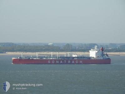
Lpg Tanker
Current Trip
| Time Travelled | 3 days |
|---|---|
| Remaining Time | 2 days |
| Distance Travelled | 927.14 nm |
| Remaining Distance | 726.05 nm |
| AVG Speed | 12.3 Knots |
| MAX Speed | 14.8 Knots |
| AVG Wind | 5.7 knots |
| MAX Wind | 16 knots |
| MIN Temp | 20.8°C / 69.44°F |
| MAX Temp | 33.1°C / 91.58°F |
| Draught | 6.5 m |
| Position Received | Now |
Current Position
| Longitude | 14.05703° |
|---|---|
| Latitude | 36.51680° |
| Status | Under way using engine |
| Speed | 12.2 Knots |
| Course | 288.8° |
| Area | Mediterranean Sea - Eastern Basin |
| Station | T-AIS |
| Position Received | Now |
Info
Information
The current position of ALRAR is in Mediterranean Sea - Eastern Basin with coordinates 36.51680° / 14.05703° as reported on 2024-06-06 17:14 by AIS to our vessel tracker app. The vessel's current speed is 12.2 Knots and is heading at the port of ARZEW. The estimated time of arrival as calculated by vessel tracking app is 2024-06-09 06:52 LT
The vessel ALRAR (IMO: 9284013, MMSI: 636012377) is a Lpg Tanker that was built in 2004 ( 20 years old ). It's sailing under the flag of [LR] Liberia.
In this page you can find informations about the vessels current position, last detected port calls, and current voyage information. If the vessels is not in coverage by AIS you will find the latest position.
The current position of ALRAR is detected by our AIS receivers and we are not responsible for the reliability of the data. The last position was recorded while the vessel was in Coverage by the Ais receivers of our vessel tracking app.
The current draught of ALRAR as reported by AIS is 6.5 meters
Weather
| Temperature | 21.9°C / 71.42°F |
|---|---|
| Wind Speed | 7 knots |
| Direction | 296° WNW |
| Pressure | 1017.2 hPa |
| Humidity | 80.1 % |
| Cloud Coverage | --- |
Featured Company
Last Port Calls
| Port | Arrival | Departure | Time In Port |
|---|---|---|---|
| 2024-05-26 07:05 | 2024-06-02 20:19 | 7 d | |
| 2024-05-15 21:04 | 2024-05-18 01:44 | 2 d | |
| 2024-05-06 13:28 | 2024-05-08 07:14 | 1 d | |
| 2024-04-22 18:32 | 2024-04-24 10:59 | 1 d | |
| 2024-04-15 04:33 | 2024-04-16 14:42 | 1 d | |
| 2024-04-09 05:25 | 2024-04-10 17:27 | 1 d | |
| 2024-04-05 04:49 | 2024-04-06 14:01 | 1 d |
Last Trips
| Origin | Departure | Destination | Arrival | Distance | |
|---|---|---|---|---|---|
| 2024-05-18 02:44 | 2024-05-26 10:05 | 1682.08 nm | |||
| 2024-05-08 10:14 | 2024-05-15 22:04 | 2018.29 nm | |||
| 2024-04-24 11:59 | 2024-05-06 16:28 | 1892.76 nm | |||
| 2024-04-16 17:42 | 2024-04-22 19:32 | 1539.95 nm | |||
| 2024-04-10 20:27 | 2024-04-15 07:33 | 734.75 nm | |||
| 2024-04-06 17:01 | 2024-04-09 08:25 | 695.03 nm | |||
| 2024-03-30 18:35 | 2024-04-05 07:49 | 1465.19 nm |
Events
| Time | Event | Details | Position / Dest | Info |
|---|---|---|---|---|
| 2024-06-06 13:39 | IN Coverage |
36.32849 / 14.84641
Mediterranean Sea - Eastern Basin
TRCKZ=>DZAZW
|
Speed: 12.2 kn Course: 305.4° |
|
| 2024-06-06 12:01 | OUT of Coverage |
36.30445 / 15.27235
Mediterranean Sea - Eastern Basin
TRCKZ=>DZAZW
|
Speed: 12.8 kn Course: 273.2° |
|
| 2024-06-06 08:19 | Status Changed | Under way using engine Default |
36.26914 / 16.21723
TRCKZ=>DZAZW
|
Speed: 12.2 kn Course: 272° |
| 2024-06-06 08:13 | Status Changed | Default Under way using engine |
36.26859 / 16.23970
TRCKZ=>DZAZW
|
Speed: 12.3 kn Course: 271.5° |
| 2024-06-06 07:55 | Detected in Sea | Italian part of the Mediterranean Sea - Eastern Basin |
36.26684 / 16.31546
Mediterranean Sea - Eastern Basin
TRCKZ=>DZAZW
|
Speed: 12.4 kn Course: 271.4° |
| 2024-06-06 07:55 | Status Changed | Under way using engine Default |
36.26684 / 16.31546
TRCKZ=>DZAZW
|
Speed: 12.4 kn Course: 272° |
| 2024-06-06 07:52 | IN Coverage |
36.26684 / 16.31546
Mediterranean Sea - Eastern Basin
TRCKZ=>DZAZW
|
Speed: 12.4 kn Course: 271.4° |
|
| 2024-06-05 23:38 | OUT of Coverage |
36.18881 / 18.51812
Mediterranean Sea - Eastern Basin
TRCKZ=>DZAZW
|
Speed: 12.3 kn Course: 271° |
|
| 2024-06-05 23:34 | IN Coverage |
36.18860 / 18.53796
Mediterranean Sea - Eastern Basin
TRCKZ=>DZAZW
|
Speed: 12.5 kn Course: 270.9° |
|
| 2024-06-05 22:11 | OUT of Coverage |
36.17320 / 18.90505
Mediterranean Sea - Eastern Basin
TRCKZ=>DZAZW
|
Speed: 13 kn Course: 272.5° |