
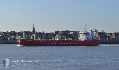
ALVANITH
Tanker B
Current Trip
| Trip Time | 1 day |
|---|---|
| Trip Distance | 400.04 nm |
| AVG Speed | 8 Knots |
| MAX Speed | 13.4 Knots |
| Draught | 6.1 m |
| AVG Wind | 7.2 knots |
| MAX Wind | 13.3 knots |
| MIN Temp | 12.2°C / 53.96°F |
| MAX Temp | 19.4°C / 66.92°F |
| Position Received | 2 m ago |
Current Position
| Longitude | 12.13246° |
|---|---|
| Latitude | 54.15718° |
| Status | Moored |
| Speed | |
| Course | 324° |
| Area | Baltic Sea |
| Station | T-AIS |
| Position Received | 2 m ago |
Info
Information
The current position of ALVANITH is in Baltic Sea with coordinates 54.15718° / 12.13246° as reported on 2024-06-01 08:11 by AIS to our vessel tracker app. The vessel's current speed is 0 Knots and is currently inside the port of ROSTOCK.
The vessel ALVANITH (IMO: 9856799, MMSI: 210253000) is a Tanker B It's sailing under the flag of [CY] Cyprus.
In this page you can find informations about the vessels current position, last detected port calls, and current voyage information. If the vessels is not in coverage by AIS you will find the latest position.
The current position of ALVANITH is detected by our AIS receivers and we are not responsible for the reliability of the data. The last position was recorded while the vessel was in Coverage by the Ais receivers of our vessel tracking app.
The current draught of ALVANITH as reported by AIS is 6.1 meters
Weather
| Temperature | 16.4°C / 61.52°F |
|---|---|
| Wind Speed | 8 knots |
| Direction | 37° NE |
| Pressure | 1012.6 hPa |
| Humidity | 90 % |
| Cloud Coverage | 53 % |
Featured Company
Last Port Calls
| Port | Arrival | Departure | Time In Port |
|---|---|---|---|
| 2024-05-31 19:47 | |||
| 2024-05-27 23:36 | 2024-05-30 00:34 | 2 d | |
| 2024-05-25 23:58 | 2024-05-26 01:46 | 1 h | |
| 2024-05-25 13:54 | 2024-05-25 15:09 | 1 h | |
| 2024-05-07 14:57 | 2024-05-24 16:28 | 17 d | |
| 2024-04-30 12:37 | 2024-05-03 07:10 | 2 d | |
| 2024-04-28 04:54 | 2024-04-29 09:04 | 1 d | |
| 2024-04-24 12:14 | 2024-04-25 13:56 | 1 d | |
| 2024-04-22 13:14 | 2024-04-23 19:19 | 1 d | |
| 2024-04-17 21:26 | 2024-04-19 21:21 | 1 d |
Most Visited Ports (Last year)
| Port | Arrivals | |
|---|---|---|
| 11 | ||
| 10 | ||
| 7 | ||
| 6 | ||
| 5 | ||
| 5 |
Last Trips
| Origin | Departure | Destination | Arrival | Distance | |
|---|---|---|---|---|---|
| 2024-05-30 02:34 | 2024-05-31 21:47 | 400.04 nm | |||
| 2024-05-26 03:46 | 2024-05-28 01:36 | 285.42 nm | |||
| 2024-05-25 17:09 | 2024-05-26 01:58 | 50.41 nm | |||
| 2024-05-24 18:28 | 2024-05-25 15:54 | 229.46 nm | |||
| 2024-05-03 09:10 | 2024-05-07 16:57 | 623.20 nm | |||
| 2024-04-29 10:04 | 2024-04-30 14:37 | 279.93 nm | |||
| 2024-04-25 15:56 | 2024-04-28 05:54 | 600.77 nm | |||
| 2024-04-23 21:19 | 2024-04-24 14:14 | 114.58 nm | |||
| 2024-04-19 23:21 | 2024-04-22 15:14 | 430.25 nm | |||
| 2024-04-08 19:36 | 2024-04-17 23:26 | 1146.07 nm |
Events
| Time | Event | Details | Position / Dest | Info |
|---|---|---|---|---|
| 2024-06-01 04:05 | Status Changed | Moored Default |
54.15721 / 12.13239
[DE] ROSTOCK
|
Speed: Course: 324° |
| 2024-06-01 04:02 | Status Changed | Default Moored |
54.15721 / 12.13243
[DE] ROSTOCK
|
Speed: Course: 324° |
| 2024-06-01 00:02 | ETA Changed | 2025/05/31 18:00 2024/05/31 18:00 |
54.15718 / 12.13240
[DE] ROSTOCK
|
Speed: 0.1 kn Course: 324° |
| 2024-05-31 20:26 | Status Changed | Moored Under way using engine |
54.15720 / 12.13239
[DE] ROSTOCK
|
Speed: 0.1 kn Course: 323° |
| 2024-05-31 20:15 | STOP Moving |
54.15899 / 12.12722
[DE] ROSTOCK
|
Speed: 0.3 kn Course: 332° |
|
| 2024-05-31 19:47 | PORT ARRIVAL |
|
54.18805 / 12.08889
[DE] ROSTOCK
|
Speed: 8 kn Course: 160.4° |
| 2024-05-31 18:28 | Change Sea Area | German part of the Baltic Sea Danish part of the Baltic Sea |
54.35438 / 11.85764
Baltic Sea
DE RSK
|
Speed: 11.7 kn Course: 136.2° |
| 2024-05-31 17:01 | Detected in Sea | Danish part of the Baltic Sea |
54.49542 / 11.45411
Baltic Sea
DE RSK
|
Speed: 11.5 kn Course: 116.6° |
| 2024-05-31 14:52 | Change Sea Area | German part of the Baltic Sea Danish part of the Baltic Sea |
54.56164 / 10.76343
Baltic Sea
DE RSK
|
Speed: 12 kn Course: 83.5° |
| 2024-05-31 14:25 | Change Sea Area | Danish part of the Baltic Sea German part of the Baltic Sea |
54.55331 / 10.61140
Baltic Sea
DE RSK
|
Speed: 11.7 kn Course: 80.1° |