
Unkown Name
Cargo
Current Trip
| Time Travelled | 10 days |
|---|---|
| Remaining Time | 6 days |
| Distance Travelled | 2580.85 nm |
| Remaining Distance | 2192.96 nm |
| AVG Speed | 10.9 Knots |
| MAX Speed | 14.4 Knots |
| AVG Wind | 8.7 knots |
| MAX Wind | 19 knots |
| MIN Temp | 24.3°C / 75.74°F |
| MAX Temp | 30.1°C / 86.18°F |
| Draught | 8.2 m |
| Position Received | 2 d ago |
Current Position
| Longitude | 135.34895° |
|---|---|
| Latitude | 7.94094° |
| Status | Under way using engine |
| Speed | 12.1 Knots |
| Course | 133° |
| Area | Philippine Sea |
| Station | T-AIS |
| Position Received | 2 d ago |
Info
Information
The current position of Unkown Name is in Philippine Sea with coordinates 7.94094° / 135.34895° as reported on 2024-05-31 17:31 by AIS to our vessel tracker app. The vessel's current speed is 12.1 Knots and is heading at the port of NEWCASTLE. The estimated time of arrival as calculated by vessel tracking app is 2024-06-10 05:12 LT
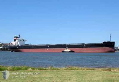
The vessel Unkown Name (IMO: 9913793, MMSI: 431665000) is a Cargo It's sailing under the flag of [JP] Japan.
In this page you can find informations about the vessels current position, last detected port calls, and current voyage information. If the vessels is not in coverage by AIS you will find the latest position.
The current position of Unkown Name is detected by our AIS receivers and we are not responsible for the reliability of the data. The last position was recorded while the vessel was in Coverage by the Ais receivers of our vessel tracking app.
The current draught of Unkown Name as reported by AIS is 8.2 meters
Weather
| Temperature | 29.6°C / 85.28°F |
|---|---|
| Wind Speed | 11 knots |
| Direction | 72° ENE |
| Pressure | 1007.8 hPa |
| Humidity | 74.2 % |
| Cloud Coverage | 18 % |
Featured Company
Most Visited Ports (Last year)
| Port | Arrivals | |
|---|---|---|
| 2 | ||
| 2 | ||
| 1 | ||
| 1 | ||
| 1 |
Last Trips
| Origin | Departure | Destination | Arrival | Distance | |
|---|---|---|---|---|---|
| 2024-04-17 13:40 | 2024-05-20 07:08 | 265.68 nm | |||
| 2024-03-22 07:33 | 2024-04-15 19:50 | 5504.24 nm |
Events
| Time | Event | Details | Position / Dest | Info |
|---|---|---|---|---|
| 2024-05-31 17:33 | Status Changed | Default Under way using engine |
7.93500 / 135.35333
AU NTL
|
Speed: 12.1 kn Course: 133° |
| 2024-05-31 17:31 | OUT of Coverage |
7.94094 / 135.34895
Philippine Sea
AU NTL
|
Speed: 12.1 kn Course: 133° |
|
| 2024-05-31 16:50 | Status Changed | Under way using engine Default |
8.03496 / 135.24649
AU NTL
|
Speed: 11 kn Course: 132° |
| 2024-05-31 16:42 | Status Changed | Default Under way using engine |
8.05166 / 135.22667
AU NTL
|
Speed: 11.9 kn Course: 132.6° |
| 2024-05-31 15:51 | Change Sea Area | Palau part of the Philippine Sea Chinese part of the South China Sea |
8.16856 / 135.10333
Philippine Sea
AU NTL
|
Speed: 12 kn Course: 134.4° |
| 2024-05-31 15:51 | Status Changed | Under way using engine Default |
8.16856 / 135.10333
AU NTL
|
Speed: 11 kn Course: 133° |
| 2024-05-31 15:51 | IN Coverage |
8.16856 / 135.10333
Philippine Sea
AU NTL
|
Speed: 12 kn Course: 134.4° |
|
| 2024-05-26 01:28 | Status Changed | Default Under way using engine |
22.05512 / 114.51704
AU NTL
|
Speed: 10.2 kn Course: 107.4° |
| 2024-05-26 01:23 | Status Changed | Under way using engine Default |
22.05938 / 114.50035
AU NTL
|
Speed: 10.2 kn Course: 116° |
| 2024-05-26 01:23 | OUT of Coverage |
22.05938 / 114.50035
South China Sea
AU NTL
|
Speed: 10.2 kn Course: 107.4° |