
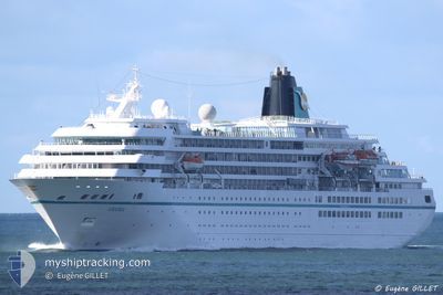
AMADEA
Passengers Ship
Current Trip
| Time Travelled | 1 day |
|---|---|
| Remaining Time | 12 h, 38 mins |
| Distance Travelled | 396.01 nm |
| Remaining Distance | 193.82 nm |
| AVG Speed | 16.1 Knots |
| MAX Speed | 17.4 Knots |
| AVG Wind | 17.7 knots |
| MAX Wind | 21 knots |
| MIN Temp | 11.4°C / 52.52°F |
| MAX Temp | 14.3°C / 57.74°F |
| Draught | 7.1 m |
| Position Received | Now |
Current Position
| Longitude | 4.18552° |
|---|---|
| Latitude | 59.56606° |
| Status | Under way using engine |
| Speed | 14.6 Knots |
| Course | 359.6° |
| Area | North Sea |
| Station | T-AIS |
| Position Received | Now |
Info
Information
The current position of AMADEA is in North Sea with coordinates 59.56606° / 4.18552° as reported on 2024-06-03 17:20 by AIS to our vessel tracker app. The vessel's current speed is 14.6 Knots and is heading at the port of NORDFJORDEID. The estimated time of arrival as calculated by vessel tracking app is 2024-06-04 05:58 LT
The vessel AMADEA (IMO: 8913162, MMSI: 308445000) is a Passengers Ship that was built in 1991 ( 33 years old ). It's sailing under the flag of [BS] Bahamas.
In this page you can find informations about the vessels current position, last detected port calls, and current voyage information. If the vessels is not in coverage by AIS you will find the latest position.
The current position of AMADEA is detected by our AIS receivers and we are not responsible for the reliability of the data. The last position was recorded while the vessel was in Coverage by the Ais receivers of our vessel tracking app.
The current draught of AMADEA as reported by AIS is 7.1 meters
Weather
| Temperature | 11.5°C / 52.7°F |
|---|---|
| Wind Speed | 17 knots |
| Direction | 252° WSW |
| Pressure | 1011.2 hPa |
| Humidity | 79.8 % |
| Cloud Coverage | 81 % |
Featured Company
Last Port Calls
| Port | Arrival | Departure | Time In Port |
|---|---|---|---|
| 2024-06-02 04:56 | 2024-06-02 16:47 | 11 h | |
| 2024-05-30 14:46 | 2024-05-31 21:44 | 1 d | |
| 2024-05-29 05:29 | 2024-05-29 16:53 | 11 h | |
| 2024-05-28 10:19 | 2024-05-28 19:59 | 9 h | |
| 2024-05-27 06:23 | 2024-05-27 17:05 | 10 h | |
| 2024-05-24 06:15 | 2024-05-24 18:41 | 12 h | |
| 2024-05-23 09:44 | 2024-05-23 20:04 | 10 h | |
| 2024-05-21 05:06 | 2024-05-21 17:45 | 12 h | |
| 2024-05-17 04:49 | 2024-05-17 17:14 | 12 h | |
| 2024-05-15 05:15 | 2024-05-15 16:16 | 11 h |
Most Visited Ports (Last year)
| Port | Arrivals | |
|---|---|---|
| 12 | ||
| 4 | ||
| 4 | ||
| 4 | ||
| 3 | ||
| 3 |
Last Trips
| Origin | Departure | Destination | Arrival | Distance | |
|---|---|---|---|---|---|
| 2024-05-31 22:44 | 2024-06-02 06:56 | 449.34 nm | |||
| 2024-05-29 17:53 | 2024-05-30 15:46 | 235.47 nm | |||
| 2024-05-28 20:59 | 2024-05-29 06:29 | 102.62 nm | |||
| 2024-05-27 18:05 | 2024-05-28 11:19 | 244.48 nm | |||
| 2024-05-24 19:41 | 2024-05-27 07:23 | 516.92 nm | |||
| 2024-05-23 21:04 | 2024-05-24 07:15 | 156.47 nm | |||
| 2024-05-21 18:45 | 2024-05-23 10:44 | 396.32 nm | |||
| 2024-05-17 19:14 | 2024-05-21 06:06 | 938.87 nm | |||
| 2024-05-15 18:16 | 2024-05-17 06:49 | 496.04 nm | |||
| 2024-05-14 17:02 | 2024-05-15 07:15 | 193.94 nm |
Events
| Time | Event | Details | Position / Dest | Info |
|---|---|---|---|---|
| 2024-06-03 07:18 | Status Changed | Under way using engine Default |
57.06415 / 5.48484
NONFD
|
Speed: 16 kn Course: 340° |
| 2024-06-03 07:09 | Status Changed | Default Under way using engine |
57.02167 / 5.51167
NONFD
|
Speed: 16.1 kn Course: 340.3° |
| 2024-06-03 06:56 | Status Changed | Under way using engine Default |
56.97086 / 5.54676
NONFD
|
Speed: 16 kn Course: 340° |
| 2024-06-03 06:27 | Status Changed | Default Under way using engine |
56.84500 / 5.62833
NONFD
|
Speed: 16.2 kn Course: 342.3° |
| 2024-06-03 06:20 | Change Sea Area | Norwegian part of the North Sea Danish part of the North Sea |
56.81603 / 5.65062
North Sea
NONFD
|
Speed: 16.3 kn Course: 343.9° |
| 2024-06-03 06:19 | Status Changed | Under way using engine Default |
56.81472 / 5.65130
NONFD
|
Speed: 16 kn Course: 340° |
| 2024-06-03 05:57 | Status Changed | Default Under way using engine |
56.71667 / 5.71333
NONFD
|
Speed: 16.7 kn Course: 340.2° |
| 2024-06-03 05:47 | Status Changed | Under way using engine Default |
56.67743 / 5.74092
NONFD
|
Speed: 16.6 kn Course: 340° |
| 2024-06-03 05:29 | Status Changed | Default Under way using engine |
56.59917 / 5.79263
NONFD
|
Speed: 16.7 kn Course: 339.8° |
| 2024-06-03 05:28 | Status Changed | Under way using engine Default |
56.59482 / 5.79551
NONFD
|
Speed: 16 kn Course: 340° |