
AMARO
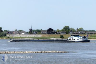
Cargo
Current Trip
| Time Travelled | 2 days |
|---|---|
| Remaining Time | --- |
| Distance Travelled | 0.21 nm |
| Remaining Distance | --- |
| AVG Speed | --- |
| MAX Speed | --- |
| AVG Wind | 5 knots |
| MAX Wind | 5 knots |
| MIN Temp | 12.6°C / 54.68°F |
| MAX Temp | 12.6°C / 54.68°F |
| Draught | 1.8 m |
| Position Received | 2 d ago |
Current Position
| Longitude | 7.65023° |
|---|---|
| Latitude | 51.91434° |
| Status | Under way using engine |
| Speed | 5.4 Knots |
| Course | 161.2° |
| Area | North Sea |
| Station | T-AIS |
| Position Received | 2 d ago |
Info
Information
The current position of AMARO is in North Sea with coordinates 51.91434° / 7.65023° as reported on 2024-05-31 06:06 by AIS to our vessel tracker app. The vessel's current speed is 5.4 Knots and is heading at the port of ZWARTSLUIS. The estimated time of arrival as calculated by vessel tracking app is 2024-06-03 07:00 LT
The vessel AMARO (MMSI: 244700115) is a Cargo It's sailing under the flag of [NL] Netherlands.
In this page you can find informations about the vessels current position, last detected port calls, and current voyage information. If the vessels is not in coverage by AIS you will find the latest position.
The current position of AMARO is detected by our AIS receivers and we are not responsible for the reliability of the data. The last position was recorded while the vessel was in Coverage by the Ais receivers of our vessel tracking app.
The current draught of AMARO as reported by AIS is 1.8 meters
Weather
| Temperature | 12.7°C / 54.86°F |
|---|---|
| Wind Speed | 5 knots |
| Direction | 281° W |
| Pressure | 1009.6 hPa |
| Humidity | 89 % |
| Cloud Coverage | 80 % |
Featured Company
Last Port Calls
| Port | Arrival | Departure | Time In Port |
|---|---|---|---|
| 2024-05-31 04:59 | 2024-05-31 06:04 | 1 h | |
| 2024-05-21 18:23 | 2024-05-22 03:34 | 9 h | |
| 2024-05-20 16:50 | 2024-05-21 07:18 | 14 h | |
| 2024-05-20 11:35 | 2024-05-20 13:51 | 2 h | |
| 2024-05-14 04:34 | 2024-05-20 07:55 | 6 d | |
| 2024-05-13 15:48 | 2024-05-14 04:30 | 12 h | |
| 2024-05-13 15:08 | 2024-05-13 15:36 | 28 m | |
| 2024-05-08 18:55 | 2024-05-09 04:41 | 9 h | |
| 2024-05-03 08:02 | 2024-05-03 08:52 | 50 m | |
| 2024-04-29 11:11 | 2024-04-29 11:50 | 38 m |
Most Visited Ports (Last year)
| Port | Arrivals | |
|---|---|---|
| 10 | ||
| 8 | ||
| 6 | ||
| 6 | ||
| 6 | ||
| 6 |
Last Trips
| Origin | Departure | Destination | Arrival | Distance | |
|---|---|---|---|---|---|
| 2024-05-22 05:34 | 2024-05-31 06:59 | 406.62 nm | |||
| 2024-05-21 09:18 | 2024-05-21 20:23 | 70.94 nm | |||
| 2024-05-20 15:51 | 2024-05-20 18:50 | 24.97 nm | |||
| 2024-05-20 09:55 | 2024-05-20 13:35 | 27.33 nm | |||
| 2024-05-14 06:30 | 2024-05-14 06:34 | 0.47 nm | |||
| 2024-05-13 17:36 | 2024-05-13 17:48 | 0.48 nm | |||
| 2024-05-09 06:41 | 2024-05-13 17:08 | 126.84 nm | |||
| 2024-05-03 10:52 | 2024-05-08 20:55 | 273.89 nm | |||
| 2024-04-29 13:50 | 2024-05-03 10:02 | 48.15 nm | |||
| 2024-04-28 09:23 | 2024-04-29 13:11 | 94.14 nm |
Events
| Time | Event | Details | Position / Dest | Info |
|---|---|---|---|---|
| 2024-05-31 06:06 | OUT of Coverage |
51.91434 / 7.65023
North Sea
ZWARTSLUIS
|
Speed: 5.4 kn Course: 161.2° |
|
| 2024-05-31 06:04 | PORT DEPARTURE |
|
51.91764 / 7.64849
ZWARTSLUIS
|
Speed: 4.8 kn Course: 156.3° |
| 2024-05-31 05:21 | START Moving |
51.97680 / 7.66232
[DE] MUNSTER
|
Speed: 3.5 kn Course: 170.8° |
|
| 2024-05-31 05:00 | STOP Moving |
51.97864 / 7.66191
[DE] MUNSTER
|
Speed: 0.2 kn Course: 511° |
|
| 2024-05-31 04:59 | PORT ARRIVAL |
|
51.97868 / 7.66188
[DE] MUNSTER
|
Speed: 0.9 kn Course: 511° |
| 2024-05-31 04:12 | IN Coverage |
52.04421 / 7.68191
North Sea
ZWARTSLUIS
|
Speed: 4.7 kn Course: 212° |
|
| 2024-05-30 14:06 | OUT of Coverage |
52.37635 / 7.87290
North Sea
ZWARTSLUIS
|
Speed: 5.3 kn Course: 246° |
|
| 2024-05-30 11:16 | IN Coverage |
52.35275 / 8.24651
North Sea
ZWARTSLUIS
|
Speed: 4.4 kn Course: 298.4° |
|
| 2024-05-30 06:54 | OUT of Coverage |
52.29786 / 8.87307
North Sea
ZWARTSLUIS
|
Speed: 5.3 kn Course: 255° |
|
| 2024-05-30 05:32 | IN Coverage |
52.31374 / 9.05936
North Sea
ZWARTSLUIS
|
Speed: 3.8 kn Course: 242.7° |