
AMAZON
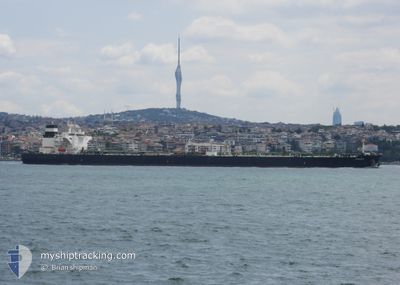
Crude Oil Tanker
Current Trip
| Time Travelled | 41 days |
|---|---|
| Remaining Time | --- |
| Distance Travelled | 6042.19 nm |
| Remaining Distance | --- |
| AVG Speed | 10.4 Knots |
| MAX Speed | 10.4 Knots |
| AVG Wind | 7.7 knots |
| MAX Wind | 23 knots |
| MIN Temp | 27.1°C / 80.78°F |
| MAX Temp | 38.6°C / 101.48°F |
| Draught | 10.6 m |
| Position Received | Now |
Current Position
| Longitude | 56.47759° |
|---|---|
| Latitude | 25.16486° |
| Status | At anchor |
| Speed | 0.1 Knots |
| Course | 134° |
| Area | Gulf of Oman |
| Station | T-AIS |
| Position Received | Now |
Info
Information
The current position of AMAZON is in Gulf of Oman with coordinates 25.16486° / 56.47759° as reported on 2024-06-23 02:55 by AIS to our vessel tracker app. The vessel's current speed is 0.1 Knots
The vessel AMAZON (IMO: 9476654, MMSI: 636014503) is a Crude Oil Tanker that was built in 2011 ( 13 years old ). It's sailing under the flag of [LR] Liberia.
In this page you can find informations about the vessels current position, last detected port calls, and current voyage information. If the vessels is not in coverage by AIS you will find the latest position.
The current position of AMAZON is detected by our AIS receivers and we are not responsible for the reliability of the data. The last position was recorded while the vessel was in Coverage by the Ais receivers of our vessel tracking app.
The current draught of AMAZON as reported by AIS is 10.6 meters
Weather
| Temperature | 31.8°C / 89.24°F |
|---|---|
| Wind Speed | 2 knots |
| Direction | 91° E |
| Pressure | 999.6 hPa |
| Humidity | 73 % |
| Cloud Coverage | 5 % |
Featured Company
Last Port Calls
| Port | Arrival | Departure | Time In Port |
|---|---|---|---|
| 2024-05-10 23:23 | 2024-05-12 05:13 | 1 d | |
| 2024-04-04 18:30 | 2024-04-06 19:52 | 2 d |
Most Visited Ports (Last year)
| Port | Arrivals | |
|---|---|---|
| 3 | ||
| 2 | ||
| 1 | ||
| 1 | ||
| 1 | ||
| 1 |
Last Trips
| Origin | Departure | Destination | Arrival | Distance | |
|---|---|---|---|---|---|
| 2024-04-07 01:22 | 2024-05-11 02:23 | 6067.66 nm | |||
| 2024-02-10 11:39 | 2024-04-05 00:00 | 9368.63 nm |
Events
| Time | Event | Details | Position / Dest | Info |
|---|---|---|---|---|
| 2024-06-23 00:07 | Status Changed | At anchor Default |
25.16474 / 56.47783
AEFJR
|
Speed: 0.1 kn Course: 141° |
| 2024-06-23 00:04 | Status Changed | Default At anchor |
25.16478 / 56.47792
AEFJR
|
Speed: 0.1 kn Course: 142° |
| 2024-06-22 15:10 | Status Changed | At anchor Under way using engine |
25.16353 / 56.48163
AEFJR
|
Speed: 0.7 kn Course: 276° |
| 2024-06-22 14:55 | STOP Moving | 6.41 nm, East of FUJAIRAH |
25.16162 / 56.48114
AEFJR
|
Speed: 0.3 kn Course: 284° |
| 2024-06-22 11:32 | START Moving | 9.67 nm, South East of KHORFAKKAN |
25.28551 / 56.52103
AEFJR
|
Speed: 3.1 kn Course: 113° |
| 2024-06-22 11:22 | Status Changed | Under way using engine At anchor |
25.28812 / 56.51829
AEFJR
|
Speed: 0.1 kn Course: 171° |
| 2024-06-21 20:27 | Status Changed | At anchor Under way using engine |
25.28768 / 56.51970
AEFJR
|
Speed: 0.4 kn Course: 202° |
| 2024-06-21 20:27 | STOP Moving | 9.55 nm, South East of KHORFAKKAN |
25.28768 / 56.51970
AEFJR
|
Speed: 0.3 kn Course: 202° |
| 2024-06-21 15:32 | Change Sea Area | United Arab Emirates part of the Gulf of Oman Omani part of the Gulf of Oman |
25.66190 / 56.78423
Gulf of Oman
AEFJR
|
Speed: 12.3 kn Course: 179.8° |
| 2024-06-21 14:15 | Change Sea Area | Omani part of the Gulf of Oman Omani part of the Persian Gulf |
25.91979 / 56.76856
Gulf of Oman
AEFJR
|
Speed: 12.4 kn Course: 174.1° |