
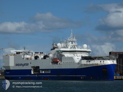
AMAZON WARRIOR
Research/Survey Vessel
Current Trip
TOWING CABLES
| Time Travelled | 50 days |
|---|---|
| Remaining Time | --- |
| Distance Travelled | 5037.47 nm |
| Remaining Distance | --- |
| AVG Speed | 4.5 Knots |
| MAX Speed | 13.1 Knots |
| AVG Wind | 14.7 knots |
| MAX Wind | 32.8 knots |
| MIN Temp | 6.5°C / 43.7°F |
| MAX Temp | 13.8°C / 56.84°F |
| Draught | 7.7 m |
| Position Received | 2 m ago |
Current Position
| Longitude | 1.09968° |
|---|---|
| Latitude | 62.19284° |
| Status | Restricted manoeuverability |
| Speed | 5.4 Knots |
| Course | 91° |
| Area | Norwegian Sea |
| Station | T-AIS |
| Position Received | 2 m ago |
Info
Information
The current position of AMAZON WARRIOR is in Norwegian Sea with coordinates 62.19284° / 1.09968° as reported on 2024-06-26 10:15 by AIS to our vessel tracker app. The vessel's current speed is 5.4 Knots
The vessel AMAZON WARRIOR (IMO: 9662394, MMSI: 311001278) is a Research/Survey Vessel that was built in 2014 ( 10 years old ). It's sailing under the flag of [BS] Bahamas.
In this page you can find informations about the vessels current position, last detected port calls, and current voyage information. If the vessels is not in coverage by AIS you will find the latest position.
The current position of AMAZON WARRIOR is detected by our AIS receivers and we are not responsible for the reliability of the data. The last position was recorded while the vessel was in Coverage by the Ais receivers of our vessel tracking app.
The current draught of AMAZON WARRIOR as reported by AIS is 7.7 meters
Weather
| Temperature | 10.5°C / 50.9°F |
|---|---|
| Wind Speed | 7 knots |
| Direction | 146° SE |
| Pressure | 1018.1 hPa |
| Humidity | 81.2 % |
| Cloud Coverage | 49 % |
Featured Company
Most Visited Ports (Last year)
| Port | Arrivals | |
|---|---|---|
| 2 | ||
| 2 | ||
| 1 | ||
| 1 |
Last Trips
| Origin | Departure | Destination | Arrival | Distance |
|---|
Events
| Time | Event | Details | Position / Dest | Info |
|---|---|---|---|---|
| 2024-06-26 06:02 | Detected in Sea | United Kingdom part of the Norwegian Sea |
62.06802 / 1.32171
Norwegian Sea
|
Speed: 4.4 kn Course: 267.8° |
| 2024-06-24 11:49 | Change Sea Area | Norwegian part of the Norwegian Sea United Kingdom part of the Norwegian Sea |
62.18974 / 1.24235
Norwegian Sea
|
Speed: 5 kn Course: 87.9° |
| 2024-06-24 10:11 | IN Coverage |
62.15149 / .96861
Norwegian Sea
|
Speed: 4.8 kn Course: 21.5° |
|
| 2024-06-24 09:08 | OUT of Coverage |
62.08311 / 1.00115
Norwegian Sea
|
Speed: 3.8 kn Course: 312.2° |
|
| 2024-06-24 06:44 | Detected in Sea | United Kingdom part of the Norwegian Sea |
62.06300 / 1.32426
Norwegian Sea
|
Speed: 4 kn Course: 269.2° |
| 2024-06-22 13:51 | Detected in Sea | Norwegian part of the Norwegian Sea |
62.18496 / 1.24634
Norwegian Sea
|
Speed: 4.8 kn Course: 87.4° |
| 2024-06-22 08:51 | Detected in Sea | United Kingdom part of the Norwegian Sea |
62.05889 / 1.33099
Norwegian Sea
|
Speed: 4.7 kn Course: 267.5° |
| 2024-06-20 14:19 | Detected in Sea | Norwegian part of the Norwegian Sea |
62.15127 / 1.27144
Norwegian Sea
|
Speed: 4.5 kn Course: 91.7° |
| 2024-06-20 13:46 | Detected in Sea | United Kingdom part of the Norwegian Sea |
62.13984 / 1.18780
Norwegian Sea
|
Speed: 4.3 kn Course: 56.3° |
| 2024-06-20 13:46 | IN Coverage |
62.13984 / 1.18780
Norwegian Sea
|
Speed: 4.3 kn Course: 56.3° |