
AMBER LIGHT
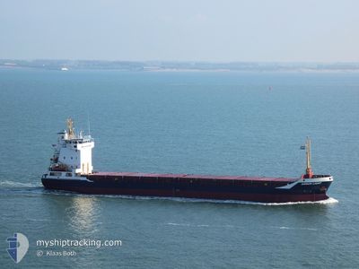
General Cargo
Current Trip
| Time Travelled | 1 day |
|---|---|
| Remaining Time | 8 days |
| Distance Travelled | 266.66 nm |
| Remaining Distance | 1307.66 nm |
| AVG Speed | 6.7 Knots |
| MAX Speed | 10.5 Knots |
| AVG Wind | 21.9 knots |
| MAX Wind | 24 knots |
| MIN Temp | 13.6°C / 56.48°F |
| MAX Temp | 16.9°C / 62.42°F |
| Draught | 5.4 m |
| Position Received | Now |
Current Position
| Longitude | 9.02387° |
|---|---|
| Latitude | 53.86478° |
| Status | Under way using engine |
| Speed | 7.1 Knots |
| Course | 62.4° |
| Area | North Sea |
| Station | T-AIS |
| Position Received | Now |
Info
Information
The current position of AMBER LIGHT is in North Sea with coordinates 53.86478° / 9.02387° as reported on 2024-06-02 01:04 by AIS to our vessel tracker app. The vessel's current speed is 7.1 Knots and is heading at the port of ST PETERSBURG. The estimated time of arrival as calculated by vessel tracking app is 2024-06-10 10:20 LT
The vessel AMBER LIGHT (IMO: 9158109, MMSI: 304778000) is a General Cargo that was built in 2005 ( 19 years old ). It's sailing under the flag of [AG] Antigua Barbuda.
In this page you can find informations about the vessels current position, last detected port calls, and current voyage information. If the vessels is not in coverage by AIS you will find the latest position.
The current position of AMBER LIGHT is detected by our AIS receivers and we are not responsible for the reliability of the data. The last position was recorded while the vessel was in Coverage by the Ais receivers of our vessel tracking app.
The current draught of AMBER LIGHT as reported by AIS is 5.4 meters
Weather
| Temperature | 14.2°C / 57.56°F |
|---|---|
| Wind Speed | 12 knots |
| Direction | 336° NNW |
| Pressure | 1016.9 hPa |
| Humidity | 95.1 % |
| Cloud Coverage | 74 % |
Featured Company
Last Port Calls
| Port | Arrival | Departure | Time In Port |
|---|---|---|---|
| 2024-05-31 01:18 | 2024-05-31 14:36 | 13 h | |
| 2024-05-29 22:55 | 2024-05-31 01:08 | 1 d | |
| 2024-05-28 16:13 | 2024-05-29 21:45 | 1 d | |
| 2024-05-15 08:00 | 2024-05-21 03:27 | 5 d | |
| 2024-05-02 08:20 | 2024-05-06 11:52 | 4 d | |
| 2024-04-29 21:52 | 2024-04-30 12:01 | 14 h | |
| 2024-04-24 22:08 | 2024-04-27 16:16 | 2 d | |
| 2024-04-23 04:55 | 2024-04-24 12:03 | 1 d | |
| 2024-04-19 11:35 | 2024-04-19 11:39 | 4 m | |
| 2024-04-16 07:15 | 2024-04-18 00:12 | 1 d |
Most Visited Ports (Last year)
| Port | Arrivals | |
|---|---|---|
| 6 | ||
| 5 | ||
| 5 | ||
| 3 | ||
| 2 | ||
| 2 |
Last Trips
| Origin | Departure | Destination | Arrival | Distance | |
|---|---|---|---|---|---|
| 2024-05-31 03:08 | 2024-05-31 03:18 | 0.62 nm | |||
| 2024-05-29 23:45 | 2024-05-30 00:55 | 14.03 nm | |||
| 2024-05-21 06:27 | 2024-05-28 18:13 | 1665.39 nm | |||
| 2024-05-06 14:52 | 2024-05-15 11:00 | 2160.54 nm | |||
| 2024-04-30 14:01 | 2024-05-02 11:20 | 484.63 nm | |||
| 2024-04-27 19:16 | 2024-04-29 23:52 | 552.10 nm | |||
| 2024-04-24 15:03 | 2024-04-25 01:08 | 103.49 nm | |||
| 2024-04-19 13:39 | 2024-04-23 07:55 | 774.10 nm | |||
| 2024-04-18 02:12 | 2024-04-19 13:35 | 331.80 nm | |||
| 2024-04-12 19:36 | 2024-04-16 09:15 | 716.85 nm |
Events
| Time | Event | Details | Position / Dest | Info |
|---|---|---|---|---|
| 2024-06-01 14:44 | Change Sea Area | German part of the North Sea Dutch part of the North Sea |
53.78312 / 6.70685
North Sea
RULED
|
Speed: 9.7 kn Course: 71.5° |
| 2024-06-01 14:43 | Status Changed | Under way using engine Default |
53.78265 / 6.70353
RULED
|
Speed: 10.2 kn Course: 76° |
| 2024-06-01 14:30 | IN Coverage |
53.78312 / 6.70685
North Sea
RULED
|
Speed: 9.7 kn Course: 71.5° |
|
| 2024-06-01 12:44 | Status Changed | Default Under way using engine |
53.69332 / 6.17075
RULED
|
Speed: 9.3 kn Course: 68.9° |
| 2024-06-01 12:41 | Status Changed | Under way using engine Default |
53.69125 / 6.15943
RULED
|
Speed: 9 kn Course: 76° |
| 2024-06-01 12:41 | OUT of Coverage |
53.69125 / 6.15943
North Sea
RULED
|
Speed: 9.3 kn Course: 68.9° |
|
| 2024-06-01 12:06 | Status Changed | Default Under way using engine |
53.66452 / 6.01675
RULED
|
Speed: 9.1 kn Course: 74.5° |
| 2024-06-01 12:00 | Status Changed | Under way using engine Default |
53.66027 / 5.99512
RULED
|
Speed: 8.9 kn Course: 76° |
| 2024-06-01 11:54 | Status Changed | Default Under way using engine |
53.65557 / 5.96912
RULED
|
Speed: 8.7 kn Course: 66.9° |
| 2024-06-01 11:48 | Status Changed | Under way using engine Default |
53.65158 / 5.94803
RULED
|
Speed: 9.1 kn Course: 66° |