
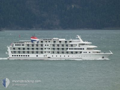
AMER CONSTELLATION
Passenger
Current Trip
| Time Travelled | 1 h, 32 mins |
|---|---|
| Remaining Time | 7 h, 25 mins |
| Distance Travelled | 12.74 nm |
| Remaining Distance | --- |
| AVG Speed | 8.4 Knots |
| MAX Speed | 9.4 Knots |
| AVG Wind | 4.7 knots |
| MAX Wind | 5 knots |
| MIN Temp | 15.3°C / 59.54°F |
| MAX Temp | 16.3°C / 61.34°F |
| Draught | 2.8 m |
| Position Received | 11 d ago |
Current Position
| Longitude | -133.95975° |
|---|---|
| Latitude | 57.98568° |
| Status | Under way using engine |
| Speed | 12.2 Knots |
| Course | 327.9° |
| Area | The Coastal Waters of Southeast Alaska and British Columbia |
| Station | T-AIS |
| Position Received | 11 d ago |
Info
Information
The current position of AMER CONSTELLATION is in The Coastal Waters of Southeast Alaska and British Columbia with coordinates 57.98568° / -133.95975° as reported on 2024-06-16 23:46 by AIS to our vessel tracker app. The vessel's current speed is 12.2 Knots and is heading at the port of HAINES. The estimated time of arrival as calculated by vessel tracking app is 2024-06-28 08:12 LT
The vessel AMER CONSTELLATION (IMO: 9838333, MMSI: 367764750) is a Passenger It's sailing under the flag of [US] USA.
In this page you can find informations about the vessels current position, last detected port calls, and current voyage information. If the vessels is not in coverage by AIS you will find the latest position.
The current position of AMER CONSTELLATION is detected by our AIS receivers and we are not responsible for the reliability of the data. The last position was recorded while the vessel was in Coverage by the Ais receivers of our vessel tracking app.
The current draught of AMER CONSTELLATION as reported by AIS is 2.8 meters
Weather
| Temperature | 15.3°C / 59.54°F |
|---|---|
| Wind Speed | 5 knots |
| Direction | 145° SE |
| Pressure | 1012 hPa |
| Humidity | 82.5 % |
| Cloud Coverage | 34 % |
Featured Company
Last Port Calls
| Port | Arrival | Departure | Time In Port |
|---|---|---|---|
| 2024-06-27 03:27 | 2024-06-27 23:15 | 19 h | |
| 2024-06-24 18:27 | 2024-06-25 14:03 | 19 h | |
| 2024-06-23 15:07 | 2024-06-24 14:11 | 23 h | |
| 2024-06-21 15:31 | 2024-06-22 17:15 | 1 d | |
| 2024-06-18 08:03 | 2024-06-19 02:11 | 18 h | |
| 2024-06-17 03:38 | 2024-06-17 23:15 | 19 h | |
| 2024-06-15 05:35 | 2024-06-16 02:07 | 20 h | |
| 2024-06-14 15:47 | 2024-06-15 02:04 | 10 h | |
| 2024-06-11 07:59 | 2024-06-12 02:07 | 18 h | |
| 2024-06-10 03:43 | 2024-06-10 23:07 | 19 h |
Most Visited Ports (Last year)
| Port | Arrivals | |
|---|---|---|
| 14 | ||
| 14 | ||
| 13 | ||
| 13 | ||
| 12 | ||
| 12 |
Last Trips
| Origin | Departure | Destination | Arrival | Distance | |
|---|---|---|---|---|---|
| 2024-06-25 06:03 | 2024-06-26 19:27 | 223.24 nm | |||
| 2024-06-24 06:11 | 2024-06-24 10:27 | 39.45 nm | |||
| 2024-06-22 09:15 | 2024-06-23 07:07 | 179.85 nm | |||
| 2024-06-18 18:11 | 2024-06-21 07:31 | 416.76 nm | |||
| 2024-06-17 15:15 | 2024-06-18 00:03 | 87.00 nm | |||
| 2024-06-15 18:07 | 2024-06-16 19:38 | 227.80 nm | |||
| 2024-06-14 18:04 | 2024-06-14 21:35 | 38.57 nm | |||
| 2024-06-11 18:07 | 2024-06-14 07:47 | 436.65 nm | |||
| 2024-06-10 15:07 | 2024-06-10 23:59 | 81.54 nm | |||
| 2024-06-08 18:11 | 2024-06-09 19:43 | 223.74 nm |
Events
| Time | Event | Details | Position / Dest | Info |
|---|---|---|---|---|
| 2024-06-27 23:15 | PORT DEPARTURE |
|
58.36697 / -134.67915
KETCHIKAN,AK
|
Speed: 6.8 kn Course: 182° |
| 2024-06-27 23:12 | START Moving |
58.37543 / -134.67856
[US] JUNEAU (AK)
|
Speed: 6.8 kn Course: 182° |
|
| 2024-06-27 03:36 | STOP Moving |
58.38150 / -134.67999
[US] JUNEAU (AK)
|
Speed: 0.1 kn Course: 88° |
|
| 2024-06-27 03:27 | PORT ARRIVAL |
|
58.38008 / -134.68036
[US] JUNEAU (AK)
|
Speed: 6 kn Course: 358° |
| 2024-06-27 01:16 | START Moving | 10.38 nm, South East of JUNEAU |
58.17208 / -134.18857
KETCHIKAN,AK
|
Speed: 4.1 kn Course: 279° |
| 2024-06-27 00:52 | STOP Moving | 10.49 nm, South East of JUNEAU |
58.16945 / -134.18855
KETCHIKAN,AK
|
Speed: 0.3 kn Course: 218° |
| 2024-06-26 18:33 | START Moving |
57.91121 / -133.16270
KETCHIKAN,AK
|
Speed: 6 kn Course: 172° |
|
| 2024-06-26 17:48 | STOP Moving |
57.92132 / -133.16205
KETCHIKAN,AK
|
Speed: 0.1 kn Course: 96° |
|
| 2024-06-26 02:04 | START Moving | 0.6 nm, West of WRANGELL |
56.46453 / -132.40570
KETCHIKAN,AK
|
Speed: 10.2 kn Course: 279° |
| 2024-06-25 14:12 | STOP Moving | 0.34 nm, South West of WRANGELL |
56.46189 / -132.39237
KETCHIKAN,AK
|
Speed: 0.2 kn Course: 316° |