
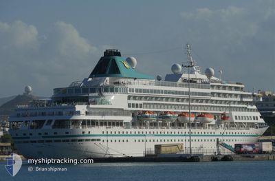
AMERA
Passengers Ship
Current Trip
| Time Travelled | 3 days |
|---|---|
| Remaining Time | --- |
| Distance Travelled | 1013.92 nm |
| Remaining Distance | 173.21 nm |
| AVG Speed | 12.5 Knots |
| MAX Speed | 21.7 Knots |
| AVG Wind | 15.9 knots |
| MAX Wind | 22.2 knots |
| MIN Temp | 11.5°C / 52.7°F |
| MAX Temp | 15.1°C / 59.18°F |
| Draught | 7 m |
| Position Received | 13 h, 43 m ago |
Current Position
| Longitude | -5.46370° |
|---|---|
| Latitude | 48.42042° |
| Status | Under way using engine |
| Speed | 16.3 Knots |
| Course | 203.6° |
| Area | Celtic Sea |
| Station | T-AIS |
| Position Received | 13 h, 43 m ago |
Info
Information
The current position of AMERA is in Celtic Sea with coordinates 48.42042° / -5.46370° as reported on 2024-05-16 02:42 by AIS to our vessel tracker app. The vessel's current speed is 16.3 Knots and is heading at the port of EL FERROL. The estimated time of arrival as calculated by vessel tracking app is 2024-05-17 04:00 LT
The vessel AMERA (IMO: 8700280, MMSI: 311000840) is a Passengers Ship that was built in 1988 ( 36 years old ). It's sailing under the flag of [BS] Bahamas.
In this page you can find informations about the vessels current position, last detected port calls, and current voyage information. If the vessels is not in coverage by AIS you will find the latest position.
The current position of AMERA is detected by our AIS receivers and we are not responsible for the reliability of the data. The last position was recorded while the vessel was in Coverage by the Ais receivers of our vessel tracking app.
The current draught of AMERA as reported by AIS is 7 meters
Weather
| Temperature | 13.6°C / 56.48°F |
|---|---|
| Wind Speed | 19 knots |
| Direction | 259° W |
| Pressure | 1002.9 hPa |
| Humidity | 88 % |
| Cloud Coverage | 18 % |
Featured Company
Last Port Calls
| Port | Arrival | Departure | Time In Port |
|---|---|---|---|
| 2024-05-12 04:47 | 2024-05-12 21:28 | 16 h | |
| 2024-05-05 08:46 | 2024-05-05 18:13 | 9 h | |
| 2024-05-03 12:11 | 2024-05-03 21:30 | 9 h | |
| 2024-04-29 11:12 | 2024-05-01 23:51 | 2 d | |
| 2024-04-26 09:24 | 2024-04-26 22:29 | 13 h | |
| 2024-04-26 09:00 | |||
| 2024-04-25 10:38 | 2024-04-26 03:05 | 16 h | |
| 2024-04-21 12:21 | 2024-04-22 00:16 | 11 h | |
| 2024-04-17 17:41 | 2024-04-18 00:21 | 6 h | |
| 2024-04-12 10:59 | 2024-04-14 18:47 | 2 d |
Most Visited Ports (Last year)
| Port | Arrivals | |
|---|---|---|
| 9 | ||
| 3 | ||
| 3 | ||
| 3 | ||
| 3 | ||
| 2 |
Last Trips
| Origin | Departure | Destination | Arrival | Distance | |
|---|---|---|---|---|---|
| 2024-05-05 15:43 | 2024-05-12 06:47 | 2508.11 nm | |||
| 2024-05-03 18:30 | 2024-05-05 06:16 | 550.81 nm | |||
| 2024-05-01 19:51 | 2024-05-03 09:11 | 592.95 nm | |||
| 2024-04-26 18:29 | 2024-04-29 07:12 | 949.48 nm | |||
| 2024-04-25 23:05 | 2024-04-26 05:24 | 54.85 nm | |||
| 2024-04-25 23:05 | 2024-04-26 05:00 | 54.11 nm | |||
| 2024-04-21 18:16 | 2024-04-25 06:38 | 1289.80 nm | |||
| 2024-04-17 19:21 | 2024-04-21 06:21 | 847.00 nm | |||
| 2024-04-14 13:47 | 2024-04-17 12:41 | 932.77 nm | |||
| 2024-04-08 19:09 | 2024-04-12 05:59 | 1336.60 nm |
Events
| Time | Event | Details | Position / Dest | Info |
|---|---|---|---|---|
| 2024-05-16 02:47 | Status Changed | Default Under way using engine |
48.39843 / -5.47795
ESFRO
|
Speed: 16.3 kn Course: 203.6° |
| 2024-05-16 02:42 | OUT of Coverage |
48.42042 / -5.46370
Celtic Sea
ESFRO
|
Speed: 16.3 kn Course: 203.6° |
|
| 2024-05-16 02:27 | Status Changed | Under way using engine Default |
48.48314 / -5.42598
ESFRO
|
Speed: 16 kn Course: 207° |
| 2024-05-16 02:25 | Status Changed | Default Under way using engine |
48.49166 / -5.41833
ESFRO
|
Speed: 16.6 kn Course: 218.3° |
| 2024-05-16 02:19 | Status Changed | Under way using engine Default |
48.51562 / -5.39475
ESFRO
|
Speed: 16 kn Course: 217° |
| 2024-05-16 02:13 | Status Changed | Default Under way using engine |
48.53667 / -5.36833
ESFRO
|
Speed: 16.6 kn Course: 218.2° |
| 2024-05-16 00:19 | Change Sea Area | French part of the Celtic Sea French part of the English Channel |
48.86655 / -4.76226
Celtic Sea
ESFRO
|
Speed: 16.2 kn Course: 232.7° |
| 2024-05-15 18:47 | Change Sea Area | French part of the English Channel Jersey part of the English Channel |
48.98908 / -2.65679
English Channel
ESFRO
|
Speed: 16.1 kn Course: 269.6° |
| 2024-05-15 18:05 | Draught Changed | 7 6.9 |
48.90532 / -2.39412
ESFRO
|
Speed: 16.8 kn Course: 305.4° |
| 2024-05-15 18:05 | Destination Changed | ESFRO FRSML |
48.90532 / -2.39412
ESFRO
|
Speed: 16.8 kn Course: 305.4° |