
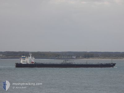
AMFITRITI
Crude Oil Tanker
Current Trip
| Time Travelled | 34 days |
|---|---|
| Remaining Time | --- |
| Distance Travelled | 1155.83 nm |
| Remaining Distance | --- |
| AVG Speed | 9.5 Knots |
| MAX Speed | 14.2 Knots |
| AVG Wind | 10.6 knots |
| MAX Wind | 33.9 knots |
| MIN Temp | 17.9°C / 64.22°F |
| MAX Temp | 26.2°C / 79.16°F |
| Draught | 8.2 m |
| Position Received | 10 m ago |
Current Position
| Longitude | 126.12681° |
|---|---|
| Latitude | 37.01629° |
| Status | At anchor |
| Speed | |
| Course | 22° |
| Area | Yellow Sea |
| Station | T-AIS |
| Position Received | 10 m ago |
Info
Information
The current position of AMFITRITI is in Yellow Sea with coordinates 37.01629° / 126.12681° as reported on 2024-06-26 16:04 by AIS to our vessel tracker app. The vessel's current speed is 0 Knots
The vessel AMFITRITI (IMO: 9419369, MMSI: 636014184) is a Crude Oil Tanker that was built in 2009 ( 15 years old ). It's sailing under the flag of [LR] Liberia.
In this page you can find informations about the vessels current position, last detected port calls, and current voyage information. If the vessels is not in coverage by AIS you will find the latest position.
The current position of AMFITRITI is detected by our AIS receivers and we are not responsible for the reliability of the data. The last position was recorded while the vessel was in Coverage by the Ais receivers of our vessel tracking app.
The current draught of AMFITRITI as reported by AIS is 8.2 meters
Weather
| Temperature | 20.5°C / 68.9°F |
|---|---|
| Wind Speed | 3 knots |
| Direction | 10° N |
| Pressure | 1014.7 hPa |
| Humidity | 79.8 % |
| Cloud Coverage | --- |
Featured Company
Events
| Time | Event | Details | Position / Dest | Info |
|---|---|---|---|---|
| 2024-06-26 16:04 | Status Changed | At anchor Default |
37.01629 / 126.12681
KR TSN
|
Speed: Course: 24° |
| 2024-06-26 16:01 | Status Changed | Default At anchor |
37.01636 / 126.12672
KR TSN
|
Speed: Course: 26° |
| 2024-06-26 15:52 | Status Changed | At anchor Default |
37.01634 / 126.12657
KR TSN
|
Speed: Course: 31° |
| 2024-06-26 15:46 | Status Changed | Default At anchor |
37.01635 / 126.12650
KR TSN
|
Speed: Course: 35° |
| 2024-06-26 15:40 | Status Changed | At anchor Default |
37.01644 / 126.12651
KR TSN
|
Speed: Course: 36° |
| 2024-06-26 15:24 | Status Changed | Default At anchor |
37.01638 / 126.12658
KR TSN
|
Speed: Course: 29° |
| 2024-06-26 15:16 | Status Changed | At anchor Default |
37.01651 / 126.12655
KR TSN
|
Speed: 0.1 kn Course: 38° |
| 2024-06-26 15:00 | Status Changed | Default At anchor |
37.01675 / 126.12634
KR TSN
|
Speed: 0.1 kn Course: 39° |
| 2024-06-26 14:46 | Status Changed | At anchor Under way using engine |
37.01722 / 126.12563
KR TSN
|
Speed: 0.8 kn Course: 79° |
| 2024-06-26 14:40 | STOP Moving | 8.18 nm, North West of TAEAN-GUN |
37.01809 / 126.12636
KR TSN
|
Speed: 0.3 kn Course: 62° |